Volcanoes
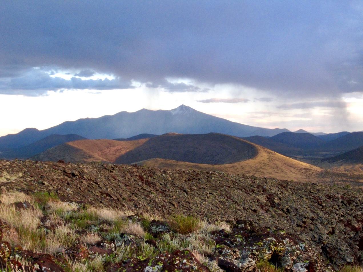
Obsessions begin early. Who knows why? As a young child, I used to draw volcanoes. I remember this distinctly. My drawings expressed the archetype: a simple cone topped with a perfect O for a crater, spewing ejecta like a fountain. Orange rivers of lava squiggled away like spaghetti. I also made volcanoes in my sandbox. Then I stuck a plastic straw in the sand and blew through it, because I wanted the volcano to erupt. It did. I got sand in my eyes and cried. But then I tried it again. And again. Volcanoes captured my imagination, and I soon learned that the part of Arizona I lived in was a landscape of volcanoes, some of them small and some large. The small one in the foreground is Colton Crater; the large one is, of course, the San Francisco Peaks.
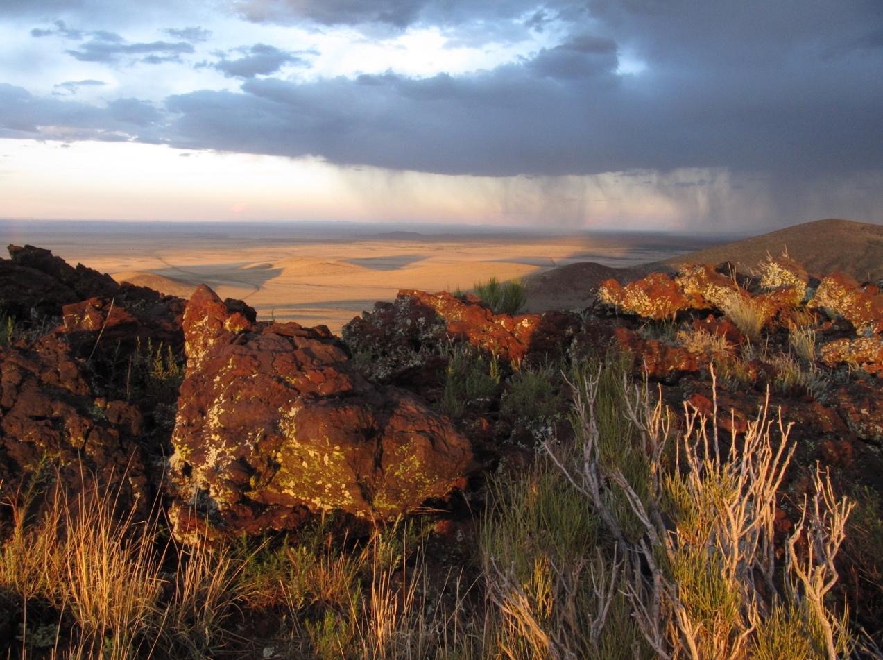
This photo is taken from the rim of SP Crater. Although you can’t tell when you’re standing on top of it, out of all the cinder cones in Northern Arizona, SP Crater is the one that looks most like a child’s drawing of a volcano. I don’t know how young I was when I first visited SP; probably pretty young, maybe about six. I recognized its volcanic nature immediately, and rejoiced. This reaction has not changed much over the years. It wasn’t until I was a grown man that I learned that SP was an abbreviation for Shit Pot, which didn’t make it onto maps because USGS surveyors deemed it an inappropriate name. It’s too bad that I didn’t know the crater’s true name when I was a kid. I would have loved it even more.
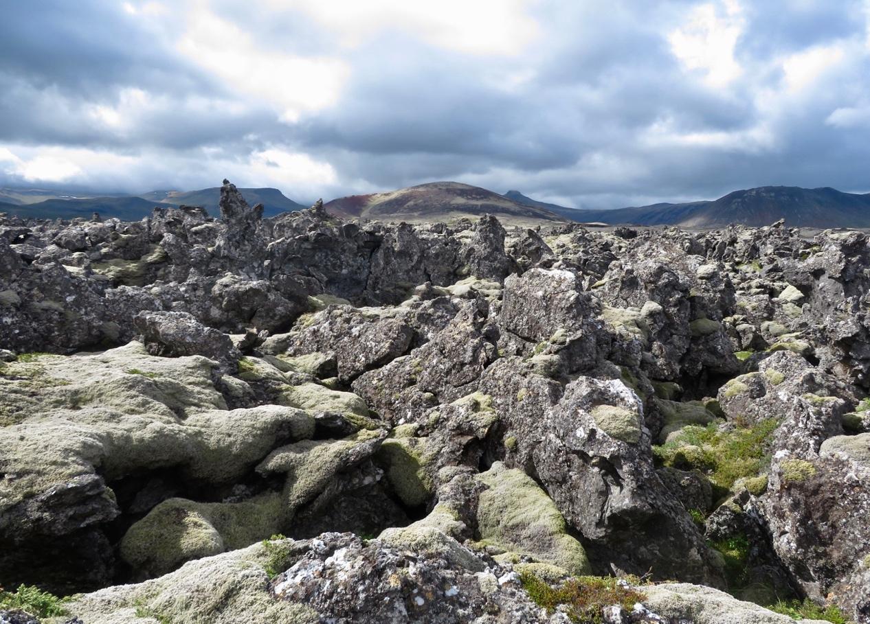
The longest mountain range in the world is almost entirely under water. It’s called the Mid-Atlantic Ridge, and it is essentially a range of volcanoes. It is also a seam along which the earth’s crust is pulling apart. How can a ridge also be a seam? Well, magma rises where the seam separates, birthing mountains. Some of these peaks poke above the water, creating isolated volcanic islands like Ascencion, St. Helena, Jan Mayer, and the world’s most remote island, Tristan De Cunha. The largest of the islands formed along the Mid-Atlantic Ridge is Iceland. In the past 500 years, one third of all the lava that has erupted on earth (not including eruptions under the sea) is on Iceland. That’s a lot of lava. The single largest effusion of lava to occur in historic times happened in Iceland in 1783-84, thanks to a row of craters known as Lakagígar—the craters of Laki. I write about this event in the essay “The Fire Priest.”
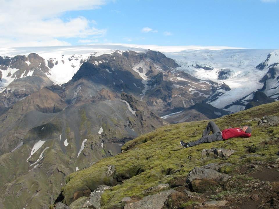
Thirteen-hundred feet below, a small, milky stream burbles its way through glacial till. It flows through a canyon composed of a ragged grayish-black rock called hyaloclastite, which is formed when basaltic magma is quickly chilled by water or ice. Where the walls are sheer, they are weirdly eroded into shapes reminiscent of melted candle wax. Where they are less sheer, the rock is lightly veneered with moss and heather. Across the canyon, the rough tongue of a glacier tumbles down between ribs of shattered rock. The glacier is an extension of a sprawling icecap that stretches far in both directions beyond the photo’s frame. The icecap is called Mýrðalsjökull, the glacier is Tungnakvíslarjökull, the stream is the Hruná, and the bed of tiny alpine flowers, heather and moss on which I rest is at the very tip of a narrow peninsula of rock called The Heiðarhorn. In its entirety, the mountain beyond me is Katla, considered by many to be the most dangerous volcano in Iceland.
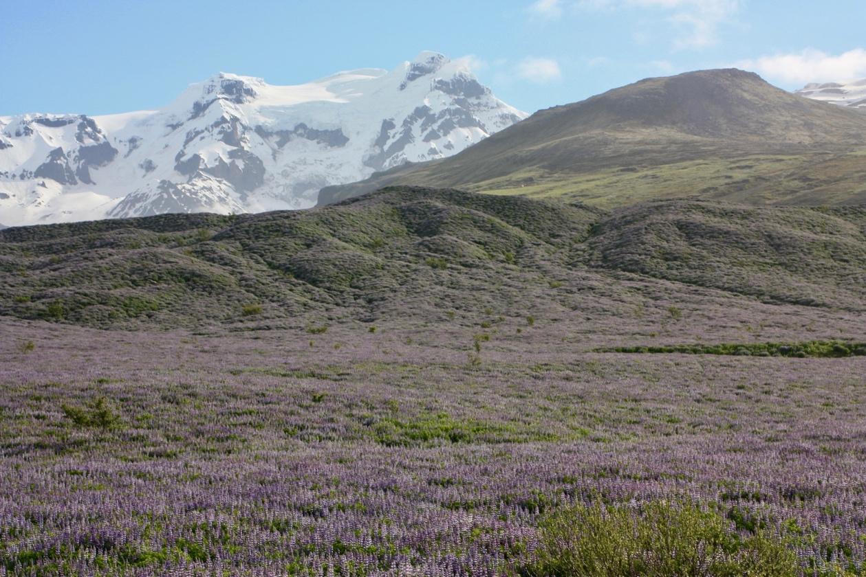
Certain volcanoes seem to be magnets for mystical experience. In the United States, Mount Shasta wins the prize: UFOs incessantly zip to-and-fro around it, and a golden-haired race of enlightened beings called Lemurians are said to inhabit a shining city inside the hollow mountain. Iceland’s winner is Snæfellsjökull; it draws spiritual seekers, artists, and visionaries. And novelists. Jules Verne portrayed the volcano as a portal to the center of the earth, and the great Icelandic author Halldór Laxness immortalized the mountain and its powers in his bizarre and hilarious novel “Under the Glacier.” Be warned! Strange things will happen to you if you set foot on the slopes of Snæfellsjökull.
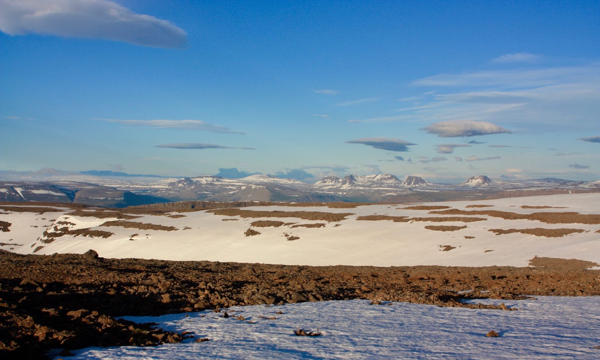
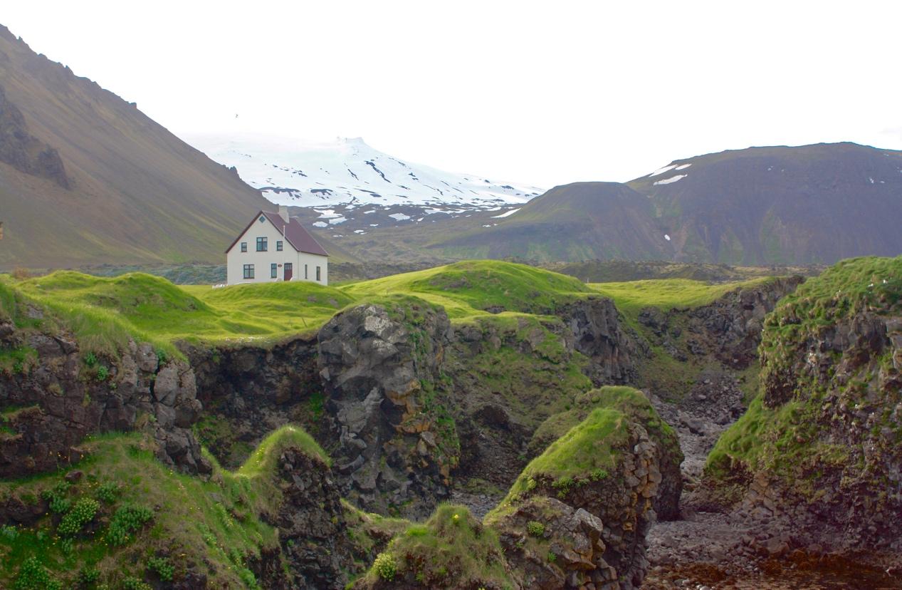
This handsome mountain is the volcano Öræfajökull. It is on the southernmost edge of an enormous glacier. A little thimble that pokes up on the rim of its crater is called Hvannadalshnjúkur, and it is the highest point in Iceland. One way to understand the volcanoes of Iceland is to think of them as weak spots in a seam that runs from southwest to northeast, right up the middle of the island. To be more precise, it is not just one seam, but a series of parallel fissures. These fissures go right under Vatnajökull, a sprawling glacier that is about the size of Delaware and Rhode Island combined, giving birth to sub-glacial volcanoes like Grímsvötn and Bárðarbunga. These sub-glacial volcanoes are all connected, fed by the same pool of magma. Grímsvötn—one of Iceland’s most active volcanoes—forms a caldera with a lake right on top of the ice sheet. When eruptions happen under ice, water moves in strange and invisible ways inside the glacier, sometimes causing a jökulhlaup—a glacial outburst flood—far from the site of the eruption.
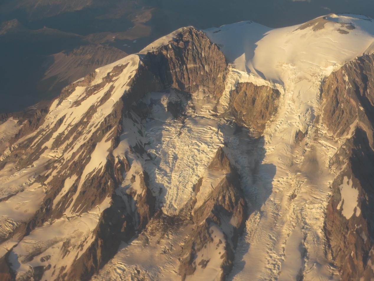
Glacier Peak is the least well-known of Washington’s volcanoes. Despite its status as the “hidden” volcano, the one tucked away in the wilderness like a shy sister in a family of extroverts, Glacier Peak has a history of intemperate behavior. Since the last ice age, its eruptions have exceeded, in magnitude, those of all other Washington volcanoes. It could teach Baker, Rainier, and St. Helens a thing or two about how to explode. In the meantime, it presides in quiet dignity over the largest expanse of wilderness in Washington. It is, in all respects, a magnificent mountain. Because of the long and varied approach, the solitude it offers, and the incredible view from its summit, it is my favorite volcano in the state to climb.

The mountain seems ancient and changeless, but it is neither. Despite its stately bearing, Baker is, like all Cascade volcanoes, a slag heap of notoriously unstable rock. She may be, by far, the tallest mountain in the neighborhood, but she is likely to erode away and completely vanish long before any of the smaller surrounding peaks that are not of volcanic origin. The signature peaks of the Pacific Northwest—Rainier, Baker, Adams, Glacier Peak, St. Helens, Hood, Garibaldi—are, in fact, the least enduring. The iconic cones of the Cascade Range are the youngest mountains in the region; a stratovolcano’s lifespan rarely exceeds a million years, and can be much shorter than that, if it self-destructs in catastrophic fashion. Among mountains, stratovolcanoes are like another Northwest legend, Jimi Hendrix: they live fast and die young.
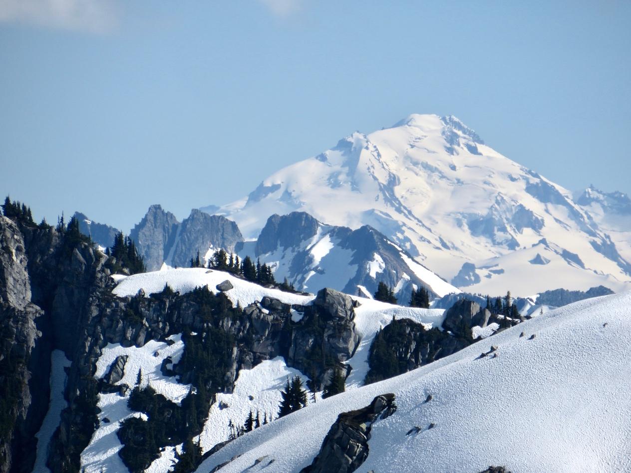
And then, there is Rainier. Tahoma. The Mountain. Both taller and burlier than any other Washington volcano, Rainier’s flanks are a complex puzzle of 29 named glaciers tumbling down between shattered ribs of unstable rock. The mountain is a beautiful mess. Although thousands of people are guided each year up its easier routes, on its more challenging routes, mountaineers train for climbs in the Himalayas, Alaska, and the Andes. In winter, atmospheric rivers from the Pacific slam into Rainier’s abrupt 14,000-foot bulk, making it one of the snowiest places on Earth. In any season, the weather can be apocalyptically bad. This beloved icon of the Northwest is also the most dangerous volcano in the United States; about 200,000 people live on top of past mudflow deposits, and about 80,000 live in the path of possible mudflows, should the mountain erupt.