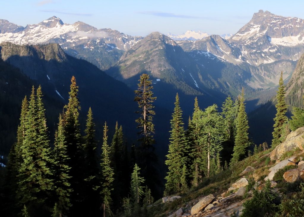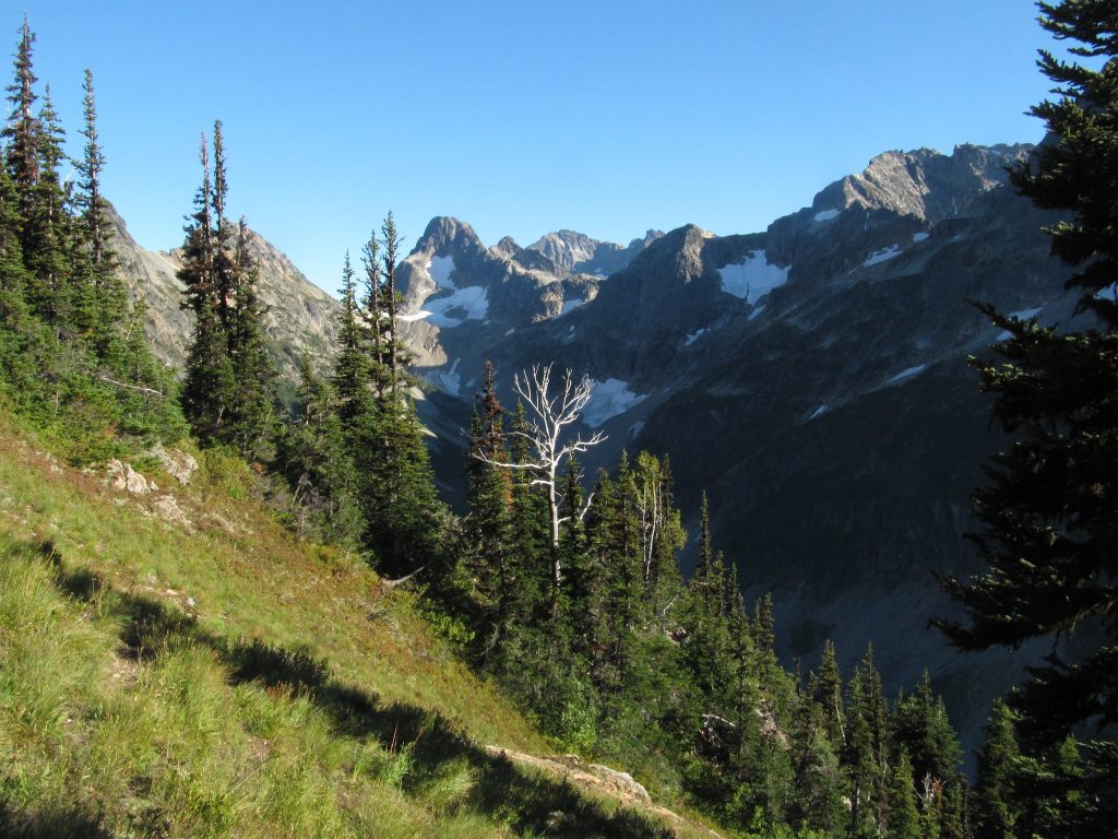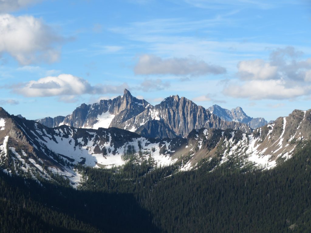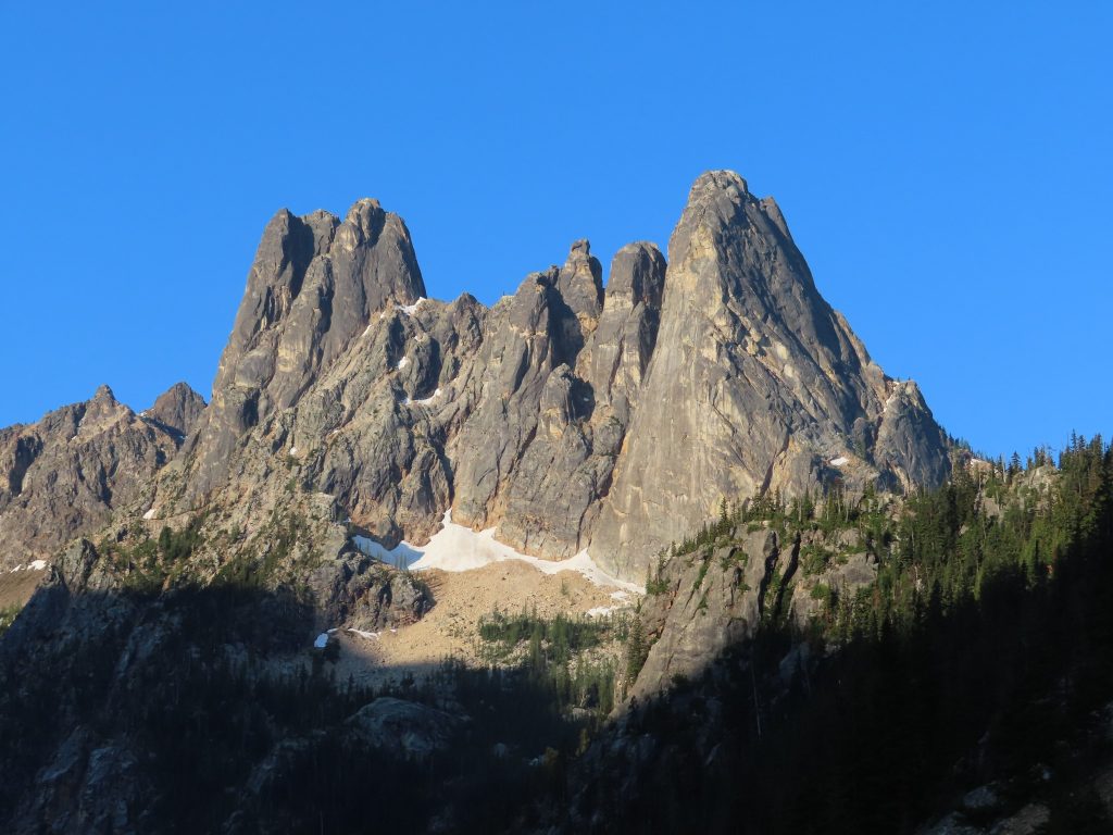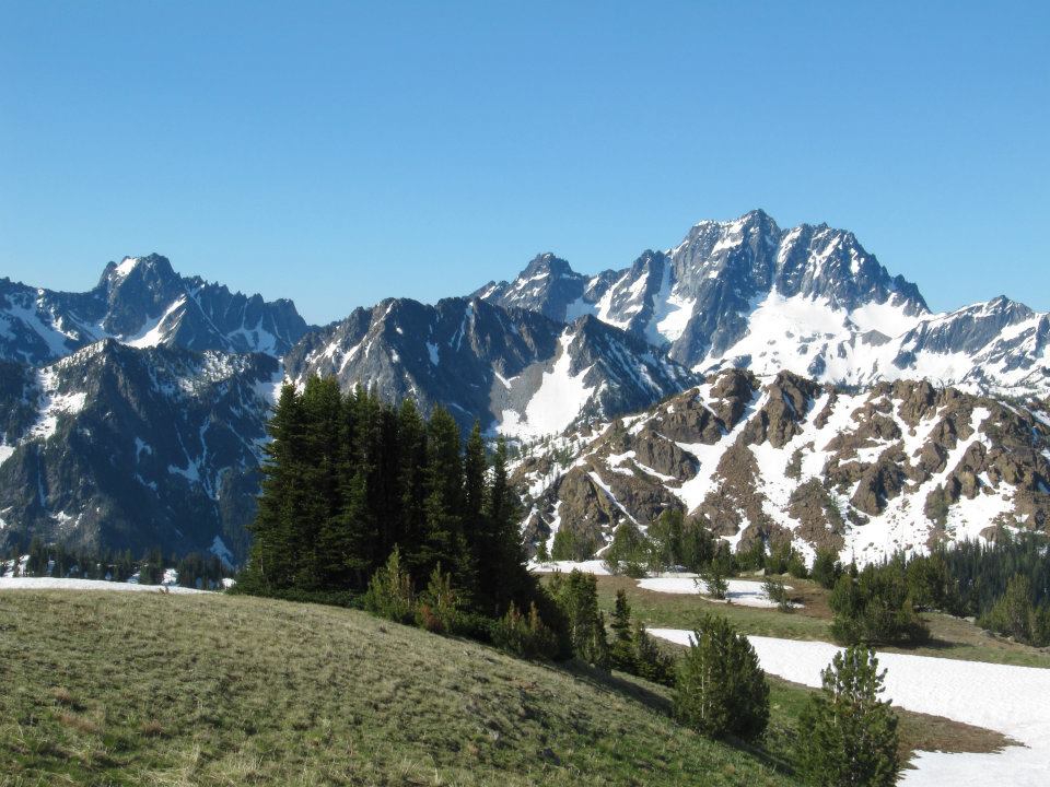
The River Knows

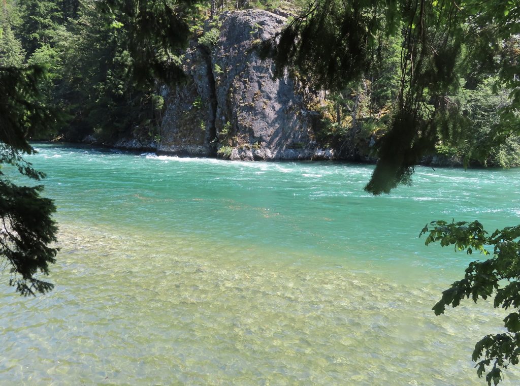
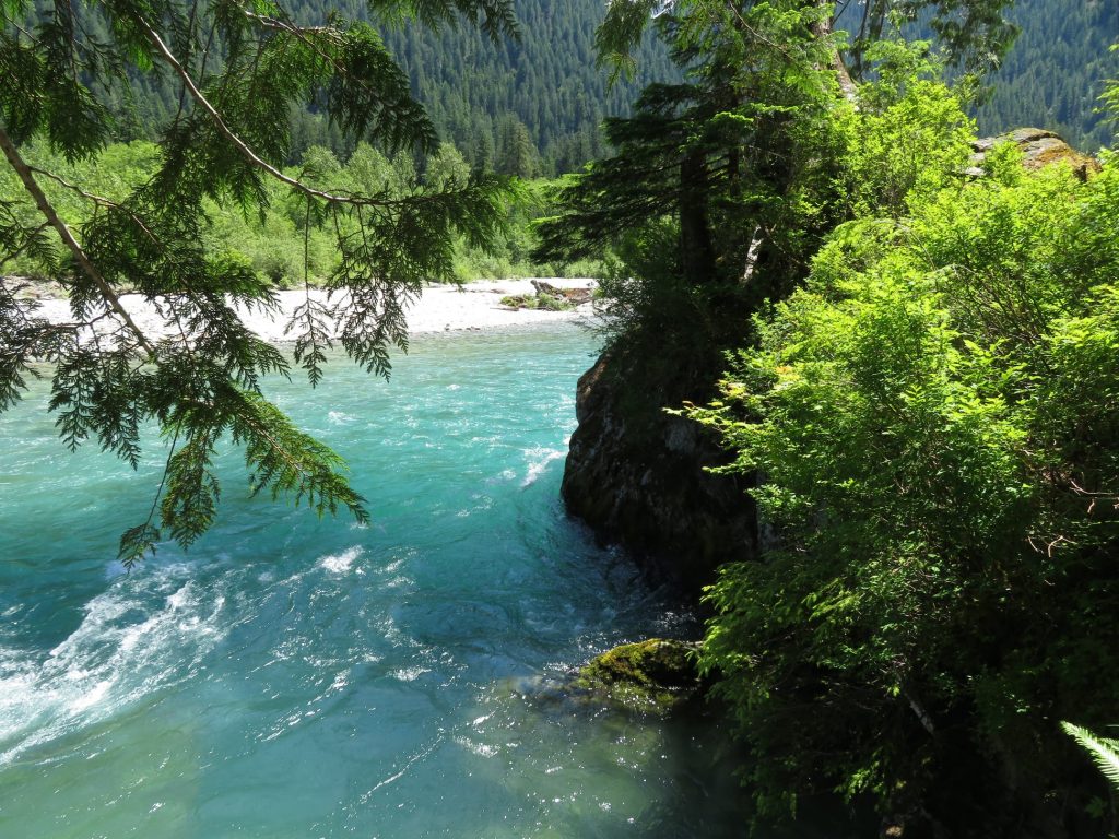
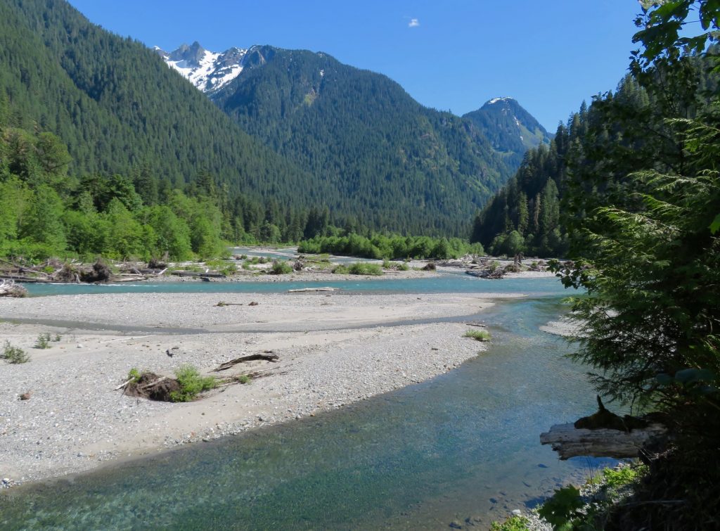
The Skykomish River, Washington

In the past few days, my friends from the desert have been messaging me. “You okay up there? You treading water?”

Seattle is in the news, thanks to an “atmospheric river” that has been aimed like a firehose at western Washington for a few days now. Atmospheric rivers are nothing new in early December, although this one is pretty damn wet, even by Pacific Northwest standards. I don’t mind. I like the rain. Rain is the soul of this place.

The river in the sky feeds the terrestrial rivers — both in the moment, and through the snowpack that will feed them come July. Rain down here in the lowlands means snow in the high country, which means that on the other side of the year, the sunny side, rivers will maintain a healthy flow for salmon, for orchards, for people, for all creatures.

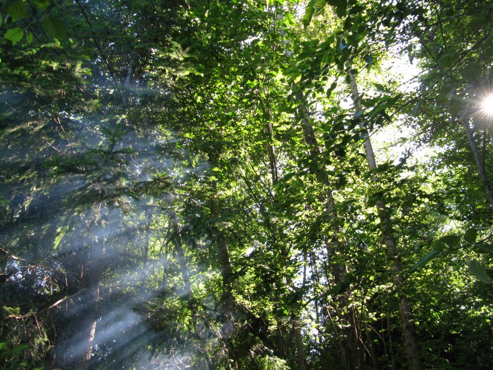
Out walking my dog through a forest of towering Douglas fir and Western hemlock, I found myself singing a truly great song, The River Knows Your Name, by John Hiatt. For anyone who has ever loved a river and felt peace along its banks, this song will ring true. “In the silence, darling, let us pray… Let the river take it all away.”

Hiatt mentions particular rivers in the song: the Brazos, the Wabash, the Seine. No doubt these are significant in his life. If the song were mine, I’d sing of the rivers of my home in the Pacific Northwest: The Skagit, the Methow, the Nooksak, the Skykomish, the Stillaguamish, the Baker, Icicle Creek. Old and true friends.

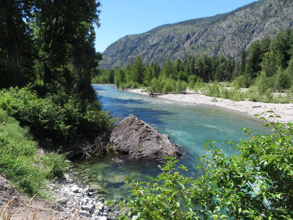
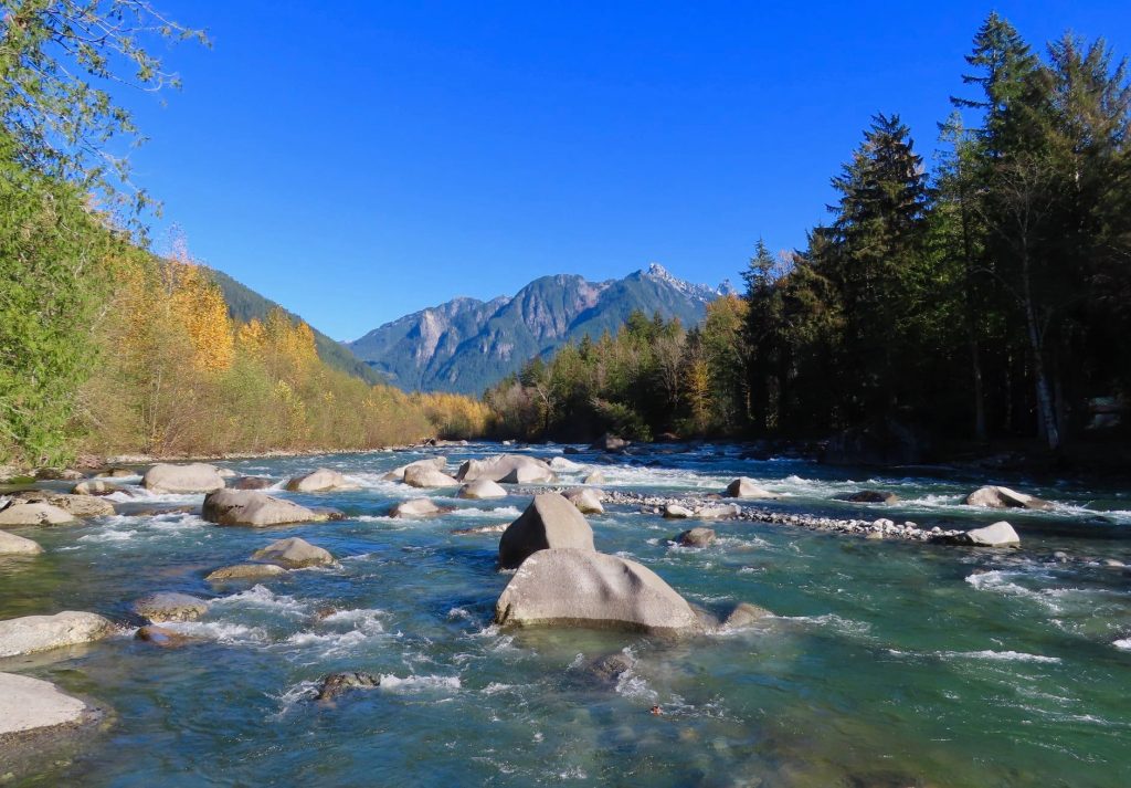
The Methow River, Washington

The first Washington river that knew and spoke my name isn’t even called a river, although in Arizona, where I was raised, it would be considered a river of magnitude and consequence. I first met Icicle Creek in 1994, when I had just moved to Seattle. I remember driving up the canyon feeling the kind of growing excitement that one feels upon first meeting a person who might become a beloved partner.

Located on the eastern dry side of the Cascade Range, Icicle Creek Canyon seemed a perfect blend of the alpine Cascades and the semi-arid country where I had grown up. It was a deep and steep canyon — over a mile deep, in fact — with rugged snowy peaks above. On the south-facing slope, open Ponderosa glades and granite benches made me think of the canyons of Central Idaho, where I had fought fires years ago.

A recent forest fire had denuded the north-facing slope, revealing countless outcrops and scattered boulders of perfect granite: a rock-climber’s paradise. The canyon made me think of the Pearl Jam lyric: “I will walk into your garden of stone.” I parked the car, scrambled down a steep bank, and sat for a long while by the raging creek. Yep, I thought, I could call this place home.

In the next few years, Icicle Canyon became a refuge. It was both church and playground. Being on the dry side of the mountains, “the Icicle” melted out earlier than other areas, making it an ideal location for late spring and early summer adventures.

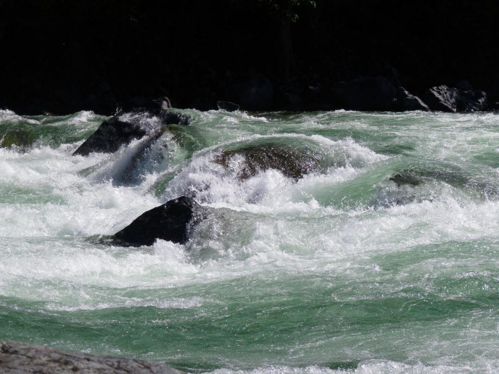
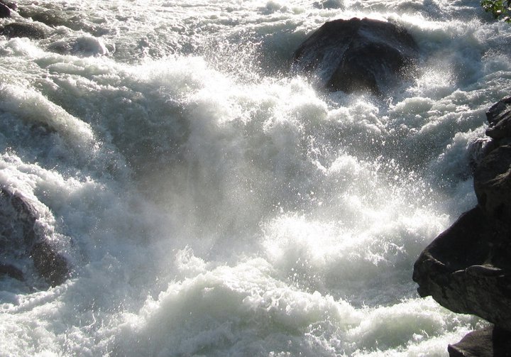
At low flow, Icicle Creek threads its way through car-sized boulders. Gates and chutes and eddies challenge the skills of expert kayakers. At high flow, it is something else altogether. Swollen with all of the melted snow from the Stuart Range, the “creek” completely inundates the boulders, creating massive billows of frothy green water and fearsome boat-swallowing holes.

Icicle Creek, Washington

Despite the canyon’s name, on summer days it could be hot to go rock-climbing in the Icicle. Dust and rattlers. Yellow Jackets and Poison Ivy. South-facing crags like convection ovens. But always, Icicle Creek down below, a noisy silver ribbon threading the rocks. Glistening like the promise of paradise when you’ve been roasting in purgatory for a few hours.

While I went cragging with friends, I sought out the high peaks alone. My eyes and feet were drawn to the summits of the Stuart Range, especially the rugged and complex massif of Dragontail, with its knife-edged aretes and steep snow chutes. I craved long days with no speech and no people — only the sound of wind and water. And at the end of a very long day, or couple of days, Icicle Creek welcomed me down.

The Stuart Range, Icicle Creek watershed, Washington

I associated the sound of that water with the joy and relief of a successful ascent. The river seemed a paradoxical embodiment of both ferocity and peace. It always seemed to me that the creek was offering a greeting. So you’ve come back. Often I would spend an hour or two at the creek, cleaning myself, dunking my head, soaking my feet in water that was not long ago part of the Colchuck glacier, and that would soon nourish an orchard of sweet apples downstream. Sometimes I would take a nap.

One such nap stands out in memory. It came at the end of a long day. I had left the trailhead at 3 AM, trudging through the forest with my headlamp. My goal was to climb and link together a series of summits: Enchantment, Dragontail, The Witches Tower, and Little Annapurna. It was a day of scrambling on loose talus, kicking steps up steep ice, and post-holing in deep snow. When I made it back down to the creek fourteen hours later, I was utterly thrashed.

There is nothing quite like the incomparable beauty of mountain water. I found an isolated little alcove with a sandbar where beams of warm late afternoon sunlight slanted through the trees, stripped down to my skivvies, and promptly fell asleep. When I woke up, I was blissfully disoriented. Wasn’t sure where I was, when it was, or maybe even who I was. I felt like a leaf floating down a river.


We each have our own rivers, the ones that speak our names. Icicle Creek is one for me. For some of my river-running friends back in my original hometown of Flagstaff, Arizona, the Colorado is a sacred river, particularly where it flows through the depths of the Grand Canyon. They are more at home on its sandy beaches than anywhere else on earth.

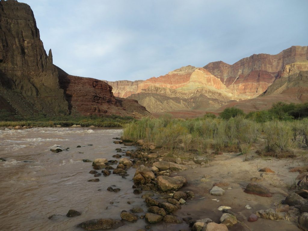
Tanner Rapids, Colorado River, Grand Canyon, Arizona

The Colorado is a sacred river to me, too. As a teenager, I spent some blessed days along its banks. Under a full moon, I sat on rocks in the river at Hance Rapids, Sockdolager Rapids, and Tanner Rapids.

Before I was old enough to backpack into the Grand Canyon, other more modest but also lovely desert rivers spoke my name. These were rivers that began in mystery somewhere in the Ponderosa pine forest, then carved their way through rusty sandstone on their way to the desert. Oak Creek, Sycamore Creek, West Clear Creek, Beaver Creek, and Fossil Creek. These delightful creeks along the Mogollon Rim held many surprises: perfect swimming holes, pockets of lushness, elegantly sculpted slots, deep potholes.

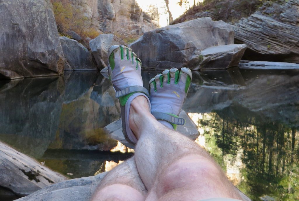
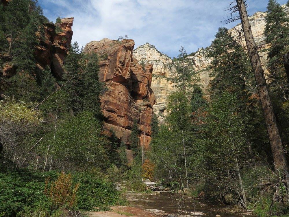
West Clear Creek, Arizona

It is remarkable to me how vivid and visceral my memories of childhood remain. We are, each of us, part of a chain.

Is it possible to look forward and backward at the same time? And to still be solidly and peacefully in the present moment? My life is tethered to those who came before me and those who will come after.

As I get older, it seems that the years go by so quickly.

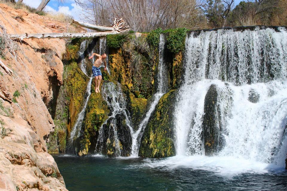
Time is sort of like a river. I apologize for the cliche, and this is not a new observation. But still. It is, with each instant, a different river, but you can revisit rivers from your youth. How easily I can close my eyes and be on the riverbanks of my Arizona childhood, camping at Tanner Rapids in the Grand Canyon, or jumping off a log into the welcoming water of Fossil Creek.

Fossil Creek, Arizona. Photo by Timo Wilsey.

In the same way, my daughter Jordan’s memories will be of cold Cascade rivers. Jordan was my frequent rock-climbing partner, and many of her memories of being with me by flowing water will be linked to our time on the rope. For instance, she might remember a nice swimming hole on the Snoqualmie, right by the bridge, with a rope swing, where we would stop for a dip after a day of climbing at Exit 38. Or she might, like me, smile at the recollection of Icicle Creek after a day of hot and dusty bouldering.

Her son — my grandson — is just over one year old. He will be shaped by his own rivers. Which ones will speak his name?

Here is a vision of something I would like to do a decade from now, when my grandson is eleven: I would like to take him to a mellow spot by a river. It doesn’t matter which one. A place where the light is dappled by the flitting leaves of birch or sycamore, where the sunlight perceived through closed eyelids is the warmest and gentlest color imaginable.

Skykomish River, Washington

I’d like to catch crawdads in a cup. Splash in the river, skip flat stones. Notice the herring-bone pattern on a spider’s abdomen. Teach him to identify trees by the bark. Help him work up the courage to jump off a rock ledge into the water. Find ripe berries and the prettiest autumn leaves.

Then, when we get hungry, grill some burgers. Maybe they will be kelp burgers, which will perhaps not be weird for either him or me in 2033. Baked beans and watermelon. On a nice tablecloth, in honor of my mother who taught me that any picnic, even if you are eating on a log, benefits from such presentation. Dos Equis for me, sweet tea for him.

After dinner, I’d teach my grandson the guitar riffs from Back In Black and the solo from Stairway to Heaven (well, air guitar). Some music never dies. I’d teach him the backing vocals on Midnight Train to Georgia (You and me, boy, we’re The Pips.)

He might be amused at the kind of music that grandpa liked. He’d fall asleep in the car on the way home. Maybe dreams would swirl around in his head, like trout in the shadowy place beneath a cutbank.

An electric car, to go with the kelp burger.

This is what I would like to do, in 2033.

Fossil Creek, Arizona

My mother is 93 years old, and her memories are less distinct with each passing day. Even so, she remembers much of her childhood. From time to time, amusing stories pop out. For instance, she remembers stealing watermelons from a neighbor’s garden, and how she and her sisters in the magical thinking of childhood assumed that if they took their shoes off, they would leave no footprints.

And how the crusty old neighbor discovered their shoes at the garden’s edge, and left a sloppy plug of chewing tobacco in every shoe. That’ll learn ya. She remembers working as a teenager in cherry orchards and in a perfume factory. She remembers eating squirrels during the Great Depression. With her twin sister Rhoda, she sang duets in churches. Once, she sang for Brenda Lee, who was in the front pew.

My mother also has memories of water. They are not like mine. She never saw a river that tumbled ass-over-teakettle out of the mountains or carved its way deep into sandstone until she journeyed out west as a young bride in 1950, moving with my father first to California, and then to the Zuni Indian Reservation, in New Mexico.

The river of her Michigan childhood, called the Grand, was part of her everyday life. It was slow-moving and placid, meandering through flat country, in no hurry to get anywhere. After heavy rains, the Grand would sometimes flood the marshy field in front of her house, and if the water in the flooded field froze over, she and her sisters would ice-skate on it, as you might expect from the children of Dutch immigrants. I can easily imagine this ice-skating girl.

There was also a nameless creek in the woods, where, on Saturday nights, the whole family (seven girls and a boy) would go to take their weekly baths. It was a time and place with no running water. A few years ago, we went ambling down an endless network of country roads in Plainfield Township, looking for that particular bathing spot in the woods. We didn’t find it. The memory was so clear in my mother’s mind, but hard to reconcile to the actual landscape.

I wonder if, in her mind, time is compressed. If it all seems not so long ago, or even if it will on her deathbed seem that everything in her life will be present all at once. As if she is a leaf on a river. Carried by water.

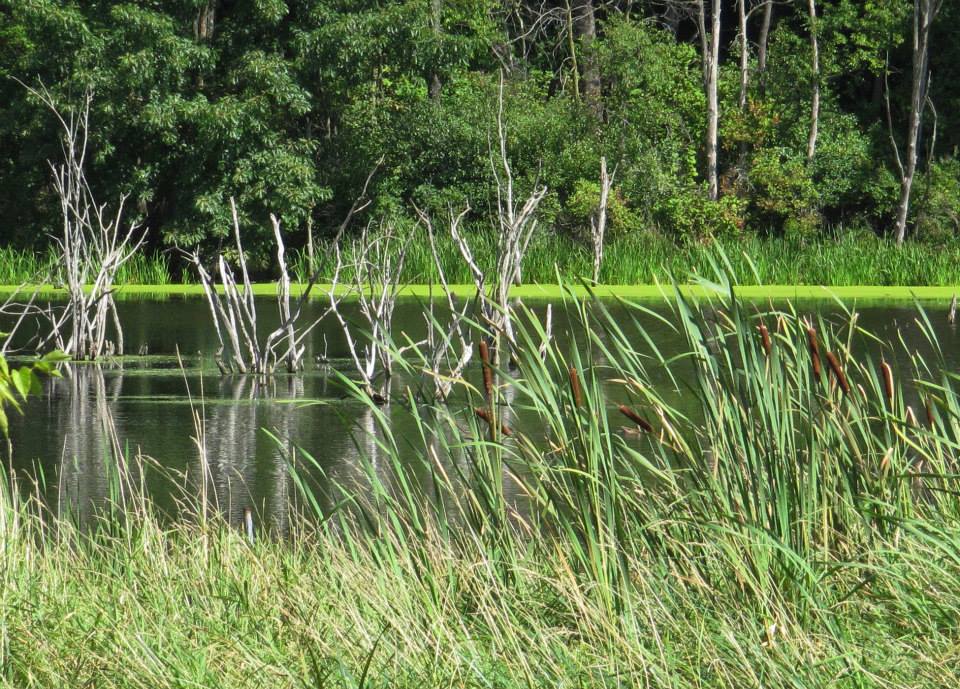
West Michigan wetlands

Diverse currents flow into us, merge, make us who we are. The currents move through us, and contribute to someone else’s story. Downstream.

My father also grew up in Michigan, but I have a hard time imagining him there. He was most at home in the high desert of Arizona and New Mexico, where he lived for most of his life. When I think of my father, I think of three rivers. His ashes were scattered into the waters of two of them. The third river often holds no water at all.

He was a modest man in every respect. He had an open ear and an open mind. He was gentle. He loved the earth and all of its creatures. He loved the Grand Canyon and the river at the bottom of it with all of his very large heart. In his later years, he lived along Oak Creek, spending many quiet mornings on its banks. Both of these streams carried his ashes away.

West Fork of Oak Creek, Arizona

He was in some ways a paradoxical man, blending his religious upbringing with his career as a mathematician. He believed that Jesus was raised from the dead, but was doubtful that Jonah was swallowed by a whale. He believed in an orderly and logical universe and he wanted to understand things. When the Apollo astronauts came out to Flagstaff to train on the lava flows, he worked on a team attempting to predict what the surface of the moon might be like, and how vehicles could navigate it.

As my father lost himself to Alzheimer’s, he didn’t remember much. He could no longer clearly tell me about the work he did for USGS with the space program. He forgot who my mother was.

Near the end, when things had become very confusing, my father leaned heavily on music. At bedtime, he listened to hymns sung by the country singer Jim Reeves. Take My Hand, Precious Lord was a favorite. “Through the storm, through the night, Lead me on to the light, Take my hand, precious Lord, Lead me home.”

On the final road trip of his life, we rode together in a moving van across New Mexico. He insisted on it, even though I was sick with the Swine Flu, and I gave it to him, and it hit his old body very hard. As we drove, he remembered all he could about living in Zuni in the 1950s. Names of kids. The choir, the track team, the basketball team.

Not long after that trip, the riverbed of his memory went dry, but I can’t help but think that in his body was residual memory. In the body itself, not just in the brain’s neural connections.

The Zuni River is a most-often dry wash that runs right through the old pueblo of Zuni, where my father spent some of the happiest years of his life. It leads eventually to the also usually dry river bed of the Little Colorado, winding its dusty orange way through the desert until it meets the big Colorado in the heart of the Grand Canyon.

Maybe a dry arroyo holds the memory of the water that once filled it.

Maybe the Zuni River remembered my father’s name.


In the year 2040, my daughters Jordan and Monty will be 50 and 41, respectively. My grandson will be 18.

I’d like to spend time with him by the river. Any river. It might be a river that means the world to me, or it might be a river that will come to mean the world to him, and that he, in due time, will want to share with his children.

In the year 2060, Monty will be 61 — the same age that I am right now. My grandson who was 18 in 2040 will be only 38 in 2060. I say only. This is not very old; this grandchild of mine might have children of his own by then.

It is strange to think of it, but in the year 2083, my grandson will be the age I am as I write this. Maybe he’ll be noticing, also, how time goes by so quickly. By the year 2100, if he’s still living, he will be 78. Not really all that old. I think of my grandparents. It is amazing to be interwoven with someone who lived in 1900, and someone else who may be alive in 2100.

The lives of those we love stretch into the future. How fleeting the time, and how present we will still be in the memories of those who follow — even if we have passed away by then.

I don’t know if I’ll ever go to Michigan again, but if I do, I’d like to find that creek in the woods.

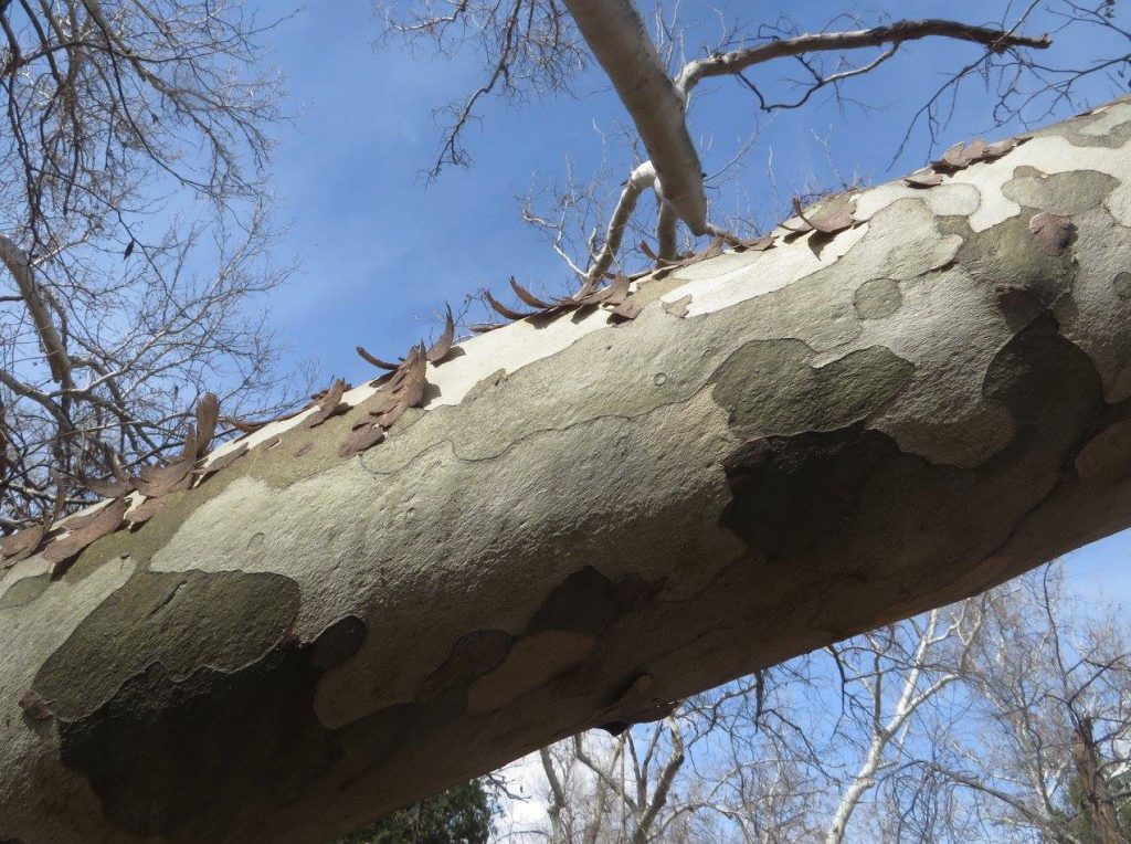
I can go to the sycamore tree by the creek where my father’s ashes are scattered, and still feel him there.

Sycamore tree, Oak Creek, Arizona

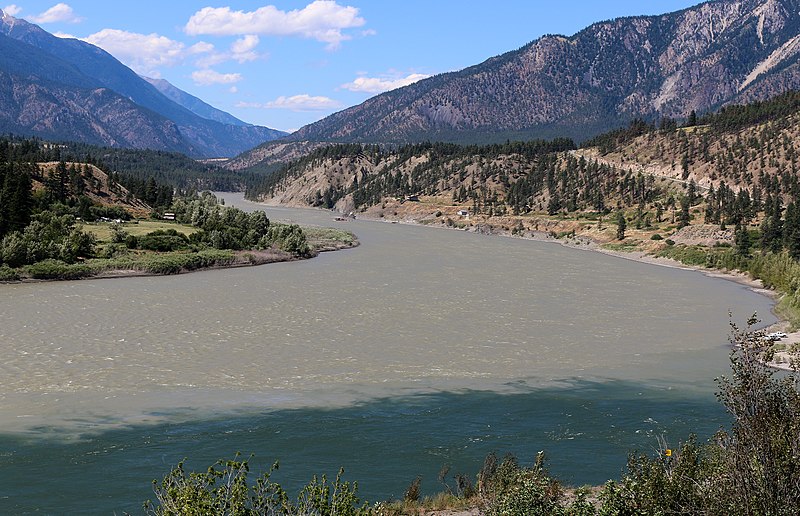
The town of Lytton, British Columbia, sits at the confluence of two of North America’s great rivers, the Fraser and the Thompson. Among rivers, they are jewels, on par with the Colorado, the Columbia, the Stikine, and the Yukon. They are the arteries of Western Canada. Although it doesn’t carry the number of fish it used to, the Fraser historically is one of the great salmon rivers of the world.

Both are large and forceful, especially in spring when swollen with snowmelt. Both cut through deep, dramatic canyons and offer powerful, exciting rapids. Both are borne of glaciers in the Canadian Rockies.

The confluence of the Fraser and Thompson Rivers near Lytton, British Columbia

When Jordan was a teenager, she and I took a guided raft trip down the Thompson. I remember the rugged bluffs, the noble ponderosas, the roller-coaster ride through huge standing waves. Massive pillows of water. But mostly I remember this:

On a calm stretch, as we drifted past some streaked, rusty hills, we looked up at some mine shafts, black holes bored into the slope. Cinnabar, I presumed. “What are those?” asked a woman on the raft. “Paprika mines,” answered the guide. The woman looked up at the hill in wonder and appreciation. “Ooohh,” she said slowly. “So that’s where it comes from!” The guide didn’t even crack a smile.

About 100 miles due south of Lytton, as the crow flies, is the Baker River. It is just shy of the Canada/US border, smack-dab in the pocket of the world that feels most like home to me. Like Icicle Creek, it is one of my favorite rivers.

Baker River, Washington

The Baker is small, unlike the Fraser and the Thompson. It has a small watershed. But what it lacks in size, it makes up for in sheer loveliness and richness of life. In its lower half, the Baker is impounded by dams. But in its upper half, the Baker runs wild and free through some of the most rugged alpine terrain in North America. Its upper watershed is roadless and trail-less. Pristine. Wet, steep, and green.

The river moves through enormous old-growth trees, Western Red Cedar, Western Hemlock, and many other species, both deciduous and conifers. There are woodland flowers such as red columbine, bunchberry, and false Solomon’s seal. Red huckleberries and purple ones, thimbleberries, salmonberries. In the cool forest, lichens and mushrooms and mosses do their all-important work. Everything is layered, intricate, interwoven. Somewhere under the mat of life there is ground, but it’s hard to find it.

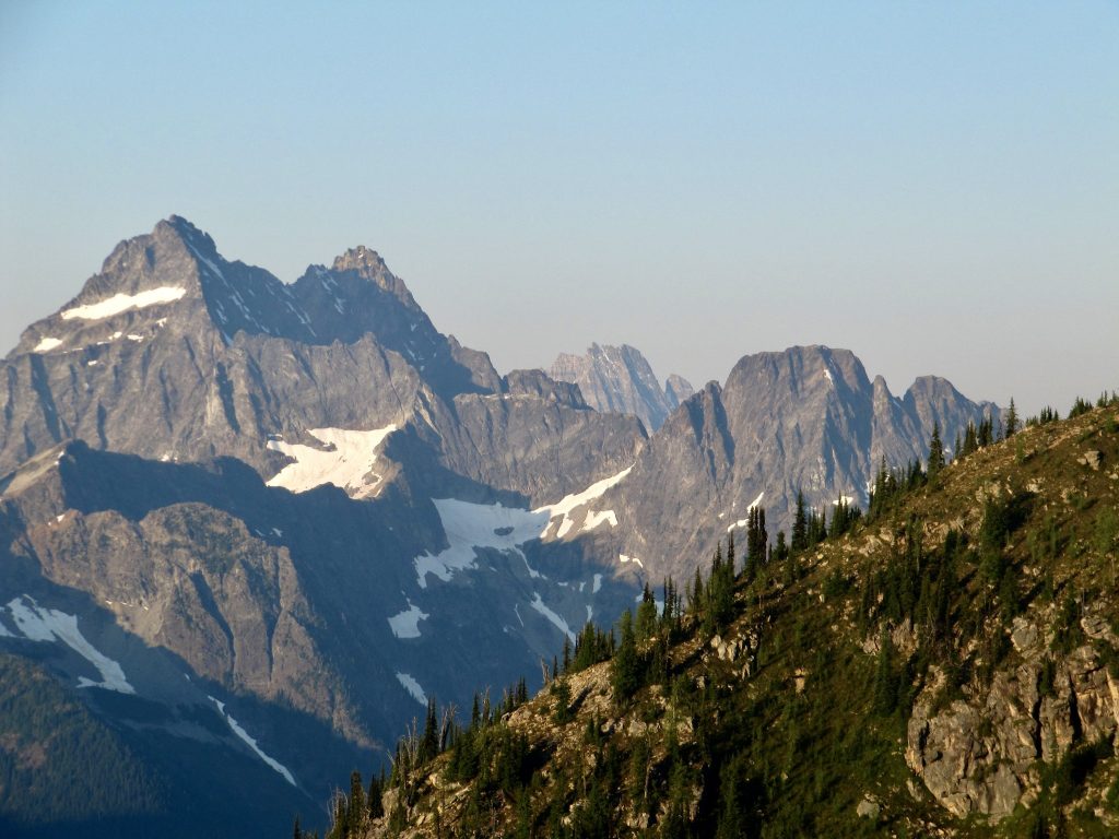
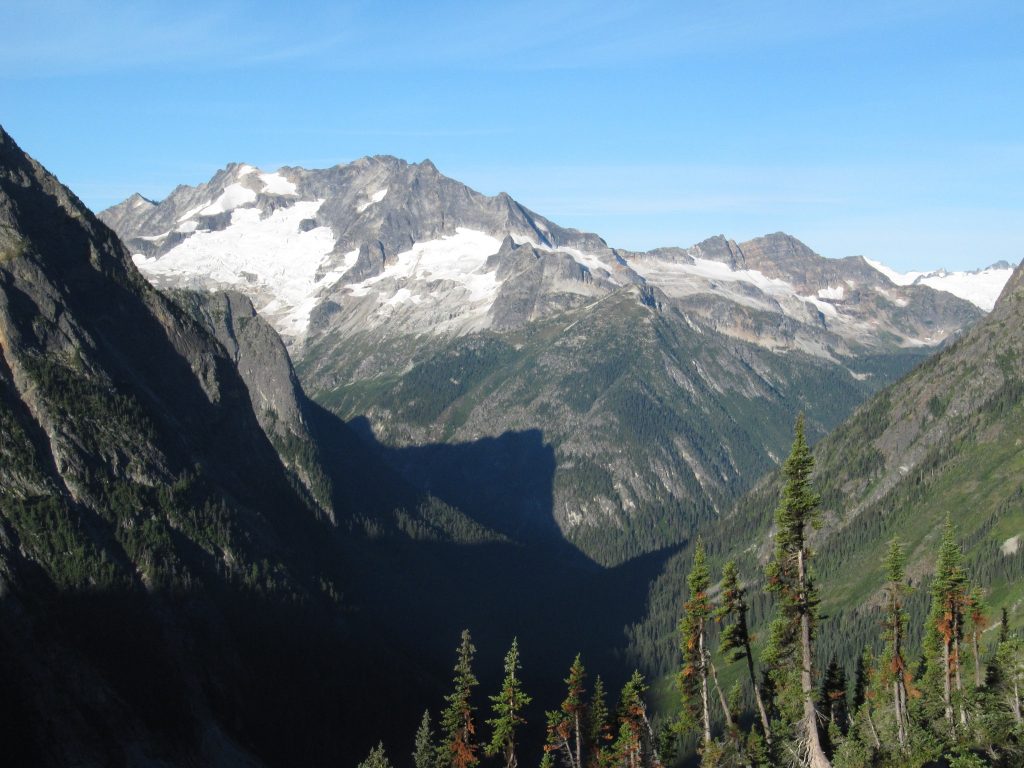
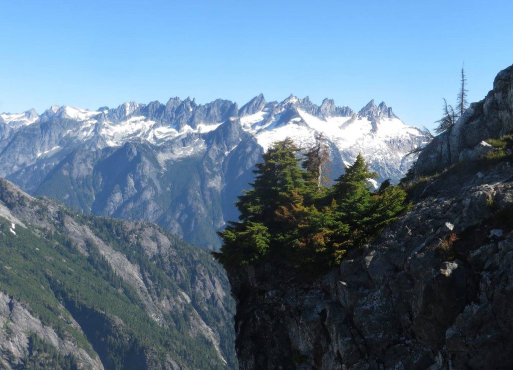
The Baker is birthed under the aptly-named Picket Range, a row of serrated peaks in the hard-to-reach heart of the North Cascades. The peaks that surround the upper Baker watershed have names like Mount Despair and Mount Fury. Snowpack tends to be deeper and last longer here than anywhere else in the lower 48 states. More than a dozen glaciers feed the stream.

The Picket Range

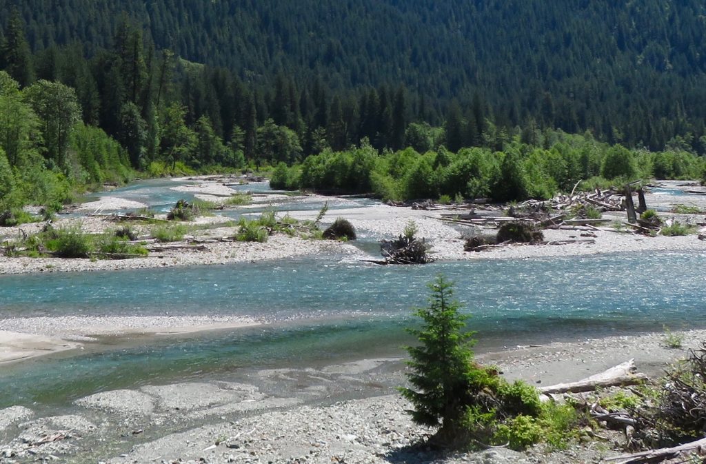
By late summer, in a dry year, glaciers might account for as much as half of the river’s flow. The beautiful blue-green tinge of the water is due to suspended silt from the glaciers that feed it. Such silt, called glacial flour, is so fine that the water appears crystal-clear up close, but imparts a slight milkiness when seen from greater distance.

The Baker supports runs of all five kinds of Pacific salmon: Chinook, Sockeye, Coho, Chum, and Pink. Also Steelhead. This is a point of distinction for such a small river. A river fed by glaciers is advantageous for salmon. It has a more even flow and a reliably colder temperature than a river fed primarily by snow and rain.

That color. Glacial water flowing over stones. Clear with a hint of teal, deepening where there are pools.

Baker River, Washington

A couple of years ago, I hiked up the Baker River with Monty. They seemed like part of the forest to me, belonging there as much as the berries and mushrooms and towering Western Hemlock. Belonging there as much as the nurse logs.

A nurse log is a fallen tree that decomposes into the ground, in the process providing a nutrient-rich place for saplings to grow. A nurse log holds, pound for pound, more life than any place in the forest. A nurse log is how one generation of trees passes along its life force to the next, how it nurtures the young, even in death.

I would like to do this hike with Monty every year, or as often as we possibly can, for as long as my legs work. In 2040, if I’m still around, I’ll be 78. Monty will be 41.


It is expected that in in 2040, unless our path changes in a significant way, all summer sea ice in the Arctic Ocean will be a thing of the past. Oceans will be increasingly acidic and increasingly bereft of life. All across the globe, mountain glaciers will vanish.

The most important word in the previous paragraph is the word unless.

It may seem that I’ve made, with no transition, an abrupt shift from personal stories to the “political” issue of climate change. My view is that I didn’t change the subject.

Because this is precisely how I understand the subject: My daughters will be 50 and 41 in 2040. My grandson will be 18. He will be the age I am now in 2083.

The year 2023 has been, world-wide, the hottest on record. This is true of both land and sea temperatures.

But the summer I want to talk about was in 2021. That was one that Northwesterners will not forget. It reached 118 in parts of Washington, and it might have been close to that at the bottom of the canyon where Icicle Creek tumbles through the pines beneath snow-capped peaks.

It was even worse to the north. On June 29, the temperature reached 121.3 Fahrenheit in Lytton, where the Thompson meets the Fraser. The day after this modest town at the confluence of two majestic rivers set this unenviable Canadian record, it burned to the ground.

Lytton is (was) on the east side of the mountains, so it can get hot. Hotter than Seattle or Vancouver, anyway. It was often the hot spot in British Columbia. But historically, hot has meant 95 and, more rarely, 100 or 105. More akin to Missoula, Montana, than to Phoenix or Bagdad. Lytton’s average high in July is a mere 82. That means that on June 29, 2021, Lytton was 40 degrees hotter than their average high for July.

In forested places, especially in arid regions, temperature should never be considered by itself. It should always be coupled with soil moisture. Think about soil moisture as a critical measure of the land’s health. Its ability to sustain plant life, fungal life, insect life, and microbial soil life. Human life.

The scenery and topography surrounding what once was Lytton is stellar. Snowcapped mountains rise nine thousand feet above the Fraser. It’s a bit like Icicle Creek, or a bit like western Montana on steroids. It is hard to over-praise this country. The slopes are draped in ponderosa pine at the bottom of the canyon, transitioning with elevation to spruce and fir and eventually alpine tundra and glaciers.

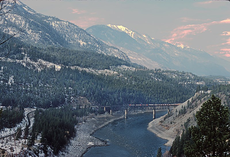
Fraser River, British Columbia. Photo by Roger Puta. In the public domain.

A temperature 40 degrees above the average July high. Imagine that, wherever you live. In Phoenix, that would be a temperature of 146. In Denver, 132. In Dallas, 136. In Las Vegas, 147. In Washington DC, 129. And in the mountain town of Flagstaff, Arizona, where I grew up, 122.

A “freak” heatwave. Words like “unprecedented” and “historic” were used to describe it. Before it happened, I think many would have considered it inconceivable. But will it be unusual in 2040? Temperatures 40 or even 50 degrees above normal have been occurring with some frequency in the Arctic for several years now.

Climate change is not in the far distance. It is bearing down on us now. It will get persistently worse in the next few decades. What we could lose is incalculable, and cannot be reduced to dollars. I think, for most of us, it is inconceivable. But we had better conceive of it.

The years go by quickly.


There is no clear line separating the personal from the political. My love of a river is personal. Icicle Creek. The Baker. The Thompson. The Colorado. And of course nothing in my life is more personal and more important than my children and their future.

2040 is not that far away. The path we are on is not in doubt — at least not to anyone who has their eyes open. It’s not my intent, in this note, to go into too much detail about the global consequences of this change. I’ve done that elsewhere, and I’ll do it again.

I will say this. The Baker River will be different in 20 years. Unless we change the path we are on, it won’t support five species of salmon. Will it support even one? I don’t know. The Thompson will be different too, although the paprika mines will still probably be there.

The year 2040 does not seem imminent, but it will come upon us before we know it. The current is moving quickly. Twenty years ago seems like yesterday to me. Heck, I played some Fleetwood Mac on Spotify, and 40 years ago seemed like yesterday.

Maybe 2100 seems like really a long ways off, but people you love will inhabit that year. Unless our path changes, they will inherit a world damaged beyond what we are willing to think about.
Unless. Unless is the key word.

Baker River, Washington

What that future will be like is determined not just by me or you, but by the whole society. It is not at all clear that Americans — or humans generally, for that matter — truly grasp the nature and the scope of this challenge. If we did fully grasp it, what would we do differently?

I don’t know. Eschew cheeseburgers? Travel by horse? Change lightbulbs? There is no single action. No single answer. Many things can be done; taken alone, none of them are adequate, or even very measurable.

If creativity and money and political influence are necessary to lead us toward solutions, then I wonder how the people who have the creativity and money and influence can be moved—by love—to apply it. Where is the fulcrum?

It may be that the most impactful thing we can do is to refuse to extend power to leaders who are neither generous nor careful. It is an unfortunate truth that some people really don’t give a shit about the future — even though their own children may inhabit it.

We need to not allow such people to advance beyond high school student council in their political aspirations.

Beyond that, it is not my intention (at least in this note) to tell people exactly what I think they should do about climate change. We will all decide for ourselves. Feeling guilty and distraught and filled with dread doesn’t help. (Trust me on that one.)

The future is not set in stone. Consequence is always downstream from choice. Think of a river. We are not only riding the current; we are the current.

Maybe my main point is this: Action is rooted in love.

We are connected to those who came before us — and to those who come after. I would like to walk with Monty up the Baker River in 2040, and see salmon in the pools. I’d like to take my grandson to a river.

I don’t know if my father’s spirit is somewhere in the universe, sentient still. If so, it would make him smile if he could see me catching crawdads with my grandson.

That is what I would like to be doing in 2040.

North Fork of the Skykomish River, Washington

Orcas, Moloch, Power, and AI

Illustration by Charles Foster, 1897, from Bible Pictures and What They Teach Us. In the public domain.

This is an essay about artificial intelligence, but I am going to begin with orcas.

An orca is an apex predator. It takes from the sea what it needs to live — salmon, tuna, seals, and so on. It is a beautiful animal, as well as intelligent and fearsomely efficient. But as intelligent as it may be, it does not invent a trawler that rakes the ocean floor, destroying the habitat of countless creatures that it doesn’t even eat.

The kind of power that humans exercise, through our use of tools, is different in both scale and quality than the hunting behavior of an orca, or tiger, or any other apex predator.

The orca has neither the means nor the inclination to destroy the complex network of life upon which it depends. Homo sapiens stands alone in this regard. No animal besides us has ever had the ability to decimate the biosphere itself.

Maybe this is what the biblical phrase dominion over the earth means. It is not, in my view, such a good thing.

For most of human history, we also did not have this ability. But we have it now. Our ability to do harm — to other humans and all creatures — has been accelerating since the beginning of the industrial revolution. The speed of that acceleration increased exponentially with the invention of the atomic bomb around 70 years ago.

With the development of artificial intelligence, the acceleration of technology — and particularly of technology that has the capacity to make our civilization self-terminating — has reached the stage where, on a graph, the curve goes nearly vertical. In our cleverness, we have created tools of such power that they can fundamentally alter the planet itself.

These tools have the bizarre capability to improve themselves, without our input. While the power of these tools is increasing at a rate we can barely comprehend, what has not kept pace is our capacity to exercise wisdom, restraint, and discernment in the use of such tools, as we make decisions regarding how we will live in relation to each other and to the rest of the living world.


A couple of nights ago, I was listening to an interview with the social philosopher and systems thinker Daniel Schmachtenberger. It was a long and wide-ranging interview, and at one point he was talking about ways in which past powerful civilizations crashed and burned.

Throughout history, civilizations that have attained great power have also been self-terminating. Even when they were conquered by an outside force, their downfall was partially or mostly because they were ripe for collapse.

The reasons are various, but also similar from case to case: They ruined their land, depleted their resources, overextended their reach, exploited their workers, corrupted their own institutions, or exhausted the morale and good will of their own citizens.

He asked a question that slipped under my skin like a splinter: “Why have we humans not been good stewards of power?”

I can hardly think of a more important question.

It’s interesting that Schmachtenberger used the word stewards in framing his question. Implicit in that word steward is the assumption that we are responsible to someone other than ourselves. We are, in other words, caretakers. We bear responsibility for the well-being of others.

To whom might we be responsible? Our children and grandchildren? Our communities? Does it go beyond that, to all humans? Or to other living creatures? Might we bear a responsibility to a deity? Or to a river that provides us with water, or to the soil from which our food grows?

Of course, if we are responsible to no one, then the future beyond our own short lives need not concern us. But most people I know are not content with that. Even if we draw our circle pretty tightly, unless we are soul-dead, most of us care about someone besides ourselves.

We all may have different notions regarding how far our responsibility extends, but I suspect most of us feel a responsibility toward our most direct descendants, at least. Our children, our grandchildren.

In this context, the word responsibility may seem a bit stiff; what we more often call it is love.

How do we become better stewards of power? Or, to frame the question a bit differently: How do we find and channel the power to become better caretakers of that which we love?

I believe that we will not be able to navigate the coming years without a substantial shift in how we exercise power — both in regard to how we treat other humans, and in how we treat the other living beings that share this planet with us.

This has everything to do with artificial intelligence.


Let me offer a brief introduction to Daniel Schmachtenberger, although it will be inadequate. I’ll start by stating that for anyone interested in how we might navigate our way through a perilous future, he is worth listening to.

In speaking to friends, I’ve described him as a social philosopher and a systems thinker. I’m not at all sure that this is how he would describe himself. In addition to those descriptors, I’d also add risk analyst. Maybe the best thing to call him is “thoughtful dude with a good heart.”

By risk analyst, I don’t mean what an insurance adjustor or stock broker does. Think bigger than that. Think about species survival. Think about ecological and civilizational collapse. Think existential risk.

Simply put, an existential risk is something that could spell disaster for everyone, everywhere.

(For example: Climate change and all of its subsidiary effects, runaway artificial intelligence, the unravelling of both ecosystems and social systems, loss of biodiversity, nuclear war, and last but not least, an economy based on limitless growth taking us past planetary limits.)

In examining these issues, Schmachtenberger often employs concepts of game theory, which is a branch of philosophy that can apply to poker, fantasy football, or even flirting with someone in a bar — but in a wider sense is about how people make choices, and how they weigh the benefits and costs of those choices.

He thinks a lot about three interlocking questions: What kind of predicament are we in? How did we get here? Where are we headed? One of my favorite quotes of his is “If we do not immediately and completely change our direction, we are likely to end up where we are going.”

Let that one sink in.

A concept from game theory that Schmachtenberger often works with is the idea of multi-polar traps. A multi-polar trap is any kind of situation in which people acting in their own self-interest make choices that harm the wider community — including, in the long run, themselves.

Multi-polar traps are characterized by a lack of trust, transparency, and coordination. A classic example from ecology is the tragedy of the commons, in which people deplete a resource for short-term gain, rather than cooperating to find a level of sustainable use that insures the resource will be available to them (and their children) in the future.

As in “Damn! No more fish in the lake! How come we didn’t see that coming?”

A classic example from social science is the prisoner’s dilemma, in which two people driven by self-interest and distrust of each other fail to behave in a way that gives the best outcome to them both.

Also, arms races in general are variations of a multi-polar trap. This includes the theory of deterrence through escalating retaliation. It may work for a while, but when it fails, it can fail catastrophically.

In a multi-polar trap, what benefits the individual (or small group) in the short-term actually harms everyone in the long-term. Thus it is that we are seduced into going down a path that leads us all to a destination no one really wants to arrive at.

(Who among us actually wants ocean acidification? Mass extinctions? Depleted topsoil? Stronger hurricanes? Who wants the ocean to hold more plastic than fish? And yet we relentlessly persist in our march toward these outcomes.)

One way to think about it: We are trapped in patterns of behavior that are self-destructive. Why? Part of the answer is that we operate within systems and institutions that are, at best, poorly designed, and at worst, downright sociopathic.

If we look for technological solutions to our problems without changing the underlying behavioral patterns that brought us to where we are, we are likely to find those very technological solutions contributing to the problems. This is because the self-destructiveness lies less in the technology itself than in the incentives that determine its use.


In addition to multi-polar trap, Daniel Schmactenberger uses another ten-dollar term: The meta-crisis. Consider this a fancy phrase for the crisis behind the crisis.

Think not of a single problem — like climate change, or nuclear war, or topsoil depletion — but rather of the recurrent patterns that give rise to our self-destructive behaviors that lead to such problems.

There are several existential threats that face humans (not just Americans) in 2024. These threats are intertwined, and they amplify each other. They can’t be solved separately; there needs to be a coordinated, whole-systems approach.

We won’t make much (if any) progress in addressing these threats as long as we operate within systems — economic systems, political systems, religious systems — that offer perverse incentives and reward destructive and exploitive behavior.

Daniel Schmachtenberger (and others) apply the principles of game theory to the open question of whether or not humans can survive our own cleverness at using tools, and our own insatiable desire to dominate one another and gobble up the rest of the living world.

When I was a teenager, the existential threat we (sometimes) worried about was nuclear war. These days, nuclear war is just one of several existential threats, and not even the one that seems most likely. Climate change and all of its subsidiary effects comes immediately to mind, of course.
And then there are ecological dominoes falling that are spoken of less often — things like topsoil depletion, dead zones in the ocean, persistent toxins in the water we drink and the air we breathe. Perhaps most disastrous: Loss of biodiversity, from insects on up. (It turns out that insects are a lot more necessary for the continuation of life as we know it than we are.)

At the intersection of environment and technology, disturbing new possibilities lurk: Engineered (or resurrected) viruses can be used as bio-weapons. The same techniques of genetic modification that can be used to enhance the nutritional value of a grain of rice can be used to make seeds sterile, so that they must be purchased, yearly, from corporations.

Are we not the masters of the world? Can we survive the bitter fruit of our own brilliance? How shall we live with ourselves?

A paradigm shift has to occur if we are to make it beyond the next couple of decades.

That paradigm shift has to involve how we understand and apply power — not only among our fellow humans, but in relationship to all other creatures. What sort of power destroys the possibility of a livable future, and what sort of power can bring us into a livable future?

In the realm of technology, who wants immensely powerful and insidious artificial intelligence, developed by people who do not have our best interests at heart, to shape our reality? Who wants a media landscape in which no one can distinguish accurate reporting from deep fakes?

Who wants a society in which people are hopelessly confused, outraged, manipulated, and fearful?

Nevertheless, we are headed, lemming-like, into that very future. “If we do not change our direction, we are likely to end up where we are going.”

We need better route-finders. Where will we find them?

I think it is best that we not give the task to machines — or to sociopathic billionaires, or authoritarian strongmen, or ambitious politicians, or the wizards in silicon valley who blessed us all with algorithms that “maximize engagement” on social media, regardless of the effect these algorithms have on the health of our society.

It is a route-finding task for all of us, guided by our meager organic intelligence.

And motivated by our sense of love, tenderness, and responsibility to those who live downstream from us and will inherit the mess we’ve made of the world.


In the popular imagination, the AI threat seems to be the specter of a super-computer run amok, a kind of overlord who either enslaves or eliminates us. I don’t know how likely this is. Some thinkers in the field of AI are concerned about it. It’s not really my primary worry.

The moment at which we are eclipsed by our machines is often referred to by the somewhat mystical term The Singularity. The word seems to be uttered with either a sense of doom or a sense of deliverance, depending on one’s view of AI. (As a recovering evangelical, I can’t help but feel a familiar vibe, as if The Singularity might be a technological equivalent of The Rapture.)

A slightly different concern is that AI will be so freakishly efficient at the tasks we give it that we will be sorry to get what we ask for. Imagine Mickey Mouse in The Sorcerer’s Apprentice, unable to control the out-of-control brooms.
(For an amusing thought experiment, google “AI and the paper clip problem”.)

As dramatic as these scenarios are, they do not express my main concern about AI. I think that long before it turns us into slaves, or simply wipes us out, or turns the world into paper clips, it is likely to be harnessed by a small group of humans driven not by the desire to shape a better and more sustainable future, but rather to gather wealth, power, and control for themselves — at the expense of the rest of us.

The same old goal, but on steroids.

It’s far more banal than Total Domination. It is likely to be, simply, the accumulation of money and influence. But banal or not, with AI at their disposal, they will be ruthlessly efficient. One of the first effects of AI may be the devaluation and impoverishment of workers whose skills will no longer be considered relevant. It is hard to predict just who these people will be.

An awful lot of rapacious human behavior and undoable damage — assisted by AI — can occur long before we reach The Singularity. AI can (and will) be directed toward more effectively exploiting and manipulating both humans and non-human nature, turning everything under the sun into… well, not paper clips necessarily, but some sort of a commodity.

If AI is developed and funded by people who seek market (or military, or electoral) advantage over their rivals, it will amplify all of the other already-present existential threats. It is an accelerant, like gasoline on a fire.

And there is my concern, in a nutshell: AI is an accelerant to every other existential risk.

The last thing we need, in 2024, is an accelerant. In addition to turbo-charging exploitation and manipulation, AI can accelerate every variety of arms race, including the development of biological weapons, surveilance tools, drone weapons, and cyber-attacks. The right to privacy is already on thin ice; with AI it will be drowned.

And let’s not forget propaganda: AI will shape what we see on our screens, and people will be deceived by disinformation more effortlessly and more easily than we already are. Convincing ‘deep fakes’ may render the idea of visual and auditory recorded evidence meaningless.

It will not surprise me if this AI capacity is used extensively within a year’s time, affecting both electoral and judicial processes.

If our primary way of apprehending truth is through our screens, we are in deep trouble.


Yes, I’m painting a grim picture. Too grim, perhaps, in the view of AI apologists.

After all, couldn’t AI be used to do marvelous things, like cure cancer, design resilient and adaptive cities, more quickly deliver us from fossil fuels, improve the efficiency and reliability of supply chains, or find an alternative to plastic?

Well, sure it could. I hope it will. All technology is available for multiple uses.

A claim I often hear is that AI, like any tool, is morally neutral. I’m not sure that I accept that claim, but I won’t argue the point here. Instead, I will make two observations: First, AI is likely to be used in any way that it can be used. And second, it is generally quicker and easier to unravel a rug than to weave one.

If AI can be used to design more efficient supply chains, for instance, it can also be used to disrupt them. If it can be used to cure a virus, it can be used to create and spread one as well. To what use shall AI be put? This question begs others: Who has the power to determine its use? Who has the wisdom? Are the power and the wisdom in the same hands?

Consider this: AI promises to deliver nearly unlimited power to the relatively small number of people who are at the spearhead of its development and deployment. Who are these people?

Well, I guess we don’t know, for sure. But they are embedded in one of three places: they work for corporations like Google and Microsoft, or are in the employ of obscenely wealthy individuals, or they are in the security/intelligence apparatus of any nation state that has the budget and the expertise to pursue the research. In all three settings, no doubt, there is a race to develop and deploy AI before adversaries/competitors do so.

Whether the goal is to increase market share or to have the most advanced weaponry, the imperative is to win against the competition. So… don’t expect cautious restraint to govern the development of AI. There is no incentive to show restraint. Those who show restraint lose the race. Your competitors (or enemies, if you want to use the word) will move ahead of you.

It doesn’t matter how many respected scientists and philosophers sign a letter warning of the dangers and urging caution.

Along with restraint, both trust and transparency will also be sacrificed. Between governments, between corporations, there will be secrecy rather than coordination. It should go without saying that the general public will not know what is happening. Most of us won’t ever know the extent to which AI manipulates us.

What sort of hunger drives people to win when the cost of winning is perhaps greater than anyone (everyone) can afford to pay? Liv Boeree, a professional poker player, has valuable insights about game theory, zero-sum games, perverse economic incentives, and how these intersect with the pursuit of power through artificial intelligence.

Boeree has memorably personified this hunger as Moloch, which she characterizes as the god of unhealthy competition. Historically, Moloch was the insatiable bull-headed god of the ancient Canaanites, who supposedly granted success and power to his worshippers — in exchange for the sacrifice of their own children.

It’s a pretty damn good metaphor.


All technologies can be (and will be) used for conflict-oriented purposes. AI will, as well. It will be used for purposes of manipulation and disinformation. It will be used to gain political, military, or market advantage.

In other words, it will be used to confer power to some people and to erode the power of other people. And in this regard, it will be more effective — by many orders of magnitude — than any technology in history.

I’m not really sure why I used future tense in the preceding paragraphs.

As we move into exponentially more powerful tech, we can’t continue to use it with the types of conflict-orientation we have used up till now. We can’t continue to use it in a way that is governed by an understanding of our life together as a zero-sum game in which some people win at the expense of others.

Understand: when I say we can’t do this, I mean we can’t do this and expect a livable future for the majority of humanity.

It is perfectly evident that some people think we can do this, and they are already doing it. They intend to be the winners at the game. My contention is that these people are willing to sacrifice a livable future for their own children (and yours) in order to win.

All of the tech we use in some way or another externalizes harm–on other (usually poorer and more vulnerable) people, on other creatures, on the atmosphere, on the oceans. It takes only a little bit of self-reflection to understand that this harm rebounds, eventually, to ourselves.

Think, for a minute, of the rapid pace of AI development. Now think of the next decade, and the capabilities of this AI deployed for the purposes of the authoritarian leaders that seem to be consolidating their grip all over the globe, like mold overcoming a loaf of bread.

But sure, AI might be used to find a cure for cancer, or find an alternative to plastic.


Whether Google is calling the shots, or Microsoft, or the Pentagon, or bunker-boy billionaires, or the security forces in any number of countries, AI will be put to the service of its developers. (At least initially. At some point, it may slip away from their control and become accessible to any genius in a basement who has the skills to use it.)

But in the meantime, what are the goals of its developers? While the goals of a corporation and the goals of a national government are not quite the same, the word domination applies to both. And that right there is the heart of the problem. It is a behavioral problem, rather than a technological one.

My understanding of how large-language AI models work is that they essentially teach themselves how to converse (and behave?) by examining a huge data set of information, primarily (but not necessarily limited to) what is available on the internet. Given how people behave on the internet, this should not give us comfort.

It may be that we can develop AI in a way that is more likely to bring about positive outcomes, but that seems unlikely unless we first change ourselves. After all, we are the data set.

No doubt, I’ve just oversimplified what they do, but the concept I’m getting at is this: AI is mimetic. It seems to me that the process is computational, not creative. Put another way: It does not seem self-directed. It lacks consciousness, will, self-awareness. It is not reflective. Right?

Right?

The more an AI ‘teaches’ or ‘improves’ itself, the greater its reach. How large can the data set become? Possibly everything ever written or preserved on a computer. An AI could, for example, quickly digest everything written by or about Tolstoy, and then generate new writing that captures the style (and presumably the values) of Tolstoy.

It may not feel what Tolstoy felt, but perhaps it can make decisions as if it felt what Tolstoy felt.

Here are some of my curiosities:

Could AI be ‘trained’ to not only understand humility, but to demonstrate it?

Could it be taught not only the concept of restraint, but the practice of it?

Could it be taught wisdom, (which is, of course, not the same as knowledge)?

To many people, these questions will seem to be odd, maybe even absurd. But I think we had better seriously consider them.

Could AI fully grasp — and not only grasp, but apply to its own behavior — the teaching of Socrates that the acceptance of one’s own limitations is the beginning of wisdom?

As any reader can tell, my disposition toward AI is not favorable. My worries weigh more than my enthusiasm. But the preceding questions are not rhetorical ones. I honestly don’t know the answers.

Could AI be used to nurture and empower people, rather than dominate, manipulate, deceive, surveil, or replace them?

On the surface, this may seem to be a question about AI, but really it is a question about us.

It’s a question about incentives.

Unless we thoughtfully shape the underlying incentives that govern its development and use, AI will be an accelerant to every variety of existential risk.

In the end, the underlying question is more about us than it is about AI: How do we become better caretakers of that which we love?

It’s a human task. It’s not a task we can outsource.

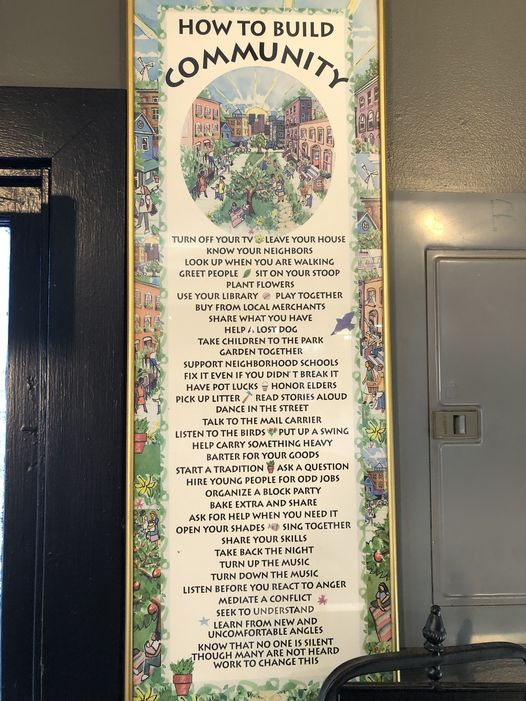
Poster in my favorite local coffee shop

Monkeyflower

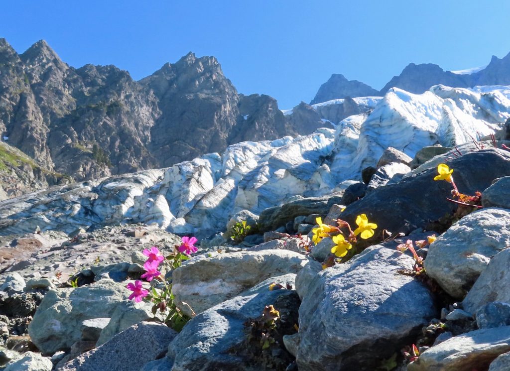
Mimulus lewisii and Mimulus tilingii, Lower Curtis Glacier, Washington

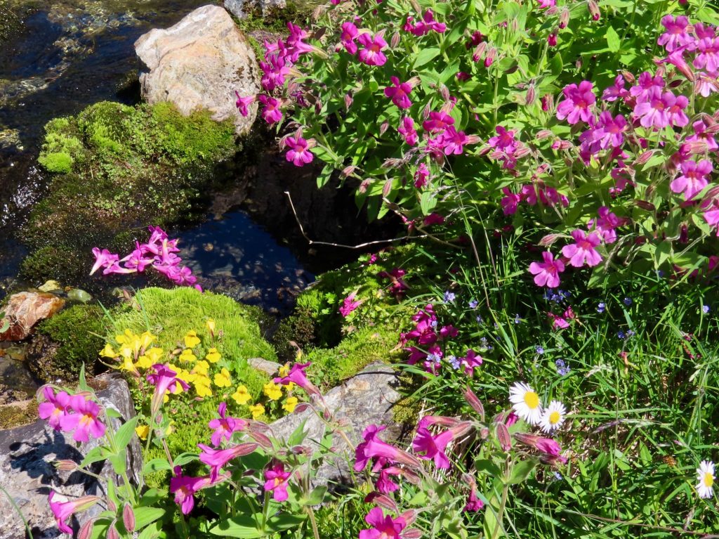
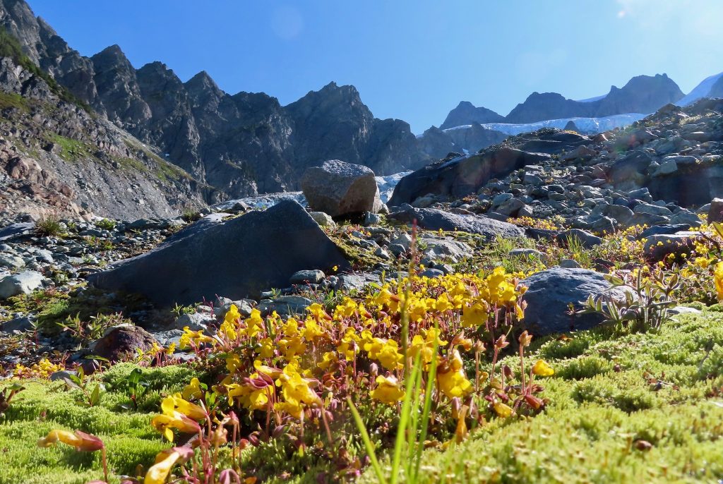
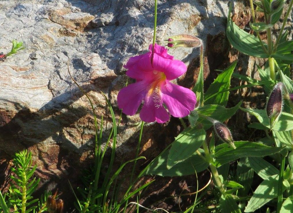
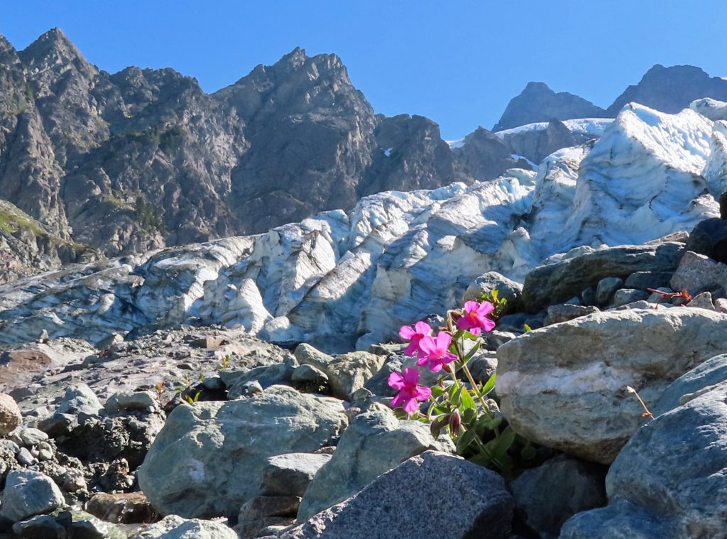
Let me introduce you to some friends of mine, delightful fellows, full of the joy of life. They live at the terminus of the Lower Curtis Glacier, on the jagged western flank of Mount Shuksan, in the North Cascades of Washington state. My bright yellow friend is Mimulus tilingii; my vibrant purple friend is Mimulus lewisii. More casually, they are known as Monkeyflowers. Specifically, they are the Great Purple Monkeyflower and the Mountain Monkeyflower.

I visit them once a year, and both tilingii and lewisii appear to be perfectly happy in the harsh environment of the glacial moraine, which is, essentially, an unconsolidated heap of rubble left behind by a retreating glacier. Some of them, seeking out a gentler neighborhood, choose lush meadows nearby. But whether they choose the moraine or the meadow, my friends are routinely buried under monumental amounts of snow, and they see daylight for just a few months of the year. It’s not any easy place to live.

Mimulus lewisii, near Lower Curtis Glacier, Washington

Although Monkeyflowers are well-suited to the hardscrabble life, they won’t hesitate to choose a cushier location, should one be available. Throughout the Cascades, in the lowlands as well as they highlands, I’ve seen them perched on tiny ledges beside or behind a waterfall; the best real estate a flower could ask for. In this regard, they remind me of a happy-go-lucky traveler who can spread a bivy sack on the barest and most exposed piece of ground and be content, yet can also enjoy a luxurious bed at a five-star resort.

Mimulus lewisii, near Lower Curtis Glacier, Washington

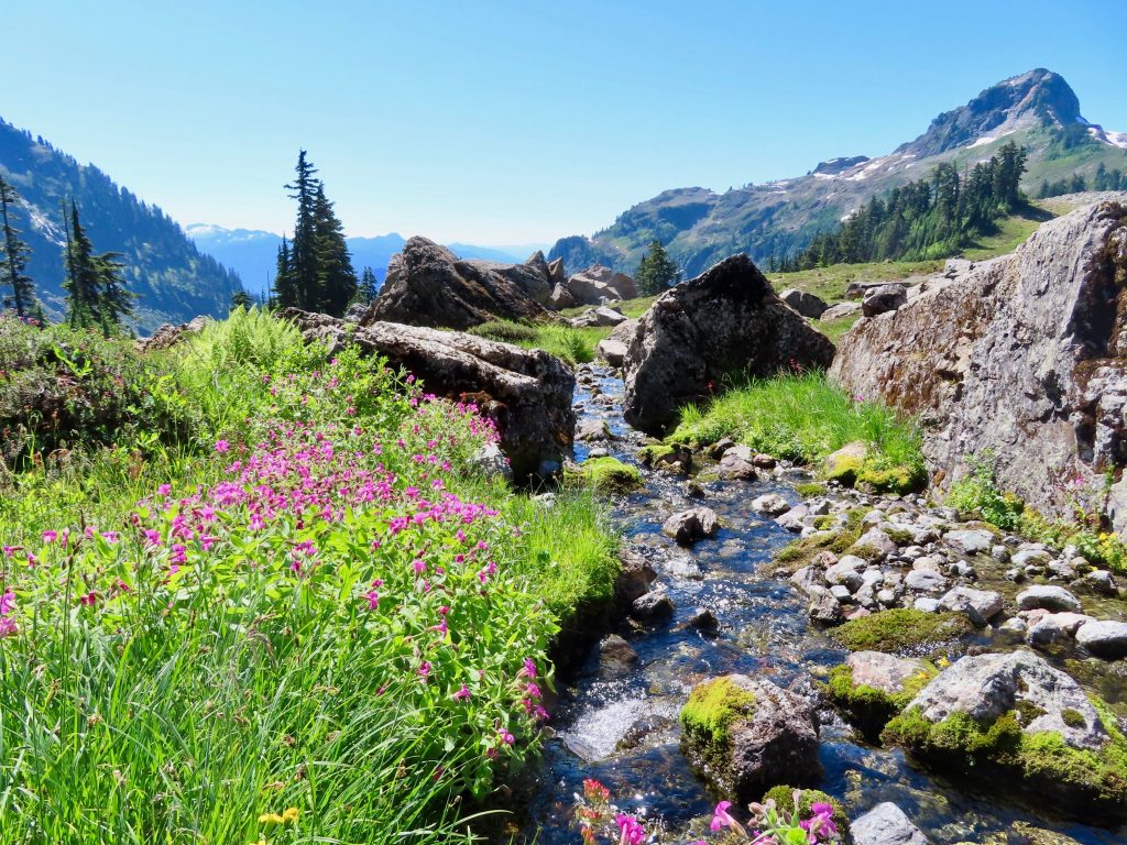
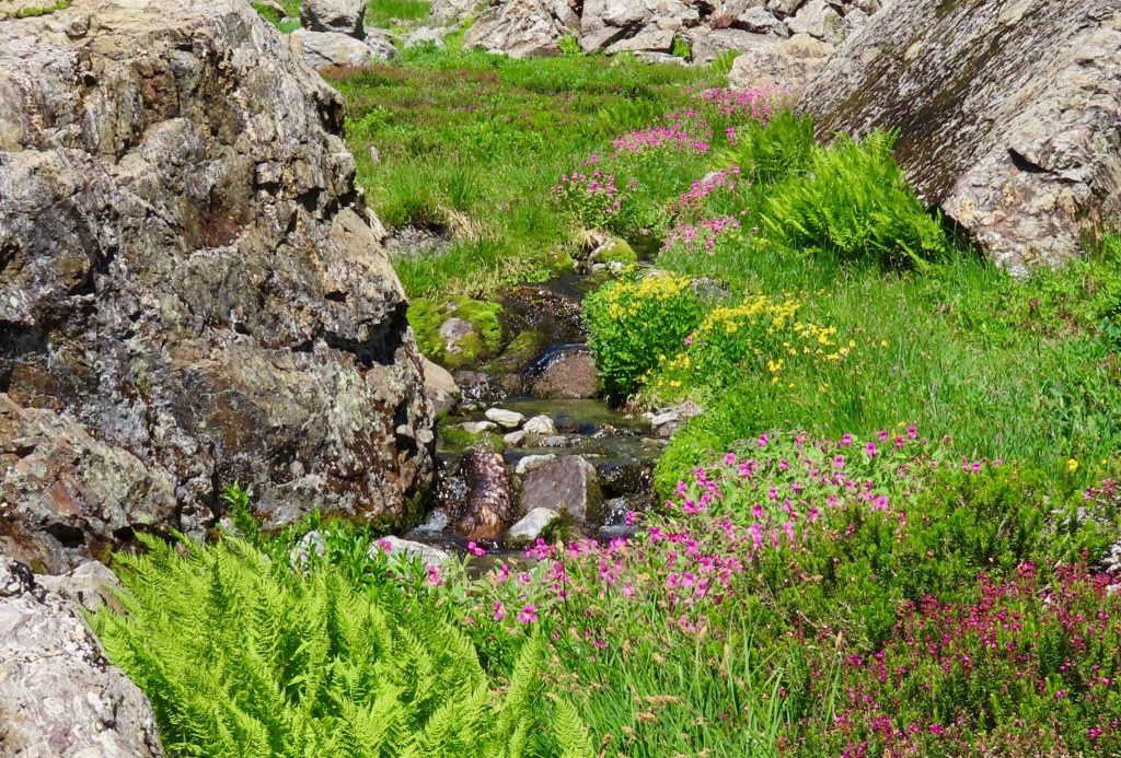
Of all the places I’ve seen Mimulus, none was more memorable than a verdant meadow near the Lower Curtis Glacier, where both yellow and purple Monkeyflowers laid claim to the best spots along a splendid creek that threaded a rock garden. I fell in love with this place, and I make an annual pilgrimage to it. The meadow hosts a party of alpine flowers, and in late August the Monkeyflowers are the life of the party.

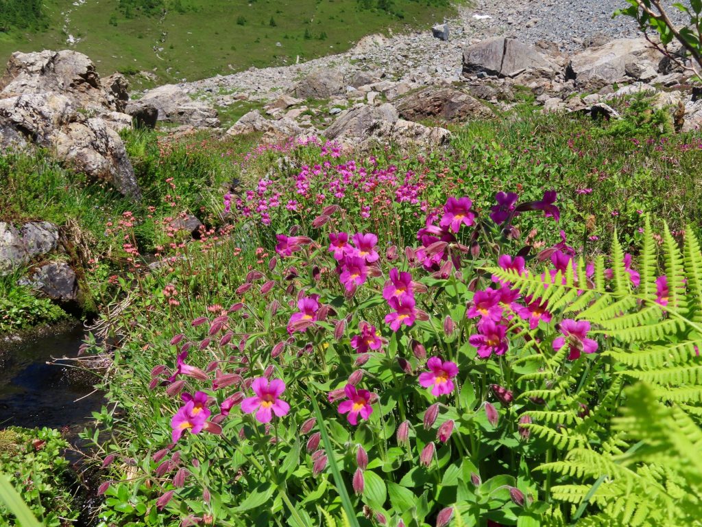
Mimulus lewisii and unidentified Mimulus (I don’t think it’s tilingii), near Lower Curtis Glacier, Washington

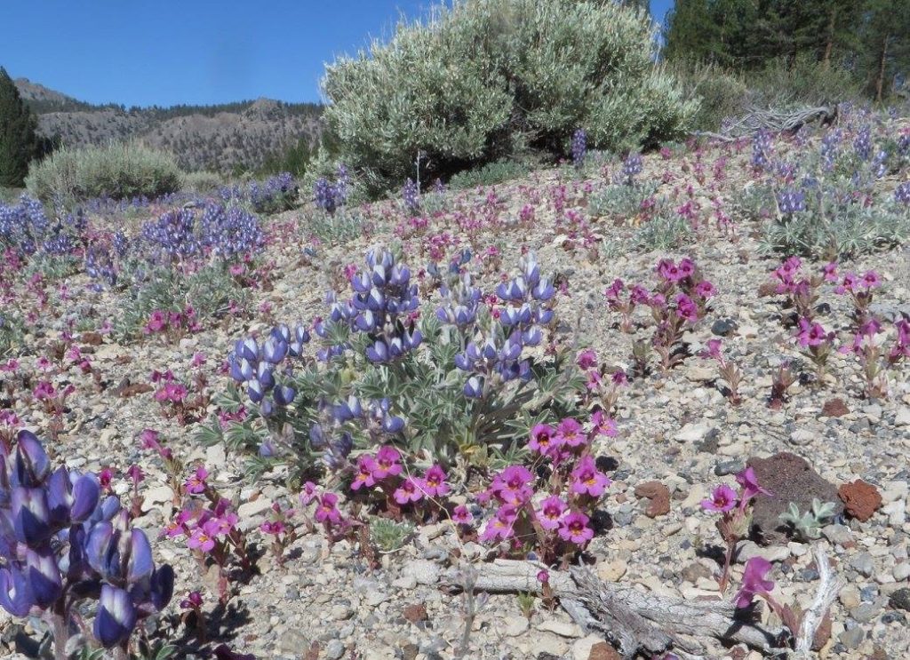
The Mimulus sisters have a cousin from California known as Mimulus nanus. This sun-loving Californian cousin lives along the eastern flank of the Sierra Nevada mountains, in a marvelous volcanic landscape called the Mono Craters. I’ve seen a profusion of gorgeous violet Mimulus nanus growing out a field of loose pumice. It didn’t seem like a growing medium that could support anything at all, and yet the monkeyflowers were happy, along with Gray’s lupine. It was hard to fathom how the tiny plants could take root there, much less thrive.

Mimulus nanus, Mono Craters, California

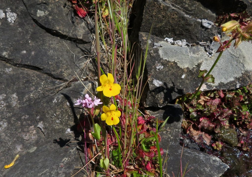
And yet another place Monkeyflowers live: a crack in a south-facing cliff of basalt on the eastern end of the Columbia River Gorge, a place that gets only about 15 inches of annual precipitation and bakes in a level of heat that can be every bit as extreme as the alpine cold of a glacial moraine that is buried in snow for eight or nine months of the year. The Monkeyflowers in the gorge don’t grow out in the open. The common name of these beauties is the Seep Monkeyflower, and as their common name indicates, they prefer to be near a seep or a creek. Any little crack will do, as long as there is some water.

Mimulus guttatus, Columbia River Gorge, Washington

It is a scrappy plant. A resilient plant. A remarkable plant. Here are some cool things to know about the Monkeyflower: It can thrive in inhospitable conditions, such as on the threshold of hot springs, or in serpentine soils that would kill most plants. It is highly adaptable to wide range of harsh climactic conditions and in soils that are heavy-laden with minerals or are just plain impoverished. In fact, Monkeyflowers make themselves at home in the snowiest place in North America, and in some of the hottest corners in the Mojave Desert. It is a pioneer plant in places that are bereft of life for either natural or man-caused reasons, such as glacial moraines or contaminated and toxic mine tailings.

Mimulus lewisii and Mimulus tilingii, near Lower Curtis Glacier, Washington

It’s a humble plant, but it harbors a kind of greatness, as humble little plants often do. Its greatness has not been lost on botanists and those who conduct genetic research. In recent years, it has become a bit of a darling to scientists who study plant evolution and adaptation. In fact, if you want to find a hopping good party of cheerful botanists, you might want to find an annual conference of Mimulus researchers. There are many hundreds of scientific papers written about Mimulus guttatus, the Seep Monkeyflower.

Mimulus lewisii, Lower Curtis Glacier, Washington

So, why is the Monkeyflower such a star? Multiple reasons. First of all, Monkeyflowers grow fast, produce lots of seeds, and have a simple and completely sequenced genome — all traits that make them ideal for genetic study. And, to quote from an article by Elizabeth Pennisi in Science magazine, “their explosion of flower colors and forms, diverse lifestyles, and extraordinary hardiness… have seduced researchers studying plant evolution and adaptations.”

What kind of research have these scientists been seduced into conducting? And what, exactly, does it mean for a species of flower to have diverse lifestyles? Well, in addition to living successfully in drastically different environments, Monkeyflowers exhibit a range of local variation in terms of color and pattern, bloom time, and other characteristics. It turns out that it’s an excellent species to study in terms of genetic mutation and natural selection.

Mimulus tilingii, Lower Curtis Glacier, Washington

For example, researchers have recently discovered that within a single patch of Mimulus guttatus there will be individual plants with different flowering times, flower sizes, and amount of seed production. The later-blooming plants prefer wet years, while the early bloomers do their best in years when drought makes an early bloom crucial. Both variants coexist in the same population, and seem to have evolved simultaneously, in a process called fluctuating selection.

Mimulus lewisii, near Lower Curtis Glacier, Washington

In a time when changing climate is disrupting formerly predictable patterns of precipitation, when even atmospheric jet streams and ocean currents are increasingly unsure of themselves and what they will do, it seems that one path to resilience is to be prepared for anything. When it isn’t quite clear (to either us or the flowers) how things will go from year to year, and when the only sure bet is an increase in weather anomalies, Monkeyflowers demonstrate the peculiar capability of evolving in multiple directions at the same time. Quite a trick! So don’t be fooled by the simple appearance and meager genome of such a humble little gravel-dwelling flower. It’s got a plan. Better, perhaps, than our plan.

A Beautiful Truth

I have been writing quite a bit lately about climate change, and what can be done about it. One of the terms that I use often is “regenerative agriculture.” It may be that this is an unfamiliar term to some people, so I think I’ll give a brief explanation.

First, this: I’d venture to guess that most people consider the burning of fossil fuels for transportation and home heating to be the main contributor of atmospheric carbon. However, the combined effects of a couple of centuries of soil degradation and fossil fuel use associated with agriculture may exceed it. It is hard to overemphasize the role of soil as both a cause of climate change, and a partial remedy for it.

Regenerative agriculture is guided by a straightforward question: What is good for the soil? (This leads to more questions: What is good for water? Pollinators? Invertebrates? Microbes? Birds?) The central principle is that soil is a neighborhood of inter-related creatures, and its continued health can be the primary concern of the farmer, land manager, or even the home gardener.

One way to think of it is that the word “regenerative” is sort of the opposite of “exploitive.” Exploitive and extractive are kindred words, just as regenerative, nurturing, and restorative are kindred words. How can a farmer or gardener relate to his or her soil in a way that is nurturing rather than exploitive? An analogy might help:

Consider a company where the workers are exploited. This might mean underpaid, overworked, harassed, deprived of benefits, and so on. It is quite possible that the company’s short-term profits are impressive, and shareholders are happy. The bank is happy.

However, the company’s long-term viability is less certain. It might be viable as long as it can get new workers to replace the ones who are burned out, chewed up, and spit out. But can it keep on doing this, indefinitely?

In a similar way, farming that exhausts soil can be quite productive in the short term. In places and times where people find it easy to leave exhausted soil behind, and simply move on to fertile virgin soil, techniques of building soil are not often considered important.

As it turns out, feeding soil a steady diet of ammonium nitrate fertilizer is like giving your employees endless cans of Red Bull rather than food. And using vast amounts of pesticide and herbicide is like flooding antibiotics into a person who is perpetually sick, with no concern about gut flora. There is a better way.

Regenerative Agriculture is not new wisdom. In fact, it is old wisdom. The farmer and author Wendell Berry (among many others) has been describing it to American audiences for the past half-century. Its principles include (but are not limited to): use of cover crops, crop rotation, responsible and appropriate management of livestock, no-till or minimum-till methods, a minimum of chemical inputs that harm soil life and water, and growing a diversity of crops rather than a single crop.

The practices of regenerative agriculture help to address some of the causes of climate change, and provide relief from some of the consequences. In a nutshell: degraded soil releases carbon into the atmosphere, while healthy soil absorbs and holds it.

Just as importantly, healthy soil holds more water than degraded soil, recharging groundwater, and decreasing ground surface temperature. A soil that holds carbon also holds water and resists compaction. It acts like a sponge, and it harbors life. Organic matter and air pockets separate mineral grains.

It is in this space that threads of fungi forge the way, and plant roots follow. Soil with higher moisture, especially if it has something growing on it, heats up more slowly than dry, bare soil. Transpiration cools the air above it. On a wide scale, this is a climate-affecting difference.

The persistent “heat domes” that increasingly plague the arid Western US are absolutely related to a deficit of soil moisture. As are, of course, wildfires. Paradoxically, compacted soil that has poor water retention can lead to problems caused by too much water pooling in fields or running off of denuded slopes: salinization, erosion, flooding.

Regenerative practices can alleviate some of the consequences of climate change. They lower soil temperature and raise soil moisture. They reduce erosion. They improve soil fertility and tilth. This has cascading effects: more microbes, more invertebrates, more pollinators, more birds, and more of everything that depends on soil life, right on up the food chain.

In the past few centuries, the ruination of soil has contributed more C02 to the atmosphere than the burning of fossil fuels. It has contributed to drought, heat waves, and famine. Rehabilitation of soil could do as much as any single action to slow down climate change. This is a huge deal.

Many people are sliding into hopelessness, as they feel that we have passed tipping points. Even if we could halt greenhouse gas emissions now, they fear, there is simply too much C02 and methane in the atmosphere already. But it is too soon to lose hope.

Regenerative agriculture — on both land and at sea — can remove C02 and break down methane. To get a handle on climate change, humans need to understand and work with — rather than against — the natural processes of the carbon cycle and the hydrological cycle. Regenerative agriculture does both.

I have written before and will write again about regenerative agriculture in the oceans, in the form of a very particular style of kelp and shellfish farming. The benefits are similar to regenerative practices on land: more biodiversity, carbon sequestration, cleaner water, and healthy food for people.

We fret over carbon dioxide and methane. Regenerative agriculture reduces both. But in regard to climate change mitigation, the chemical compound we don’t talk about nearly enough is actually good old H20. Water. And regenerative agriculture does something about that, too.

I’ll make a point that seems more ‘spiritual’ than scientific: the practices that improve soil’s ability to absorb both water and carbon are the very same practices that reflect a benevolent attitude toward life of all kinds: animals, plants, fungi, and invertebrates.

In other words, generosity matters. The project of improving soil has everything to do with our treatment of other living creatures. We have a damaged relationship to our fellow creatures. We have a damaged relationship to soil. To water. We can repair it.

Many of us hold deep anxiety about our future; we know we have put ourselves on a path of self-destruction. Curiously enough, the path that leads to our deliverance is the path of caring for other creatures as much as we care for ourselves. This is a beautiful truth.

Anyone can play a role in caring for soil. No role is too small. If you have a yard, you can decide to forego chemicals that harm soil life. You can put away the leaf-blower. You can raise flowers that feed pollinators. You can participate in and advocate for community gardens, school gardens, food forests, rooftop gardens, church gardens.

When you vote, you can pay attention to a candidate’s views on land and water management. You can support businesses that do the right thing when it comes to soil. You can find ways to support local, small farmers, especially those that treat land, water, plants, and animals with respect.

There is hope for our children and grandchildren if we can shift our thinking. We need to work with the earth. Stewardship can replace exploitation; reciprocal relationship with other living beings can replace domination. Love can be our guiding star.

Atolls

Tsuga mertensia, Del Campo Peak, Washington

The title of this essay might lead a reader to expect a literary journey to someplace tropical, someplace in the South Pacific, someplace with coconut palms and a hammock. That might be a welcome diversion to readers who are weary of winter. Alas, this is not a journey that escapes the cold. On the contrary, it is a journey that heads straight into it. And there will be trees, but they are not palms.

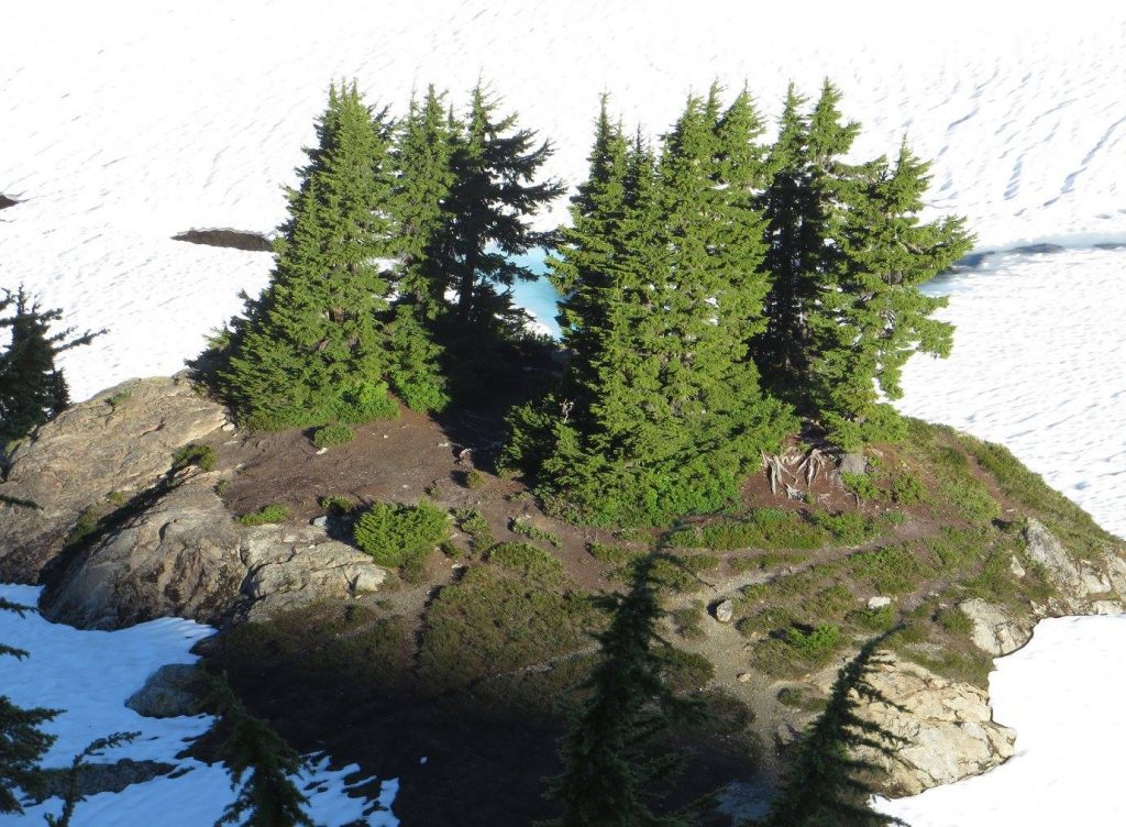
This essay is indeed about atolls — but not ones formed by a coral reef. The atolls of which I speak are formed by a cluster of remarkable, resilient trees called Tsuga mertensia: the mountain hemlock. They occur not in the South Pacific, but in the Pacific Northwest, high up in the rugged, cold, and snowy North Cascade mountains of Washington state.

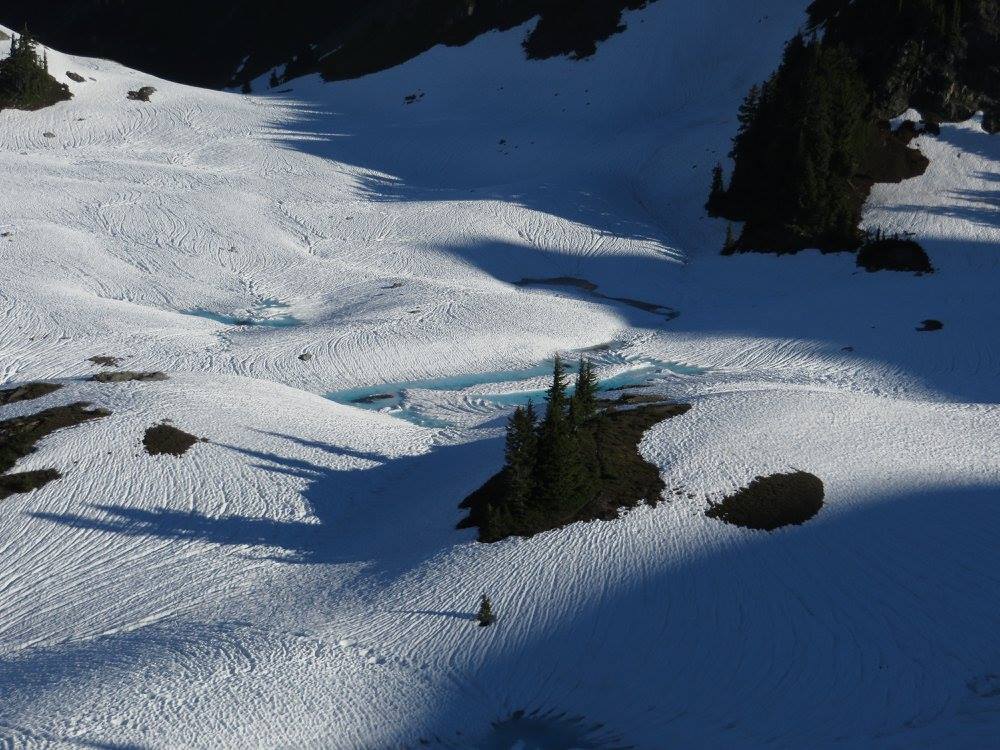
Like their tropical counterparts, these alpine atolls are small islands surrounded by water — only the water, in this case, is snow. And also like their tropical counterparts, they form through a process of gradual accretion, as life builds upon life.

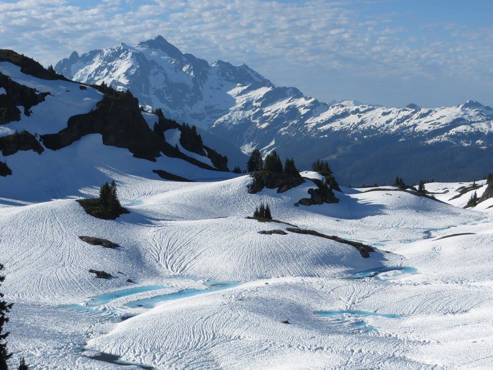
Of course, they are not really atolls at all. It’s a metaphor, first employed by an alpine botanist in the 1930s. But it is an apt metaphor. They look like islands in the summer, when the meadows around them are a sea of wildflowers. And they look even more like islands from October to June, when they are surrounded by billowing waves of snow.

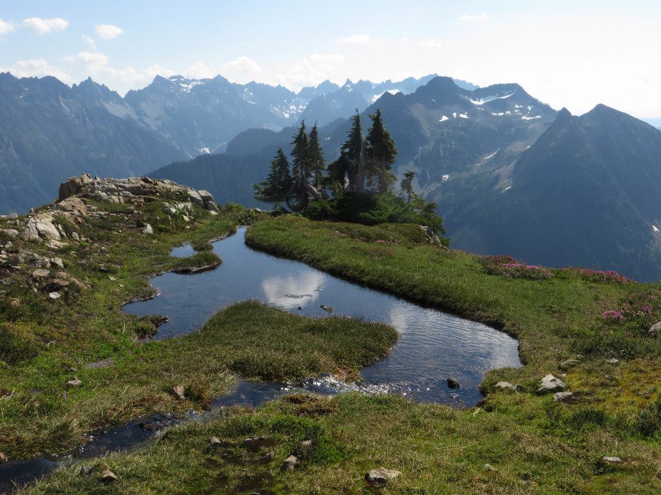
Yellow Aster Basin, Washington

How do these atolls form? And why, among all possible distribution patterns that a tree species might adopt, does the mountain hemlock adopt this one?

The answer comes into clarity at the nexus of several key facts about climate, topography, and biology. First of all, snow is very, very deep here. The growing season is short. There are hazards to be avoided. It can be tough for any living thing to go it alone in such a place. In the subalpine zone, a seedling is more likely to survive if it is in the lee of a larger tree. Hence, the presence of one tree makes life easier for the next one, and the next one.

Yellow Aster Basin, Washington

But I am getting ahead of myself. First let me introduce you to the tree itself. To my mind, the mountain hemlock captures the spirit of the North Cascades as well as any tree. If you’ve ever taken a day trip to Mount Rainier, or went skiing at the Mount Baker Ski Area, you’ve seen it. It is the snow-plastered tree that graces the January picture on a calendar.

In fall and winter, atmospheric rivers from the Pacific take aim at the Northwest coast, giving the lowland forests a long, deep drink. These forests host behemoth trees like the coast redwood, Sitka spruce, western hemlock, western red cedar, and Douglas fir. Along the rivers, big leaf maples drop their dinner-plate-sized leaves. All of these are magnificent trees. In fact, in terms of both diversity and sheer majesty, I can’t think of any place with better trees.

But where the Pacific storms bump up against the steep slopes of the North Cascades, where the wind picks up speed as it sweeps upslope, where mist wraps around ridge lines, and where the dense clouds drop heavy wet snow — tons of it — a different tree comes into its own. A tree that was built for just this climate and just this topography. It is not as big as the lowland trees, but what it lacks in size it more than makes up for in character.

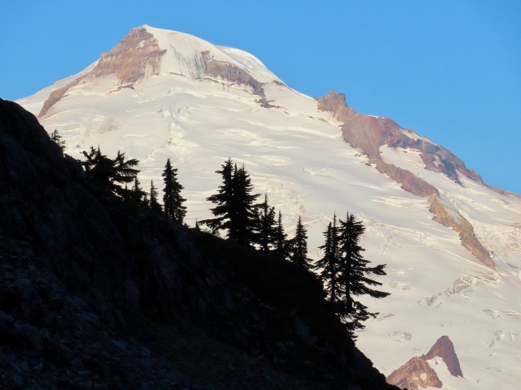
Kulshan, also known as Mt. Baker. Mountain hemlocks on a ridge, Washington

It is the quintessential tree of the wet, western slope of the mountains. It is the brooding tree that so often is shrouded in mist, the one with the dark and hoary silhouette up on a ridge line. It is a dignified tree, maybe even somber. At lower elevations, mountain hemlock drapes the slopes in a dense and continuous forest. In the hours before dawn, it can be a bit spooky to hike through a forest of mountain hemlock. The word primeval comes to mind.

Mountain hemlocks in mist, Gothic Basin, Washington

At higher elevations, it diminishes in size and grows more sparse. It often forms attractive clumps—atolls—in a meadow. One of the most distinctive features of the tree is a droopy leader at the top. It also has graceful branches that subdivide at the end into many small, supple twigs, creating a web-like bough that can hold big loads of snow (until a skier or climber happens to be directly underneath them). This leader and branches give it a distinctly different profile than the stiff and prickly spruces that occur in the subalpine zone on the dry eastern side of the Cascades.

The tree produces tons of small, narrow cones that are brown with papery scales when mature, and a beautiful luminescent shade of purple when immature. The bark is grey and shallowly furrowed. The needles are bluish-green, short, and flat, reminiscent of rosemary. They are arranged spirally around the twig, creating a ‘bottlebrush’ appearance which is accentuated in midsummer, when the growing tip erupts in bright new growth, like little stars at the end of each twig.

Mountain hemlocks in mixed conifer forest near Maple Pass, Washington

It’s clear from its name that it is not a flatlander. It inhabits coastal ranges from Southeast Alaska to California, where it is found in only the wettest parts of the Sierra Nevada. Aside from a few pockets in Northern Idaho and the northwest corner of Montana, it is not a Rocky Mountain tree. It likes things damp, shall we say. And, even though it is superbly adapted to snow, it is not a tree that wants its roots in frozen soil.

In the North Cascades it starts as low as 3000 feet, where it mixes with Pacific silver fir, and extends all the way to timberline, which is generally between 6000 and 7000 feet. Mountain hemlock inhabits the middle kingdom, between the giant trees of the valley bottoms and the wilderness of rock and ice above. On these startlingly steep slopes, it forms extensive, dense stands.

Mountain hemlock forest, Lost Creek Ridge, Washington

If you are hiking up into the high country from one of the valley bottoms, it will take a long time. For several miles and for an elevation gain of four thousand feet, you will see a lot of tree trunks. At first, you’ll be in the lowland forest of the western hemlock, the western red cedar, and the Douglas fir. It’s a lush forest, filled with mossy nurse logs, and the dense understory of salmonberry, red huckleberry, thimbleberry, devil’s club, salal, and various other shrubs.

After you’ve gained about 1000 feet (depending on your trailhead elevation), you will notice a change in the trees; you’ve entered the silver fir zone. You’ll be in this domain for a long time, and for a lot of switchbacks. Gradually as you ascend, mountain hemlocks will appear, and after gaining about 1500 feet, they will predominate. It will remain so until timberline.

At the lower end of its range mountain hemlock is a large tree, though not as large as its sibling, the western hemlock. The largest known mountain hemlocks in Washington approach 200 feet and are about 6 feet in diameter. (This is big, but not nearly as big as the lowland and coastal behemoths of the aforementioned species, some of which can reach 300 feet and be nearly 20 feet in diameter.) A typical large mountain hemlock might be 100 feet tall with a trunk a couple feet wide. Like the western hemlock, it is a tall, straight tree with a cylindrical form.

In the mountain hemlock zone, the forest is somber and dark. There isn’t as much of much of an understory as in the lower forest (although there are delicious huckleberries!). Brief and occasional glimpses of the snowy peaks above will tantalize you, through the thick trunks and heavy boughs of the hemlocks. Ever so gradually as you ascend, the hemlocks get smaller, but it’s only noticeable over miles and hours.

Kulshan through Mountain hemlock boughs, Washington

Now and then you may emerge from the forest into an avalanche path, a brief and chaotic strip of sudden sunlight, Sitka alder, downed trees and debris. Kind of a battle zone. Tongues of snow will last well into late summer. As much as any tree, mountain hemlock bears the brunt of natural violence. Avalanches routinely rip through timber, leaving behind a tapestry of bright and dark green stripes. It’s common to see large trunks snapped in two, like toothpicks. But this destruction notwithstanding, Tsuga mertensia has made its peace with snow.

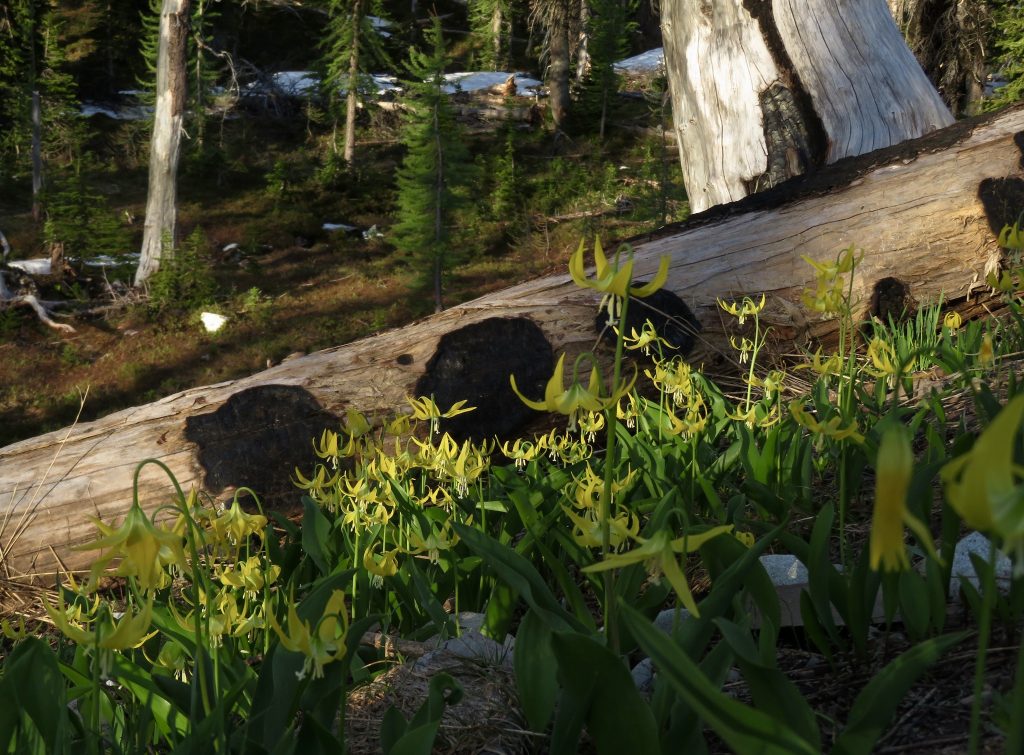
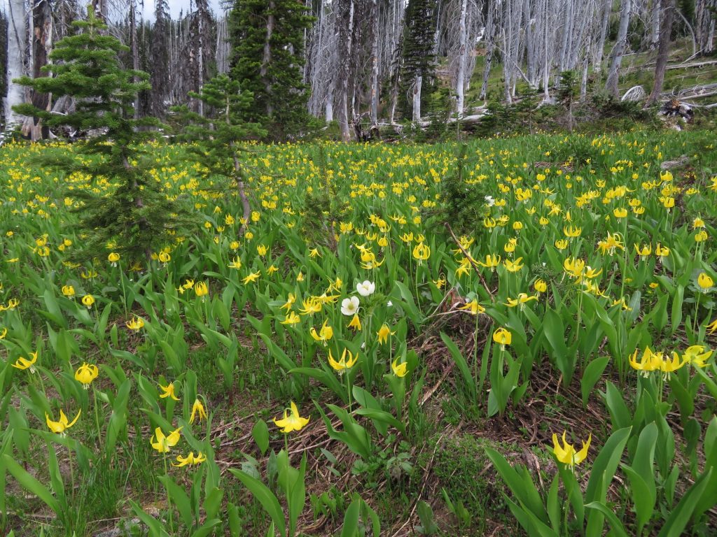
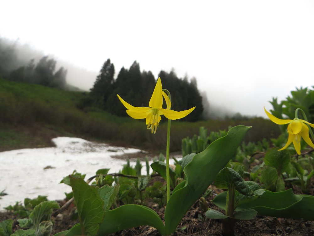
Glacier lily, Mountain hemlocks, and avalanche paths, Sibley Creek, Washington

At the upper extent of its range, as it approaches timberline, the mountain hemlock can appear to be a whole different character. The higher you go, the smaller the trees become, both in terms of height and girth. Whereas they are tall and cylindrical at lower elevation, trees in the high country, burdened as they are with deeper loads of snow, can be beautifully misshapen. It is a creature defined by its relationship with snow.

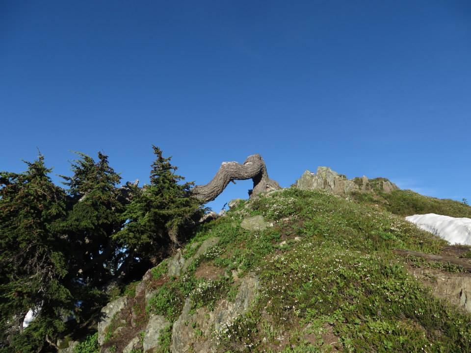
Their crowns may be truncated or their boughs widely splayed. Their trunks may be J-rooted or bent. Without the benefit of a human pruner, these trees in the subalpine zone can become a piece of bonsai art. And like other trees that live at timberline, mountain hemlock can take on a gnarled, stunted form (known as krummholz) where it hunkers down in deference to fierce weather.

Mountain hemlock at timberline, Sibley Creek Ridge, Washington

In the upper drainages of the Nooksack, the Baker, and the North Fork of the Skykomish, mountains of startling vertical relief form pockets that catch the prevailing southwesterly winds. These topographical catcher’s mitts bear the full force of the atmospheric rivers that hit the Cascade range. As a result, these watersheds are among the wettest places in North America.

Annual precipitation in these places can easily exceed 140 inches. Most of it comes in the winter. At the Mt. Baker ski area, annual snowfall averages around 600 inches and in many winters exceeds 800 inches. In the winter of 1998–99, the ski area recorded 1140 inches of snow — a world record. These are conditions in which the mountain hemlock thrives.

Yellow Aster Basin, Washington

In one quite distinctive way, Tsuga mertensia demonstrates how it has evolved to succeed in such a snowy place. A very high sugary sap content imparts unusual flexibility in the trunk of the tree. This renders them extremely ‘bendy,’ so that they can be held down all the way to the ground by heavy snow loads, and then spring back up when the snow melts. BOING!!! Backcountry travelers are familiar with these ‘catapults,’ and are careful to walk around them rather than straddle them.

The Cascades are so effective at wringing moisture out of the atmosphere that the country on the leeward side, the eastern slope, is a spacious dryland forest of ponderosa pine. Not far beyond that, it is essentially a treeless grassland, thick with ticks and rattlesnakes (but not without its charms). But on the western slope where the mountain hemlock lives, the situation is steep, wet, and green. Cross-country travel is diabolically difficult. The North Cascades are a stand-offish range, not offering their treasures easily. But the treasures are sublime.

Mountain hemlock and Mt. Shuksan, Washington

I’ve been speaking in a somewhat inexact way about ‘zones’ of vegetation. The concept is familiar to anyone who has driven a highway that goes from a low place to a high place. In each zone, there are not only characteristic trees, but shrubs, berries, flowers, fungi, birds, mammals, and all manner of living things. As elevation is gained, the species change, and so do the patterns of growth, of size, of density and spacial arrangement.

For many human travelers, the zone that is most sublime is what is known as the subalpine. The word ‘subalpine’ simply means below the alpine, which is accurate enough but not very poetic. What it is: slopes of butter-yellow avalanche lilies, timbered knolls, waterfalls, boulder gardens threaded by chattering streams, and glorious cirques jeweled with lakes that mirror snowcapped peaks.

Foggy Lake, Washington

It’s where you camp the night before you attempt one of those high peaks, and wake up to a frosted world. Frozen or flowing, water infuses the landscape; it is in tiny pools, rivulets that gather into streams that tumble and plunge toward the rivers down below. It’s in dewdrops that bead the leaves of every flower and bush.

Mt. Shuksan, Washington

From high summer to the first snows of October, it’s a place of extravagant life. A lot of living is packed into a few short months. A whole lot of procreating. A lot of interspecies drama. A lot of color. The wildflowers waste no time, and neither do the bumblebees, butterflies, and birds. Tiny pollinated urns turn into plump berries on scarlet bushes. Ptarmigan chicks scuttle about in the heather, and marmots hoot at intruders.

Many modest summits top out in the subalpine, offering views that rival those from any hard-gained alpine peak. Glorious undulating ridges offer miles of delightful scrambling, alternating between rocky outcrops, meadows, and dense thickets of scrappy, dwarfish trees. Sibley Ridge and Trapper Peak are two of my favorite destinations in the subalpine.

A well-situated atoll and the Pickett Range, Washington

At a lower elevation Tsuga mertensia thickly carpets the slopes, but in the subalpine it is sparser, more widely scattered. It lives in clusters that are most often situated on small rises or ridges. In other words — atolls. The trees do not populate bowls or depressions; they are staking out the high ground. Why?

Mountain hemlock atoll, Yellow Aster Basin, Washington

Because that is where the snowpack is thinnest, which means that is where the growing season is the longest. It’s where young trees are safe from avalanches that sweep away or bury everything in their path, and it’s where tiny saplings feel the warmth of the June sun, long before the surrounding meadow is free from its heavy blanket of snow.

Despite how these outcrops and promontories are exposed to the full force of winter gales, it is precisely here that young mountain hemlocks find a hospitable place to get started in life. Especially if they can grow close in the orbit of an old survivor. The typical pattern is that there are, within a small atoll, one or two trees that are significantly older and larger than the rest.

In any atoll, one intrepid tree had to start things off. If the winged seed from a Tsuga mertensia cone was lucky enough to land on a good spot, it might make it. The first years would have been the hardest. Then there comes a time when this persistent pioneer tree becomes shelter for another. And so the atoll begins.

Solitary Mountain hemlock, Yellow Aster Basin, Washington

Once a single tree is tall enough to poke out above the winter snowpack, it creates conditions favorable for the growth of new trees. The dark foliage of the tree speeds melting around its base, allowing for patches of warm, bare ground while an adjacent meadow is still blanketed in snow.

There is a correlation between snowpack and the establishment and expansion of atolls. In an extended period of drier and warmer winters, atolls are likely to expand and new ones will become established. When there is a longer growing season, trees stake out new ground. These trailblazers will survive and grow tall enough to establish a safe harbor for subsequent seedlings. On the other hand, a string of heavy snow winters will inhibit the expansion of atolls and prevent new ones from getting started.

The way these mountain hemlock atolls are dispersed across the landscape is very satisfying to the eye. It is as aesthetic as any designed garden. One way to think of it is that this particular instance of beauty is shaped by hardship. Or, to be more precise, it is shaped by Tsuga mertensia’s response to hardship.

In our thinking about evolution and adaptation, we often recognize the importance of competition — especially in situations where life is particularly precarious. Do we appreciate, also, the importance of cooperation? Do we understand the ways in which one tree grows in the grace of another?

Mountain hemlock atoll with Mt. Shuksan

Worry Stones

Hidden away in a dresser drawer, I have a beautiful hand-made bowl that was given to me as a gift about two decades ago, from an old friend of mine, a fine woodworker. It really should not be in a dresser drawer. It should be where people can see it, and I have determined that it now will be.

I had invited my friend to Washington to climb Mount Shuksan, a glorious peak that rivals, to my mind, the Grand Teton in both its rugged profile and extraordinary dignity. It was such a pleasure to climb it with my friend. Although it was not explicitly stated, I felt that the bowl he gave me was kind of an exchange; I shared with him a sacred place, a place that I dearly love, and he shared with me an exquisite expression of his love of wood.  

Inside the bowl, also hidden from view, are a couple hundred stones. To be more specific, they are semi-precious stones that I had gathered, shaped, and polished over a few years. I intended to fashion them into jewelry, particularly earrings to adorn the lovely ears of my wife and daughters. Intended is the key word in that last sentence.

Leopardskin jasper, intricately-branched moss agates, citron with rutile inclusions, tiger’s eye and hawk’s eye, rare and lovely Biggs jasper, jade, serpentine, hematite banded with iron, rhodonite and delicate pink rhodochrosite, pearly-blue chalcedony, deep blue sodalite laced with veins of milky quartz, softly-glowing green amazonite.

I dabbled for a while in lapidary work, but never acquired the skills and expensive equipment necessary to become serious about it. To my recollection, all I ever made was earrings. When we moved to a house that didn’t have a good space for a grinding wheel, I put the unfinished stones in the wooden bowl, and that was the end of that. I’ve not worked with them since.

I rarely think about these stones. Whenever I happened to open the drawer and see them—always incidentally, while looking for something like toenail clippers—they have felt symbolic of the unfinished bits of my life. The intention I once had of turning them into jewelry has slipped, like an unreturned phone call, into oblivion.

This tendency to begin something and not to finish it is part of my nature. It manifests in so many ways: Doing the dishes, reading Tolstoy, finishing up a degree in Restoration Horticulture. Learning to build a cob house and a green roof. Grafting fruit trees, cultivating mushrooms, making stone jewelry, playing the trombone. Half-done. Half-learned.

Enough learned to know and appreciate what is possible. When I look at the bowl of stones, a little zing goes through me, a little moment of enthusiasm. What if I set up my grinder again, turned these stones into something finished? But I suspect I won’t do it. Yes, yes, I could, if only I set my mind to it. But there are so many books to (not) read first. 

Despite the fact that they never became jewelry, I don’t regret any of the time spent on those stones. Both effort and joy went into the process. I loved finding rough-cut slabs at some funky little rock shop. Rummaging through crates at estate sales. Spending the day at some obscure creek or beach looking for water-polished treasures, or chipping away at outcrops for agates.

And then the pleasure of finding just the perfect little square inch of beauty in the stone that I could chisel out, then grind into the shape I wanted, then polish until it shimmered. It was an activity I could get lost in, an activity that kept me in the moment and quieted the mind. In this way, it was like making music, or shaping a poem, or climbing a cliff.

Maybe at some point I will actually make a few more pairs of earrings. The rest of the stones I may just give away, unfinished. They serve no practical purpose. I guess you could put one in your pocket and rub it. See what it does for you. Throughout history, people in many cultures invested stones with symbolic meaning.

According to Wikipedia, worry stones are “smooth, polished gemstones, usually in the shape of an oval with a thumb-sized indentation, used for relaxation or anxiety relief. The smoothness of the stone is most often created naturally by running water. The size of a worry stone is often about half the size of a silver dollar coin…”

This use of the stone is reminiscent of many ancient beliefs about stones conferring certain powers or protections upon those who are adorned with them. I don’t know about that. But I do know that working with these stones did my spirit some good, in much the same way that growing a garden and keeping bees does my spirit good.

Making money from the sale of jewelry was never the goal. In fact, making the jewelry was never even the goal. What was the goal? I suppose I don’t really know, but it’s sort of like this: I remember the way my dog Rosie, who has moved on now, would gnaw at a bone for hours, lost to everything but the visceral pleasure of crunching on a pig’s knuckle.

A dog who worries at a bone has not a care in the world. When I was hunched over a work bench, chipping away at a hunk of stone, there was no room in my mind for anxiety about the future, or disappointment with myself, or gripes aimed at the Creator.

A dog “worries at a bone,” we say. Funny that this word worry applies to both a mental state of anxiety and the verb that can also describe what we do (or at least what I do) to banish it. Maybe the stones in this gorgeous little bowl are worry stones. A way to calm the spirit. 

A kind of pig’s knuckle. The mineral manifestation of prayer. A way to feel connected to the earth. A way to pay attention. A way to show gratitude.

A Beautiful Mess

On the summit of Ruth Mountain, Mount Shuksan in the distance.

My education about the geology of the North Cascades began with the climbing guidebooks of the late and great Fred Beckey, the legendary dirt-bag climber and curmudgeon. Collectively known as “Beckey’s Bible,” the three-volume Alpine Guides were the first books I bought in Seattle, when I moved here in 1994. I considered them a doorway to adventure. They are without a doubt three of the most influential books in my life. 

Beckey’s Bible, books I, II, and III

Beckey’s guides introduced a whole generation of pilgrims to these mountains. Although the primary purpose of the books is to describe climbing routes, I found myself drawn to his introductions as much as his route descriptions. He goes into considerable detail regarding the geography, geology, botany, and history of the different sub-regions of the Cascades. 

Beckey is famous as a cantankerous climber, but definitely underrated as a wordsmith. Consider, for instance, this sentence describing Mount Shuksan “…rising in a spearhead of dark rock (greenschist), carved by elements into deep cirques and ragged aretes, adorned with chaotic hanging glaciers, frosted and tiered with snow plaques and ice patches.” 

Mount Shuksan from the Northeast, on the way to Ruth Mountain. I am inside the caldera.

After reading that, I knew right away that I had to climb Shuksan. And I did climb it, and it was memorable for many reasons—not the least of which was the most splendid outdoor latrine I’ve ever had the privilege to use. (I bring up this usually private moment only because while visiting this latrine I witnessed the most spectacular icefall I have ever seen.) 

I knew from that first description that I needed to get up Shuksan, but what I didn’t know right away is how deeply in love I would fall with the area all around the mountain, an area of geological mysteries, record-breaking snowfall, botanical oddities, perfect alpine lakes, and scenery that is as grand as any place in North America.  

While I’ve only reached the summit of Shuksan once, I’ve made repeated trips to three neighboring peaks that are less lofty but no less magical: North Twin, Tomyhoi Peak, and Ruth Mountain. And I make an annual pilgrimage to swim in the lovely Lake Ann and climb around on the ice of the Lower Curtis Glacier, nestled in a cirque on Shuksan’s western flank.  

Lovely Lake Ann doesn’t melt out until August. Shuksan, with the Upper and Lower Curtis Glaciers.

So while Shuksan richly deserves to be praised in poetry, prose, and song, while it deserves to have dissertations and books written about how it came to be, this blog post is mostly about the land around it. More specifically, it is about two incredible and peculiar geological features that sandwich the great mountain.

One of these features is immediately to the west of Mount Shuksan, and a hiker making his way to the Lower Curtis Glacier will cross it. The other is just to the east of Shuksan, and a climber standing on the summit of Ruth Mountain will be standing right in the center of it—likely without even knowing it.  

Both of these features are the result of geological events of almost unimaginable drama and violence, events that fundamentally altered the landscape. And yet, for all their impressive magnitude, both features have been so thoroughly eroded over time that they will be pretty much invisible to the eye that is not trained to see them. 

I am speaking of ancient calderas. 

***

The gentle and elegant slopes of Ruth Mountain, remnant of an ancient volcano.

Just to the east of Mount Shuksan, Ruth Mountain is a bit of an anomaly—a relatively gentle, smooth-sloped triangular peak that stands out conspicuously in a sea of jagged rock draped with precarious and fractured glaciers. When I stand on the summit of Ruth, gazing at the razor-sharp skyline of the Picket Range and the dark and forbidding Nooksack Tower, I’m amazed that I could enter the inner sanctum of such a place with relative ease.

Ruth’s easygoing aspect and straightforward approach is unusual in a region where climbing and suffering are synonymous. The welcoming character of the mountain is fortunate for an aging solo climber; it means I don’t have to rope up, and I can easily do it in a day, even with a wonky knee and a growing old-man belly.

Inside a crevasse on Ruth Glacier.

(Because the route up Ruth crosses an active glacier that has a few easily avoidable crevasses, many people do rope up on it. It is considered more than a casual hike, and some guide services charge clients in the neighborhood of $800 to reach its summit. But it is not a hard ascent, is usually done in a day, and poses minimal risk to anyone with common sense, good boots, and some skill with an ice ax.)

The summit offers a stupendous vantage of some of the North Cascades’ most impressive features, such as the aptly-named Picket Range and the austere Nooksack Cirque with its hanging glaciers and seracs poised to come crashing down into the cirque at any moment.

Nooksack Cirque, from the summit of Ruth. Along with Ruth Glacier, headwaters of the Nooksack River.

Indeed, it almost seems unfair that such a summit can be reached by an uncomplicated day-hike, when so many other nearby summits (with lesser views) require bushwhacking through nearly impenetrable forests, side-hilling on diabolical scree, and threading your way through gullies of shattered rock. A trip up Ruth seems like I’m getting away with something. 

The Pickett Range. Remote, incredibly difficult to travel through. The wild heart of the North Cascades.

Often, it is a precipitous peak surrounded by gentler neighbors that draws the eye and holds a viewer’s appreciation. But I find Ruth’s shape to be a lovely and satisfying contrast to the dramatic topography around it. Its shape is related, of course, to its history. Ruth looks different from the neighboring peaks because it is different.

Like the ugly duckling who was really a swan and not a duck, Ruth is not kindred to the peaks around it. While the peaks around it are the non-volcanic and crumpled result of tectonic plates colliding, Ruth—along with its modest neighbor to the north, Hannegan Peak—is what remains of an ancient volcano. And Ruth sits in the middle of a caldera known as the Hannegan Caldera. Its creation was about 3.7 million years behind us.

If you’ve been to Ruth, you may be surprised to learn this. Standing on the summit and looking over the landscape of rugged peaks and deep glacial valleys, it does not look like you are in the middle of caldera. But there are signs, for those who know how to read them. 

The event or sequence of events that created the caldera was bizarre, kind of delightful to contemplate, and unique in the world as far as geologists can tell. At least they haven’t yet found evidence of a similar occurrence elsewhere. While calderas are not all that uncommon on the face of the earth, the Hannegan Caldera holds a special distinction: It is the only known “two-phase, reciprocal, double-trap-door collapse caldera” in the world. 

Wow. That’s a mouthful. What the heck does it mean?

***

On the face of it, there is nothing exceptional about a caldera (although they are exceedingly cool). Calderas occur where potent volcanoes obliterate themselves in an explosive eruption, thus emptying a subterranean chamber of magma. The roof of this chamber then collapses, either in whole or in part, creating a depression that is akin to a crater, but much bigger.

The sunken area is most often roughly circular, although the shapes vary. A caldera might look more like a football, or a kidney, or an amoeba, or a jellybean. Sometimes resurgent volcanic activity will raise bumps or cinder cones within the caldera. Geysers, boiling mud pots, and fumaroles indicate that plenty of heat is not far beneath the surface, and future eruptions are possible. Often, the caldera will fill with water.

As a chain of impressive subduction-zone volcanos, the Cascade Range holds its share of calderas. The most recent, most famous, and most visible one is in Oregon, where a stratovolcano in the style of Rainier, Baker, and Adams erupted about 5700 years ago, leaving behind the deepest and one of the most beautiful lakes in North America. 

Crater Lake is the most recently formed caldera in the Cascade Range. Incredibly photogenic and instantly recognizable, it is a poster child for calderas. The lake was formed when Mount Mazama obliterated itself in an eruption that geologists estimate as a solid 7 on the Volcanic Explosivity Index. 

Crater Lake, Oregon. Caldera formed by the eruption of Mount Mazama. NPS photo, by Kim Chamales

A 7 on the VE scale is a damn big blast, by the way. Enough to cover most of the USA with ash. In our lifetimes, there has not been a 7 anywhere in the world. The largest eruption in the past century was Mount Pinatubo, in the Philippines, in 1991. It was a 6. There have been a handful of sixes in human history, including the infamous Krakatoa, in 1883. 

The largest eruption in several millennia was Tambora, in Indonesia, in 1815. It was a 7. The eruption that created the caldera of Santorini and probably also birthed the legend of Atlantis, circa 1600 BC, is estimated to have been a 7. And that’s it—just those two. They don’t get any bigger than that for the duration of recorded human history.  

I should mention that a 7 is not just a little bit bigger than a 6. The scale is exponential, so a 7 is ten times greater than a 6. The VE scale goes to 8, and an 8 is commonly referred to as a ‘supervolcano,’ although the term ‘supereruption’ would be better, since eruptions of such magnitude are not always associated with a single discernible mountain peak. The last time an 8 rocked the planet was 27,000 years ago in New Zealand, and the most recent Yellowstone eruption of this size occured 640,000 years ago.

Mount St. Helens, in 1980, was only a 5. I say only as if a 5 were merely a hiccup. 

St. Helens.Tiny photo, big blast. Getty Images

The two calderas that are on both sides of Mount Shuksan, the Hannegan and the Kulshan Calderas, were both created by explosions estimated to be 7 on the VE scale. As the crow flies, they are less than eight miles apart, and Shuksan is placed squarely right between them. Mount Shuksan has definitely witnessed some dramatic action in its time here on earth! If a mountain could talk, what stories it would tell. 

***

This seems as good a time as any to talk about time. And size, too. And power.

I’ve hiked through both the Hannegan and Kulshan Calderas on many occasions. On every trip, I stop to admire and photograph the alpine wildflowers. On the way to the Lower Curtis Glacier, on a ridge just above Lake Ann, there is a slope that hosts a smattering of Saxifraga tolmiei, also known as Tolmie’s Saxifrage. It is a delicate and tiny flower, hunkering close to the ground. It thrives in the snowiest of locations, and is endemic to the Pacific Northwest.

From this ridge of flowers, you can see most of the million-year-old Kulshan caldera, with Mount Baker beyond it, to indicate the possible site of the next big hole in the ground. The flowers on the hillside are lucky to last a month before they shrivel. 

An alpine flower such as Saxifraga tolmiei lives for a handful of years. A flower on the plant lives for maybe a month before it shrivels. Blink of an eye—but long enough to get pollinated by a bee, develop its seeds, and broadcast them across the waiting ground. The bumblebee that fulfills the purpose of the flower also lives for a short summer season. Long enough to do its work. 

Are we much impressed by age? Or by size? In what way do we understand power? There is power in a VE7 eruption. There is power in an earthquake, or a tsunami, or a river of ice. There is a different kind of power in the saxifrage blossom and in the bee that pollinates it. 

Saxifraga tolmiei, aka Tolmie’s Saxifrage. Very small and gorgeous alpine, it hunkers low to the ground.

It’s been my experience of life that significance is not measured solely in terms of duration. Neither is it reckoned in terms of size. Significance is a subjective assessment, based on what is in the heart and soul (if I may be permitted to use such a mushy term) of the one making the assessment.

Consider a dog that has the lifespan of a decade, but lives on in the heart of a human who gave it a name. Consider a beloved child whose life is cut short by illness or accident; she is on earth for only a few years, but is of greater significance to her mother than any thousand-year-old tree or million-year-old mountain. Consider a single afternoon that, for one reason or another, you carry with you like a treasure. Consider yourself. 

Sam, the noble dog, on the shores of Puget Sound. He was too young this year to take into the wilderness.

Each creature and even each caldera is one part of a larger story of interaction and inter-being that encompasses all of time. 

In the wet forests of the Cascades, I am always entranced by the ephemeral blooms of mushrooms that are, quite literally, ‘here today and gone tomorrow.’ But the fleeting fungi is just the fruiting part of an underground web of mycelium that persists under snow, through seasons of drought, through times that seem barren. 

In similar fashion, a single aspen tree—a short-lived species—scuttles its golden spade-like leaves in the sunlight for a mere fifty years or so before it falls to the ground and transitions to soil. But a single tree may be part of a grove, and a grove has characteristics of a living organism. The life force of an individual tree is carried on through the grove the way water from a thousand small creeks merges in a river. Hard to say where anything ends.

Aspens, San Francisco Peaks, Arizona. A long ways from Mount Shuksan, but another sublime mountain.

In trying to imagine and write about geological history, it is easy to compress a million years into a moment, as if on a Tuesday there was a certain landscape, and then—Boom!—on Wednesday there was the Hannegan Caldera where yesterday’s meadow had been. 

It’s easy to imagine the distant past as one rapidly occurring cataclysm after another. It’s easy to picture a pell-mell succession of eruptions, floods, meteors, climate shifts, extinctions. But do we imagine life being placid and serene for a pterodactyl in the Mesozoic? Or for a Woolly Mammoth in the Pleistocene? 

When describing landscape-shaping events, I’m tempted to resort to comic-book exclamations: KABOOM!!! KAPOW!!! CRAAACK!!!. I’m tempted, also, to visualize them as discreet, single events. For instance, in regard to the plate tectonics that creates mountain ranges: India plows north through the Indian Ocean, slams into Asia, and just like that—OOOOF!!!—the Himalayas are thrust skyward. Or, closer to home: a big slab of ocean floor basalt slams into North America and then is transformed, by geologic wizardry, into the greenschist crags and towers and summit pyramid of Mount Shuksan. PRESTO!!!

The complex wall of greenschist that makes up the western flank of Shuksan, above Lower Curtis Glacier.

But when that chunk of ocean floor basalt that is the genesis of Mount Shuksan“slammed” into North America during the Mesozoic era, it’s not as if a human observer (a time-traveller, of course), could have walked out of her palm-frond hut on the Pacific coast, and watched a chunk of land crash into the beach like an out-of-control ferry coming too fast into a dock. She wouldn’t see that basalt transformed by pressure and heat, then crumpled and folded and thrust 9000 feet into the air. She probably would have seen just another pleasant Mesozoic sunset. Heard the plaintive cry of a pterodactyl. If we could squeeze time and let its essence drip out, what would that essence be? The earth is inconceivably violent and sublimely peaceful. Simultaneously.

What endures for millenia, what endures for a month, what is melting too quickly, and what is timeless. Shuksan, Lower Curtis Glacier, and monkeyflowers on the glacial moraine.

And what about the slice of time that we inhabit, right now, in 2023? It is probably more cataclysmic, more pivotal, more dramatic, than any comparable slice of time from the past. For instance, what we may perceive as a slowly-unfolding change in climate is, in terms of the earth’s rhythms, happening unbelievably fast. Faster than such changes have happened before. 

***

So, back to that intriguing phrase “two-phase, reciprocal, double-trap-door collapse caldera.” 

It helps to take it one word at a time. The relevance of the word ‘collapse’ has already been established; a caldera is formed when an area of land that sits atop a hollowed-out subterranean chamber collapses. What does ‘two-phase’ mean? It simply means that the collapse of the caldera occurred in two distinct phases, separated in time, rather than as one event. 

Now, let’s move on to the idea of a trap door. Maybe the best way to proceed is to conjure up the mental image of the entrance to the lair of a trap-door spider. A trap door is, essentially, a flap. Just like a flap of skin after an injury, only it’s on the skin of the earth. For most of the perimeter of the flap, there is a discontinuity in the skin, a crack in the earth. But on one end, the ground is unbroken and continuous. This forms a hinge. 

Imagine a giant, somewhat circular chunk of land that sits above an empty chamber. Prompted by gravity, the land begins to sink. As it does so, cracks form around the perimeter of the circle. They are called faults. But on one end of the circle, faults do not form, and the structural integrity of the land holds it up and inhibits the collapse. In other words, there is a sort of hinge on one end of the caldera. As a result, the collapse is lopsided, far more pronounced on one end than on the other. More of a slump than a uniform drop. 

This is where the significance of the descriptor two-phase kicks in. Keep in mind that in geologic time, phase one doesn’t happen on Tuesday, followed by phase two on Wednesday. Phase one and two may be separated by tens or hundreds of thousands of years. Enough time can elapse between phases for more volcanic activity to occur within the caldera. 

Magma chambers can refill, raising a large bump within the caldera. More eruptions can occur, emptying the chamber again. Another collapse occurs. It happens, once again, to be a trap-door collapse, where the sinking happens on only one side. Only this time, the side that collapses and the side that is hinged are reversed. Voila: A double-trap-door collapse. It is reciprocal because the two sides take turns. 

***

Although local geologists know them, neither the Hannegan nor the Kulshan caldera are well-known among the general population. They are certainly a far cry from famous. But there are some famous calderas all around the world.

For instance, the city of Naples, Italy, is cradled inside a mammoth caldera known as Campi Flegrei. It’s a risky place for three million people to live. The still-active volcano of Vesuvius sits on the edge of this huge caldera, giving a daily reminder to the citizens of Naples that there are no guarantees in life.

Elsewhere in the Mediterranean, the circular arrangement of the Greek islands of Santorini hints at a caldera that is now filled by the sea. The eruption that created this caldera may have been the event that gave birth to the legend of Atlantis. 

In Yellowstone National Park, three enormous and overlapping calderas bear testimony to the explosive past of a “supervolcano” that sits above a hot spot in the earth’s mantle. Yellowstone Lake partially fills one of these calderas. 

In California, the ski town of Mammoth is nestled inside the huge Long Valley Caldera. The center of the Long Valley Caldera holds some delightful hot springs that would be even more enjoyable if they were not pretty much constantly occupied by aggressively naked and often inebriated climbers, hipsters, shamans, and shred-betties.

Despite the stellar scenic qualities of these two obscure calderas of the North Cascades, the reason they are not as well-known as the other examples mentioned here is simple enough: they simply aren’t easily recognizable as calderas.

I’ve mentioned that a person standing on the summit of Ruth Mountain would have trouble realizing that he is inside a caldera. It’s equally true that a hiker laboring up the slope to Lake Ann, looking back at the gleaming snow cone of Mount Baker, would have trouble realizing that the valley she is looking across is, in fact, the center of the Kulshan Caldera. 

Many of Earth’s calderas are much older than the Hannegan and the Kulshan, yet remain clearly recognizable. In contrast, the two calderas that flank Mount Shuksan are difficult to discern just by looking at the landscape; geological sleuthing is required. Why is this? The answer has to do with another reality of the North Cascades: the presence of ice. 

A rare event: a hot spring all to myself, on a glorious morning in the Long Valley Caldera, California.

It can be hard to recognize an ancient caldera in a place where aggressive glaciation has scoured the land. During recurrent ice ages, glaciers thousands of feet thick advanced and retreated several times, removing softer rock and leaving more resistant rock behind. When the caldera rim has been breached, tongues of ice widen and deepen the breach. After the ice is gone, rivers assume ownership of the valleys. Lakes drain away. 

Other processes that sculpt a landscape continue. Further volcanic activity can alter the caldera’s appearance, raising new mountains within the caldera. It may no longer look anything like a bowl. A hiker can be standing smack dab in the middle of an ancient  caldera and never know it. But there are geological signs for those who can read them. There are ways that rocks tell the story.  

One way that rocks tell the story is with thick deposits of a volcanic rock called ignimbrite, which is a blend of volcanic ash and pumice, welded together. (If you’ve heard of volcanic tuff, it is the same thing as ignimbrite.) The name is derived from a combination of the Latin words for fire and rain. The name bears no relation to James Taylor; it has to do with the origin of ignimbrite in a pyroclastic flow from an explosive eruption. 

Sunrise on the ignimbrite of Hannegan Peak.

The rock that composes Mount Shuksan is very dark. It is greenschist, which is a metamorphic rock formed from basalt that has been altered by pressure and heat. On a gloomy, misty day, this dark rock adds to the brooding mystique of the mountain. In contrast, the ignimbrite deposited by caldera-forming eruptions is a light-colored formation, ranging from beige tan to grey. It looks frothy, like hardened meringue on a petrified pie. 

More ingnimbrite, this time in the Kulshan Caldera. From the trail to Lake Ann.

Ignimbrite is evident on the south slopes of Hannegan Peak; from the slopes of nearby Ruth Mountain, you can see it glowing in the light of sunrise. It is also evident in the watershed of Swift Creek, eroded into steep gullies. In both cases, the light rock is visible from a distance, and it tells the tale of two calderas. 

***

That tale is a single chapter in a long and complicated story. The story is as long as the earth is old. I intended, in this blog entry, to only dip into the chapter about two calderas in one of my favorite corners of creation. But I must also say a bit about Mount Shuksan, that incomparable mountain first introduced to me in the words of Fred Beckey, who had spent more than a few days on its slopes. So the last part of this blog entry is not about calderas at all. It recounts some geology that is older and stranger than calderas. It is about the formation of the mountain range that is most significant to me, which is to say: closest to my heart.

In addition to Mount Ruth and the Lower Curtis Glacier, another one of my favorite places in the shadow of Shuksan—I’m not embarrassed to call them my sacred places—is Tomyhoi Peak, which is a short distance to the north. I try to go there once a year, and a year that I miss this hike feels just a bit incomplete. 

I’ve written at length about Tomyhoi Peak before, so I won’t do it here, except to quickly mention that among its charms are a fern grotto that boasts greater fern diversity than any place in North America, incomparable blueberry meadows, and a basin of jewel-like tarns that melt out in late July, and are perfect for an icy baptism. 

Shuksan again, this time from the north. On the way up Tomyhoi Peak. Mt Baker is just to the right of this photo. I don’t know why I don’t have a photo of the two of them in the same frame.

I bring up Tomyhoi, briefly, because the view of Shuksan from Tomyhoi is splendid, and in one notable way quite different from the views of Shuksan that you get from either Ruth or the Lower Curtis Glacier. There is no place better than the upper ridge of Tomyhoi if you want to view craggy Mount Shuksan side by side with the other great mountain of this region: Mount Baker, the volcano, the reigning queen.

And here’s Baker. I prefer the native name of Kulshan. Baker is some British dude who never even came here. Baker is the queen. She could be the cause, someday, of the next caldera. Who knows?

I love this view. Baker (or Kulshan, to use its indigenous name) and Shuksan, equal in beauty, are utterly unalike. One is clearly a volcano; the other clearly is not. I love the North Cascades, in part, because of this contrast. It suggests a long and complex history. The volcano is a recent creation, a youngster, merely the most recent expression of the forces that created the two calderas, and Rainier, and Glacier Peak, and a long line of ghost volcanoes that have come and gone, leaving their signatures in layers of ash.

But that other mountain, the craggy one… How did it come to be? And why are they right next to each other?

Shuksan again. This is the view most people see, from near the Mt. Baker ski area.

For a long time, the North Cascades was one of the least understood mountain ranges in America, at least in terms of a coherent narrative of its origin. Sure, the volcanoes were easy enough to understand, but the jagged mountains in northern Washington are, for the most part, not volcanic. The range seemed like a jigsaw puzzle where even after it’s assembled, the pieces don’t seem to fit. At least, the assembled picture seems more like a Picasso than a Rockwell.

Before the theory of plate tectonics was widely understood and accepted (which is to say before the 1960s) the geology of the North Cascades was pretty inexplicable. This mountain range was in many respects a perplexing jumble of rocks that didn’t belong together. One sub-range was composed of a granite batholith, like the Sierras in California. Another sub-range right next to it was composed of metamorphosed sediments, or sea-bed basalts, or even an oddball rock like Dunite, which is rare on the surface of the earth, but common in the Mantle. These patches of different rock types seemed pasted on to each other with no rhyme or reason.

But there is a reason, and it begins with a key fact to keep in mind when contemplating the jigsaw puzzle: A subduction zone right off the coast. A place where one of the earth’s crustal plates collides with another, and then keeps going, diving deep under the North American continent, experiencing heat and pressure, buckling, folding, changing before it is thrust high into the sky.

And in addition, just to make things even more interesting, the presence of south-to-north strike-slip faults (like the San Andreas Fault in California) that over time shift whole chunks of land northward. In some places where plates meet, they don’t collide; rather, they slip sideways. The Straight Creek Fault, which passes near Mount Shuksan, is one such south-to-north strike-slip fault.

Plate tectonics was indeed the key to the puzzle. In the words of an unnamed contributor to Wikipedia, “…the new science of plate tectonics illuminated the ability of crustal fragments to ‘drift’ thousands of miles from their origin and fetch up, crumpled, against an exotic shore.” 

Some uncredited authors, like some dirt-bag climbers, have a way with words. 

The North Cascades are as geologically complicated as any mountains in North America, and the area specifically around Mount Shuksan is especially so. A geologic map of the area presents a tapestry of slivers and wedges, shards and blobs. It’s a collage of chaos, a mosaic with no discernible pattern. A mess.

The colors represent different rock types. The lines are faults. Mount Shuksan is center right. Ruth Mountain is further to the right. The Kulshan Caldera is center left, right in between Shuksan and Baker. Can you guess what QTcc means?

Mind you, the word ‘mess’ is not a geological term. A geologist might refer, instead, to plutons and terranes, deposits and intrusions. She might go on to explain that intrusions come from below, while deposits are laid down from above. A pluton is a mass of magma that didn’t erupt on the surface, but rather solidified underground; a terrane, on the other hand, is a chunk of land that moves laterally, thanks to the phenomenon of continental drift.

But then she might concede, as well, that… yeah, it’s a bit of a mess. A beautiful, fascinating mess. Why is it so messy? It’s messy in large part due to a phenomenon known as exotic terrane accretion. What the heck does that mean? Well, turn the word accretion into a verb: accrete. To accrete is to add one thing to another. Slap it on, glob it on, paste it on. So an accretion is a bit of something that is pasted on to another bit of something. But what is a terrane, and why is it exotic?

I’ll let a geologist explain it. In the words of Dr. Ralph Dawes of Wenatchee College, “A terrane is a group of related rocks that formed together in one area, do not show any relationship to the other rocks around them, and are separated from the rocks around them by faults. Terranes range in size from a few square miles to thousands of square miles. Plate tectonics explains how terranes can be moved across an ocean and added to a continent. Because terranes come from a distant location they are often referred to as exotic terranes.”

And there you have it: The North Cascades are made up of bits and pieces of land from all over the Pacific Rim, plastered together. Terrane is another word, a snazzier word, for a ‘crustal fragment.’

Starting in about the 1970s, a few geologists began employing the new technique of paleo-magnetic analysis in order to determine the origin of rocks. This led them to construct what seemed, at first, a theory a little too implausible to believe. But, over the past few decades, more and more evidence is lining up to support it. What’s the theory? 

I like the way the geologist J.N. Carney puts it: “It was soon determined that these exotic crustal slices had in fact originated as ‘suspect terranes’ in regions at some considerable remove, frequently thousands of kilometers, from the orogenic belt where they had eventually ended up.” The movement of these terranes was not just in one direction; in addition to ‘slamming’ into North America, they also ‘slipped’ northward in much the same way that Californian real estate on the west side of the San Andreas Fault is currently slipping northward toward Seattle. 

I love the phrase ‘suspect terranes.’ Hmmmm…. Where are your papers, you wandering chunk of granite?

Simply put, these fellows were suggesting that a sizable chunk of the Cascades—the mighty Stuart range batholith, to be precise—originated in Baja California. The alignment of magnetic crystals in the granite of Mount Stuart—crystals which are sensitive to the position of the magnetic North Pole—functioned as nature’s own GPS. They indicated the latitude at which the rock was formed.

Mount Stuart, not in the vicinity of Shuksan, but one of the premier peaks of the North Cascades. And an immigrant from Baja California.

What at first seemed a crackpot theory has now wandered into mainstream acceptance as more and more evidence accumulated. Such is the way of geology. Drifting pieces of land that, one after another, have plastered themselves onto the western edge of what is now Washington, are referred to as ‘exotic terranes.’ They are exotic because they come from far away. The granite of iconic Mount Stuart, a dramatic peak that exemplifies the grandeur of the North Cascades, hitched a ride from Mexico, and probably without documents. It slipped north, five or ten feet at a time. This ‘suspect terrane’ was quite determined. It was playing the long game.

Dragontail Peak and Colchuck Peak, Stuart Range. More hitchhikers from Mexico. Reflected in the water of Colchuck Lake.

So it seems that chunks of this snowy Alpine range are tropical in origin. Some chunks came from Mexico, and some came from far out in the Pacific. The greenschist of Mount Shuksan started out as a terrane of ocean-floor basalt that got intimate with North America about 100 million years ago, more or less. As it turns out, the North Cascades, like the West coast cities of Seattle, Vancouver, and San Francisco, has a long history of immigration.

The hike from Artist Point to the Lower Curtis Glacier—a linear distance of only six miles—moves through at least four different rock types. In the process, it traverses an ancient caldera, crosses a pluton of igneous rock, and ends up on a vast pancake of ice where huge boulders of greenschist tumble from the cliffs above, and then bounce off the glacier, shattering as they hit slabs of granite below. The ice is dimpled by thousands of small projectiles.

Detritus from the constant rockfall on the Lower Curtis Glacier. Shards of greenschist, embedded in the ice.

Throughout the geological crazy quilt that is the Mount Shuksan region, narrow tongues of one rock type intrude into another. Seemingly random pockets of one type are nestled within another. The land is dissected by faults running in multiple directions. Because of the extreme topography, rockfall and erosion carry rocks of one sort far from their original placement.

One rock type may smear into another. On the way to Tomyhoi Peak, in a place where landslides are funneled through a cleft in the cliffs, one such smear has created a unique soil blend that has brought together many different species of fern that are not usually found together. This small pocket holds greater fern diversity than any place in North America.

Ferns growing in the seam between two distinctly different rock types. Tomyhoi Peak.

I always linger in the fern grotto, as I call it. The place has come to be emblematic, to me, of the whole Mount Shuksan region. And let me say that the word grotto is a bit tongue-in-cheek. It has, to me, a vaguely Victorian ring to it. A grotto sounds like a manicured place, a quiet little hide-away where well-mannered people enjoy crumpets and tea. It sounds gentle.

This is not such a place. It’s a rocky outcrop below a large and unstable talus slope. It’s ragged. In the summer, rocks tumble down; for much of the year, avalanches are funneled through the gap in the cliff above. The avalanches carry trees down, snapping them like toothpicks. This grotto is under construction, so to speak. And yet, the delicate ferns grow in the cracks.  

I love the juxtaposition of rocks and life. This whole essay has been about rocks, but my experience in these places always involves life: the pasqueflower that grows along a creek, the rotund ptarmigan chicks scuttling around witlessly through the heather. In the pre-dawn hour, plump toads hop along the trail like gray stones moving by magic in the dark. The life is not always well-disposed towards me; once, between Lake Ann and the glacier, while climbing over some rocks, I was walloped by some unseen creature, most likely an insect of some sort. My hand swelled and throbbed, then turned numb and tingly. I just kept on hiking. It got better. 

Sometimes the life is vaguely menacing. Also in the pre-dawn hour, I’ve briefly glimpsed the sleek body of a cougar crossing the trail ahead of me. More than once, I’ve encountered black bears. I take great delight in watching mountain goats navigate the steep and polished slabs of granite by the terminus of the Lower Curtis Glacier, where Shuksan Creek tumbles exuberantly into the valley that was once the epicenter of a VE7 eruption. The goats keep their distance, but stay close enough to watch, hoping, perhaps, to chew on a salty pack strap or lick a place on the rock where I might pee.

The greenschist of Mount Shuksan lasts for millennia, while the living creatures (including me) live and die in the blink of an eye. Regardless of duration, both are significant. And they are intertwined, of course. The greenschist, the ignimbrite, the hitch-hiking granite pluton, the tiny saxifrage, the sleek cougar, the indolent toad, the vulnerable ptarmigan, the sure-footed goat, the human who is glad to escape suburbia for a day… all are made of the same stuff.

And all of it is, indeed, a beautiful mess.

Basalt!

I could start with this: CaMgO6Si2. What does it tell you about basalt? Not much, if you don’t know how to read it. Some important things, if you do. But I am not a chemist, and this is not a textbook, so I will not delve into the proportions of pyroxenes, olivine, and silica. I won’t talk about the differences between basalt, gabbro, andesite, and rhyolite. I’ll keep it simple: Basalt is lava. It is a certain kind of lava. It is common on the face of the earth, and even more common on the floor of the sea. It possesses some interesting characteristics. And it can be beautiful. 

Basalt is the most common bedrock on the face of the earth, although most of it is on the ocean floor. On land, it accounts for about 10% of the earth’s surface. Most of it occurs in large provinces known as “flood basalts,” places where huge amounts of basaltic lava erupted, over an extended period, above a “hot spot.” A hot spot is a place where a plume of magma rises through the earth’s mantle, and finds its way to the surface.  The word plume sounds sort of sort of playful and non-threatening. Delicate, even. Plume is the French word for feather. It is easy to imagine a feather of magma tickling the underbelly of the earth’s crust. The word conveys neither the volume of magma involved, nor the consequences of its entry into the surface world.  

Hawaii is one such hot spot. The magma plume remains stationary, but the earth’s crust slides over it, creating the impression that the hot spot is moving. The Big Island is currently located right over the hot spot; in the past, it was Maui, and before that, Molokai, then Oahu, and so on. The string of islands stretching to the northwest leaves a record of how the tectonic plate has moved. Yellowstone also sits over a hot spot. A series of ancient calderas lined up between Yellowstone and northern Nevada shows us how the hot spot has moved—or, rather, how it has has not moved, but the earth’s skin has moved over it. The reason Yellowstone is sometimes referred to as a potential “supervolcano” is because the amount of magma that can be brought to the surface by a mantle plume is incredibly large—far larger than the amount of magma that lies beneath a subduction-zone volcano. 

I suspect that in the imaginations of most people, the archetypical volcano is a glimmering cone, like Mount Fuji or Rainier, or Cotopaxi. Most of the planet’s famous volcanoes belong to mountain chains that parallel plate boundaries. Along a plate boundary, one tectonic plate dives beneath another, partially melting in the process. This fuels the volcanoes. But despite their beauty and fearsome eruptions, these subduction zone volcanoes are not the sources of most of the earth’s basalt. Other volcanoes rise right in the middle of a tectonic plate, far from a subduction zone. The explanation is a hot spot. The lava might break through via explosive eruptions, but it also might come through a series of cracks or rifts that bleed lava in huge amounts over thousands of years. These may not be as impressive as a towering mountain, but over time they are responsible for most of the lava on the earth. 

Iceland sits directly above another hot spot. In fact, the island is only one small part of an enormous area of flood basalts, most of it under water. This area—known as the North Atlantic Large Igneous Province—spans the Atlantic, from the coast of Greenland to the coast of Norway. This hot spot, however, is unique in one respect; instead of being in the middle of a tectonic plate, it occurs right along the boundary of two plates that are spreading apart. This means the volcanoes of Iceland are fueled by two sources: a hot spot and a separating seam. As a result, Iceland is particularly active. In the past 800 years, one third of the lava that has flowed over the earth’s surface has been on the island of Iceland.

There are Large Igneous Provinces (LIPs) all over the world. Most of them are on the sea floor, but a few well-known LIPs are on land. The largest of these regions is an area in Russia called The Siberian Traps. This region is roughly the size of Alaska. Another well-known LIP covers about one-fourth of India and is known as The Deccan Traps. Why are these geological landforms called Traps? The word is derived from the Swedish word for step. Over thousands of years, the basalt was deposited in multiple layers. On the flank of a mountain or canyon, each of these layers has the appearance of a terrace, or a step. 

In the United States, we have our own homegrown LIP, the Columbia Basin flood basalts, which cover much of Washington, Oregon, and Idaho, and a small slice of Nevada as well. It is the largest expanse of basalt in North America. As massive as it is, however, it is small compared to the Siberian Traps. It is difficult to be precise about the volume of lava that came from the eruptions that created the Siberian Traps, but geologists have estimated that it could have covered all of Western Europe to a depth of one kilometer. 

It could take an entire book to really talk about basalt. It merits such attention. Like water, it is both ubiquitous and fascinating. People take it for granted. (They may also take it for granite.) But I am not a geologist, and I’m only writing a blog entry. This is not a Large Igneous Lecture (LIL). It is a Small Igneous Blog Entry (SIBE). It is also an excuse to share some photography. So it is high time that I focused on the beauty of basalt in one of its common forms: the column. 

Based on the circumstances of its creation, basalt is diverse in texture, color, and form. Sometimes it solidifies into columns; other times it is amorphous, ropy, or frothy. Sometimes it is dense; other times it is full of holes from trapped air bubbles. In places where recurring lava flows occurred over thousands or millions of years, it is often stratified, like sedimentary rock, with each layer displaying distinct characteristics due to a different rate of cooling or different proportions of mineral ingredients. 

Columnar basalt is formed when a thick lava flow cools slowly. Lava that is in immediate contact with air or water will not form columns, but interior lava that is insulated has more time to cool. As it cools, the lava contracts. Cracks develop, just as they do in the mud of a drying lakebed when the perimeter of the lake does not shrink, but the mud within the perimeter does. The cracks do not occur in random fashion; as it turns out, nature prefers an angle of 120 degrees. And this creates hexagons. The thicker the flow, the longer it takes for lava to cool. The longer it takes to cool, the larger in diameter the columns will be. If the cooling of the lava was uniform throughout the flow, the hexagons would be perfect, but seldom is cooling uniform. With uneven cooling, the hexagons are distorted and irregular. Of course, some columns just feel a need to be different, and so pentagons occur from time to time. Nature is a dance of pattern and variation.

One delightful example of columnar basalt is at Svartifoss, the Black Waterfall, in southern Iceland. This is a magical little enclave. A distinctive feature is that the columns fracture and drop from the bottom up, forming an overhang with hundreds of small roofs. As the blocks break off and drop to the slope below, they assemble in a talus slope of hexagonal boulders. Hexagons are common in nature. Snowflakes, the cells of a honeycomb, pomegranate seeds, the many facets of an insect’s eye, and even carbon molecules are all hexagonal. Next time you are in a bathtub, take a good look at bubbles; while a single bubble is circular, the interior bubbles in a raft will morph to hexagons. This is a manifestation of the dense packing principle, which involves the most efficient way to fill a space with the least amount of material. 

It would take many lifetimes to investigate the smorgasbord of basalt in Iceland. One good place to sample the variety of structure and texture is along the rugged coastline, where basalt cliffs meet the relentless pounding of the North Atlantic. It is possible to see how different layers of basalt take on different characteristics. The water exploits weaknesses in the rock, sculpting towers, caves, and arches. One of the best examples of columnar basalt in Iceland is the long cliff at Gerduberg, on the Snæfellsnes Peninsula. There is something deeply satisfying about standing at the base of basalt columns, staring up at the parallel cracks. There is something even more satisfying about climbing them!

Basalt columns occur in volcanic landscapes all over the world. Three of the most famous formations are the Devil’s Postpile, in California; Devil’s Tower, in Wyoming; and the Devil’s Causeway, in Northern Ireland. I don’t know why the devil has such a fondness for columnar basalt. I find nothing sinister in these magnificent columns. Much of my home state of Washington is covered in basalt, due to the huge prehistoric effusion of lava known as the Columbia Basin flood basalts. A connoisseur of columnar basalt has much to choose from. Frenchmen Coulee is well-known for its tall basalt columns, many of them curiously rippled like crinkle-cut French Fries. The Tieton River valley offers miles of beautiful columns, tinged orange by lichen, rising above the beautiful swift-flowing Tieton River. But my favorite columnar basalt in Washington may be a crag at a place called the Drumheller Channels, just south of Moses Lake, in the desert interior.  

At Drumheller Channels, a long row of columns rises out of the grasslands. The top of the crag is a mosaic of basalt pillows separated by deep cracks. (Don’t drop your car keys!) It is a hike across a few miles of tick-infested grasslands to reach these cliffs, so it is very quiet and peaceful. From the top, the view over the channeled scablands feels oceanic. Approximately 15,000 years ago, unimaginably huge floods from glacial Lake Missoula scoured this country, carving deep coulees and countless potholes.

At the beginning of this SIBE, I mentioned that basalt has some interesting characteristics. I’m about to go into detail about one of those characteristics. It has to do with a chemical reaction that takes place between basalt and carbon dioxide. But first,  let me say this: At my local plant nursery I can find basalt, ground to a fine powder and put in a bag, ready to add to my garden soil as an amendment. What is the benefit of that? Well, in theory, it adds some minerals that are important for root development and the uptake of nutrients and water. Many people know that volcanic soil, as it breaks down, is often quite fertile. In particular, basalt is high in both calcium and magnesium, which are important for plants. In practice, I consider the value of basalt dust as a garden amendment to be slight, although the people who put it in bags would beg to differ.

Which isn’t to say I’m not a fan of basalt dust. On a world-wide scale, and over the course of millennia, there is no denying the virtues of basalt-derived soil. It is often the substances that seem most humble and unremarkable that in fact hold properties that enable life and keep the earth in balance. One of the intriguing properties of basalt is this: As it weathers, it actually absorbs CO2 from the atmosphere, and transforms it to calcium carbonate in the form of calcite crystals. In effect, it changes CO2 from a gas to a solid. This property of basalt is gaining more attention in our time of runaway climate change. 

Enhanced Rock Weathering is gaining more attention as one proposed method of removing CO2 from the atmosphere and putting it back in soil. We all know what weathering refers to: the natural processes, both chemical and physical, that turn rocks into dirt. “Enhanced weathering” is a fancy term for speeding up the process. When proponents of ERW speak of weathering, the weathering they intend to “enhance” is primarily the breakdown of basalt. The way to enhance basalt it is to pulverize it. To make, essentially, a whole lot of basalt dust, and then get a whole lot of farmers to willingly spread it over a whole lot of fields. Maybe it could even be bagged and sold at your local nursery. 

It almost sounds too simple to be true: You can grind basalt into powder, spread it on crops, and it not only benefits crops (well, maybe)—it also takes CO2 out of the air, as well. If the practice was wide-spread enough to bring this basalt dust downstream and into the ocean, it might also help estuaries by making the PH of the water slightly more alkaline. It sounds sort of like a crazy idea, to try to save the planet by smashing basalt. (I have vastly oversimplified the issue by putting it into these terms.) The reasoning is this: The process of CO2 sequestration through the weathering of basalt is already happening in nature, but it happens slowly and the effects are too small to address the degree of CO2 that is currently plaguing us. Why can’t we speed it up? Could it work? I don’t know, but it is being studied by serious people. 

As it turns out, this stone that chronicles a time when almost all life on earth was wiped out due to a climate drastically altered by greenhouse gases, offers us some possible avenues to try to stop those same disastrous climatic changes from happening again. There is a wonderful geological irony to it. In the 4.5-billion year history of the earth, there have been a few catastrophes that have set back life in a major way. Most of these extinction events, as they are called, have been associated with the same large-scale vulcanism that gives us LIPs and most of our basalt. In fact, the worst extinction event happened at the end of the Permian era, about 250 million years ago, and was due to the extravagant vulcanism that created the Siberian Traps. How interesting that the type of rock that is most associated with extinction-causing climate disasters is also the type of rock that, over time, sets things right again. 

In the natural cycle of vulcanism, the weathering of the basalt produced in atmosphere-altering eruptions is a long-term mechanism through which the greenhouse gases from those very eruptions are reduced. On a geologic time scale, basalt-derived soil does indeed absorb atmospheric CO2 and transform it to calcium carbonate. In due course, the alkaline calcium carbonate finds its way to the sea and gradually brings acidic oceans back into balance. But it takes a long damn time. How long? Well, far, far longer than Homo sapiens has (so far) walked the earth. Geologists estimate that it took nine or ten million years for life to bounce back after the Permian extinction, when no one was around to smash up the basalt. 

At the time of the Permian extinction event, the concentration of CO2 in the atmosphere was probably at least twice what it is now. This was sufficient to kill 85 to 90% of terrestrial species, and 95% of marine species. How high is the concentration of CO2 in today’s atmosphere? In 2021, it reached 421 parts per million (PPM). Although not as high as it was during the Permian Extinction, this is definitively higher than it has been at any point in the past 800,000 years, probably higher than it has been in the past 3 million years, and possibly higher than it has been in the past 23 million years.

On the climb up to that high concentration at the end of the Permian era, it was a relatively slow climb until certain tipping points were reached; then it accelerated. If we are educated about what is happening in our world currently, we are familiar with some of these tipping points: The release of methane from the sea floor. The thawing of permafrost. The loss of Arctic ice. Unless we change direction decisively, we are likely headed into an extinction event as severe as any the earth has yet experienced. Will it be “game over” for the earth itself? Of course not. Basalt, for instance, will endure. Water will endure—although most of the life in it may not. But it will be game over for the vast majority of plants and animals. How will humans fare? Who knows? But considering that we depend on other living creatures for our survival, the outlook is poor. 

Of course an extinction “event” doesn’t happen all at once. In fact, it’s not a single event. It doesn’t happen on a Tuesday at 3:40 PM. In fact, it can’t even be pinned to a specific year or even decade. The event we are in now is not unfolding quickly enough to compete with news headlines about Covid-19 or Afghanistan—but it is of greater consequence than anything else that makes the news. Nothing else even comes close. It’s hard to predict how long it will take, although on a geologic time scale it is happening drastically fast—far more quickly than any previous extinction event caused by volcanic activity. 

How much “enhanced weathering” of basalt would it take to make a difference? A helluva lot. How much would it benefit crops or estuaries? Not clear. Is this a silver bullet? No. There are no simple answers to the problem of climate change. The problem is so large that our efforts to combat it must be correspondingly large. It is increasingly clear that modern human societies are not changing quickly enough to slow down greenhouse gas emissions in the next couple of decades. We must find ways not only to decrease what we put into the air, but also to remove what we have already put into it. I don’t know what the best solutions will be, but it seems to me that we need to look to natural processes for insight. In that regard, basalt has something to say to us—whether we pulverize it or not. If we listen carefully, the soil itself may tell us what to do. The water, too, may tell us.

I do not know if basalt can be a key to unlock at least a partial solution to climate change. I do know that basalt is, to me, a synecdoche of the earth herself. It is both the question and the answer. It is Brahma, Vishnu, and Shiva, the beginning, the middle, and the end. And it looks so good in columns.

***

I don’t have a public comments option, but I welcome your responses. Feel free to leave a comment at markrozema62@gmail.com

April in the Gorge

The day begins before sunrise, in the Skamania cemetery, on the banks of the Columbia. It is the still hour, the hour of dew and cold blue light. This is when the river speaks most clearly to me. 

For a long time, I enjoy the silence and watch the inscrutable surface of the water. Gradually, a song enters my mind. A song that moves the way this deep and ancient river moves at dawn. O Magnum Mysterium.

Morten Lauridsen, the composer of this achingly beautiful piece, is a Northwesterner. He composes his choral works on the shore of a roadless island in the San Juans, perched in a bare-bones cabin above a channel where powerful tides ebb and flow.

I think it comes through in his music, which moves as water does, currents swelling under the surface. The Latin text is about the birth of Christ, but I feel the song as a celebration of incarnation, however one may understand and experience it. 

Spirit embodied in flesh, moving through us and beyond us. In the still hour on the banks of the Columbia, I feel that the spirit of all life moves through water, which, after all, infuses every cell of every creature. 

Water can be understood first of all as a physical substance, a molecule made up of two atoms of hydrogen and one of oxygen. As such, it is subject to the laws of physics and chemistry, but it is also—in just about every culture on earth, that I’m aware of—held to be a sacred and spirit-sustaining substance.

Water, along with vulcanism, is a primary shaper of the earth. It is a force that both gives life and takes it away. Its movement through both the landscape and through the living cells of all creatures is, simultaneously, the most powerful and the most gentle of all terrestrial forces. 

It is a recurring theme in my writing these past few years, this dual nature of water. The undeniable force of it; the sustaining grace of it. During my journey into the gorge, I am intrigued by the story told in stones, seduced by the blossoming orchards, entranced by the diversity and ingenuity of flowers. But always I return to the river.

It may seem that a river is a mutable thing, a temporary feature of the landscape in comparison to the solid ramparts of stone or the towering cones of the Cascade Range. But in fact the river is ancient. It has been here longer than the mountains have been. 

When travelers in the Columbia River Gorge see the icy white volcanoes on both sides of the river, and see the many layers of basalt that comprise the walls of the gorge, a common assumption they make is that the volcanoes are responsible for the basalt. They are not. The lava is much older than the mountains, and the river, in turn, is older than the lava.

The basalt layers were laid down by ancient volcanoes in the vicinity of what is now Hell’s Canyon. Starting about 17 million years ago, a proliferation of parallel cracks in the earth opened up, and began to gush a phenomenal volume of lava. The eruptions occurred over the span of a couple million years, and in that time huge rafts of lava called “flood basalts” covered much of what is now Oregon, Idaho, and Washington.

The flood basalts are many-layered. The geologist Nick Zentner has compared them to layers of a German Chocolate cake, and it is a pretty apt metaphor. At the time the basalt was laid down, the land was relatively flat. This is why the layers are quite uniform in thickness, even as they tilt upward and rise through the deepest part of the gorge. And then—slowly on a human scale, but quickly on a geologic scale—the Cascades were thrust upward. The banks of the Columbia rose over 3000 feet in about 3 million years, and through it all, the elevation of the river stayed constant, holding its own. Think of how the blade of a table saw is stationary as you push a piece of wood into it.

The Cascades rose because one of the earth’s tectonic plates was colliding with another, and, in a process called subduction, diving beneath it. In essence, this crumples the surface of the earth. As the subducted plate is forced downward, it melts, creating a reservoir of magma that rises to the surface and finds expression in stratovolcanoes such as St. Helens, Rainier, Adams, and Hood. 

I say “such as” because a stratovolcano is a slag heap of rotten rock, and has a short life, as mountains go. Along the spine of the Cascades, these iconic white cones that seem so enduring are, in fact, a young feature. They come and go. There were other volcanoes before them, and there will be more after their demise. In a north-south line along the spine of the Cascades, above those places where magma gathers, they will sprout like ephemeral mushrooms along a weak seam in a rotting log. 

Things are not as they seem. The mountains seem changeless and the river seems ever-changing. But the river—which is always fluid, which with each passing second is, as Heraclitus famously said, always a different river—is the constant. 

On the wet western end of the gorge, the rock that comprises the walls of the gorge is somewhat obscured by dense foliage, but as you move eastward into the dry eastern end, the bones of the gorge are increasingly revealed. 

Extravagant evergreen forest gives way to open groves of gnarled Garry Oak and grasses that are verdant in spring, but within a few months will be burnished bronze in late-afternoon summer sun. They will soften with gauzy seed-heads. The grass and oak groves alternate with smoky grayish-black basalt cliff bands and talus slopes. It gives the effect of terraced slopes. 

The benches that bask in the sun are freckled with wildflowers such as lupine, grass widow, and balsam root. In April, the eastern end of Columbia River Gorge is bathing in sunshine and coming alive. An astonishing diversity of blooms carpet the slopes. But the further east you go, the more the softness of vegetation fades until rock itself is the dominant feature. 

And the rock has a story to tell. Reading rock strata is reading history, but the reading requires interpretation. For many years, geologists were puzzled by many features of the Columbia gorge. In time, it became clear that the land was shaped, decisively, by two different kinds of flood, both of them of a magnitude that is hard to imagine: Floods of lava, and floods of water. Both kinds of flood left a testimony, for those who were able to read it. 

The man who read the walls of the gorge most carefully and interpreted them with greatest insight, a geologist by the name of J. Harlen Bretz, was ridiculed by other geologists for most of his career. 

The reason for this scorn was his theory of a catastrophic flood large enough to fan out across most of Eastern Washington, powerful enough to strip the topsoil from hundreds of thousands of acres, capable of creating deep and wide gouges in the desert such as Grand Coulee, and voluminous enough to fill the entire Willamette valley with backed-up water. Bretz thought this flood explained many things that could not in any other way be adequately explained. 

He was right, but for several decades it was considered an outlandish and fanciful story, and Bretz was accused of trying to sneak a “biblical flood” in through the back door of geology, a cartoonish catastrophe to explain natural features that surely must have a more prosaic genesis. But Bretz stuck to his guns, and his reading of the stone textbook eventually persuaded other geologists. 

More and more evidence bore him out, and now every student of Northwest geology knows about how the Scablands were formed, and how glacial Lake Missoula—the size of modern-day Lake Ontario—drained in a hurry when an ice dam from a retreating ice sheet gave way and unleashed the great flood. Or, to be precise, failed and re-formed and failed again, releasing a series of great floods. 

How big was the largest of these floods? Well, near the town of The Dalles, Oregon, on the eastern end of the gorge, the high-water mark is around 800 feet above the present level of the river. Downstream, where the gorge gets narrower, the high-water mark is between 900 and 1000 feet above the river.

On the west end of the gorge, not far from Portland, many travelers stop at the Vista House, an ornate little cupola perched high on a basalt cliff. This iconic viewpoint provides a magnificent view upriver. It is hard to imagine, while sitting on the stone wall at Vista House, hundreds of feet above the Columbia, floodwaters that reached 400 feet above the viewpoint. 

The inconceivably vast and powerful floods splayed widely across what is now Eastern Washington, eliminating the rolling hills that had been there, and gouging into the underlying basalt. The relentless water penetrated fractures in the basalt and pried chunks of it loose, creating broad flat-bottomed and sheer-walled canyons called coulees like the mile-wide Moses Coulee, and of course the famous Grand Coulee, site of the largest concrete American dam. 

Drawn generally south-westward by gravity, the water gathered and pooled behind a natural geographical constriction at Wallula Gap. This temporary lake, designated Lake Lewis in honor of Meriwether Lewis, was near in size to Lake Missoula. Imagine the power of a body of water that size, funneled through a gap in a ridge. Downstream from here, the water entered the gorge where it both gathered speed and rose higher.

At various points where the gorge narrowed and choked the flow, water again backed up and slowed down, depositing sediment it had carried to that point, including mammoth boulders brought all the way from what is now Montana, embedded in icebergs that were left behind on benches, like bits of food left behind when a sink drains.  

These boulders, which are different in composition from the black basalt cliffs of the gorge, are poetically known as erratics. They are not only in the gorge; they are all over Central Washington, where it is not uncommon to see a huge light-colored boulder—or a cluster of them, like a more random version of Stonehenge—in the middle of a wheat field. And they are scattered throughout the orchards and vineyards of Oregon’s Willamette Valley. 

The word erratic is derived from the Latin for wanderer. It usually applies to a stone moved by a glacier, a stone that is out of place. In the gorge, these boulders are ice-rafted erratics, carried by floods. They can be found several hundred feet above the river, stranded in meadows. Like a baby swan among goslings, out of place. 

Giant boulders from Montana. Forty, fifty, ninety tons. In a landscape of chocolate-dark basalt, they stand out: banded granite or metamorphosed shale, gleaming white in the sun. Rocky Mountain stones. I’m reminded of the Talking Heads song: And you may find yourself in another part of the world… And you may ask yourself, “Well… how did I get here?”  

The water backed up for hundreds of miles into the Willamette River Valley, dropping the sediment that is responsible for one of the richest and most fertile farming areas in America. Oregon’s prank on Washington: Hundreds of thousands of acres of prime Washington topsoil, deposited for free in Oregon. Floating icebergs settled and melted, leaving behind the erratics trapped within them. 

And then the water went away. It drained into the ocean and it percolated into the ground. It went back up into the sky to fall as snow again. It didn’t go away; it shape-shifted. It infuses everything. As I wind down the highway fifteen-thousand years later, the Talking Heads song is stuck in my head:

Letting the days go by, let the water hold me down… Letting the days go by, water flowing underground… Into the blue again, into the silent water… Under the rocks and stones, there is water underground.

It may be the case that many travelers through the gorge are aware, either vaguely or with some degree of precision, of the gargantuan floods that ripped through the gorge between 11,000 and 15,000 years ago, near the end of the last ice age. The once-ridiculed theory of J. Harlan Bretz has now moved into the body of common knowledge. Just like the idea of plate tectonics and subduction zones, glacial Lake Missoula and the Ice-age floods that it spawned have crossed over from the rarified world of geology journals into the awareness of tourists who stop to read roadside markers along the Columbia River scenic highway.

However, people can still make faulty assumptions from accurate knowledge. And one of those assumptions held by many in the Northwest—along with the mistaken notion that the gorge’s basalt was laid down by Cascade volcanoes—is that the ice-age floods carved out the Columbia River Gorge. 

Perhaps it’s easy to think that a lake the size of Lake Ontario, when it drains abruptly and creates a flood huge enough to strip the soil from half a state, can punch its way through anything, including a formidable mountain range.

But the ice-age floods from glacial Lake Missoula did not create the gorge. It was just one more chapter in the river’s long story. The gorge was already here, and the floods merely widened and further sculpted it. They picked at weaknesses in the basalt, stripping away the pickings. They widened the base of the valley floor, leaving behind the sheer walls on the Oregon side that make this place a Mecca for waterfall lovers. They stripped away most of a small volcano that was smack-dab in the way, leaving behind the resistant inner plug of lava that we now call Beacon Rock.  

Throughout the long stretch of time, the river’s flow has been interrupted by natural dams made by glaciers and landslides. In modern times, both the Columbia and its main tributary, the Snake, are now impounded by a series of man-made concrete dams. These dams produce electricity, facilitate irrigation, and allow for large boat and barge travel all the way to Lewiston, Idaho. For much of its course, the river is now a sequence of lakes. 

The dams also have damaged the natural ecosystem of a flowing river in numerous ways, the most obvious being the decline of salmon runs. Before the construction of these dams, the Columbia watershed was—hands down—the most productive salmon fishery on earth. It is hard, these days, to imagine the abundance that once was. Lewis and Clark’s journals give us an inkling. 

We can manipulate water in any number of ways, we can put it in a billion plastic bottles, we can poison it, we can generate electricity from it, we can go to court or to war over who pretends to own it, we can even kill off the living creatures in water by altering its temperature or acidity, but the water itself is not subjugated. 

Whatever we do in the short term—erect dams, build levees and seawalls, dredge channels, drain wetlands, divert rivers, deplete aquifers—water will have the last word in our conversation with it. This last word may not be to our liking. On the other hand, if we understand and cherish and respect it, it will continue to sustain us. 

I have come to the gorge in the third week of April because it is the peak of wildflower season down here. The high country of the North Cascades, my usual stomping ground, is still buried in snow ranging from 100 to 140 inches deep. The lovely little alpine flowers I seek above timberline will not see the light of day until around the summer solstice.  

But down here, April is the tender month. There is water underground. There is water in the air in the still hour before sunrise. Snowpack from the forests all around Mount Adams is starting to melt, and some of that that runoff fills the countless creeks that make their way to the Columbia, and some of it replenishes the groundwater. 

When I imagine a flood towering 900 feet above the riverbank, a flood capable of carrying boulders from Montana, I like to follow that mental picture with this one: a dewdrop on the petal of a delicate lavender triteleia. One drop of dew. Of course, where there is one such drop, there are billions. Not possible to quantify. But each drop, in and of itself, contains the whole. 

Coming across such a flower on a sun-baked south-facing bank later in the day, I might detect no moisture in the soil at all. I might test it with my finger and conclude that the soil is, as the saying goes, dry as a bone. But bones are not dry, and my finger is not discerning enough to detect what the flower’s roots can draw in. It doesn’t take much. 

Does the soil moisture eventually become too scarce for the roots of of the triteleia to find it? Sure. But not before it blooms, is pollinated, and drops seed. The seed will wait; it is patient. When the time is right, it all happens quickly. It will not miss its chance. 

One of my favorite places in the gorge is an area of blocky and broken basalt known as the Labyrinth. It is a kind of garden of stone. The architecture bears witness to the floods that stripped away weaker rock and left more resistant outcrops behind. The territory is perfect for many desert flowers that thrive in thin, rocky soil.

In hollows and along benches where the soil is a little better, there are intermittent groves of Garry Oak. When a blush of new grass is under the groves, and tender new leaves just budding out on the trees, it seems an idyllic place for some Bacchanalian display of carnality—but such behavior might lead to a good deal of suffering later, as Poison Oak is as present in this neighborhood as Garry Oak.

Above the labyrinth, raptors—both eagles and hawks—wheel constantly in broad circles, catching thermals. It is common for a stiff breeze from down the gorge to shave the grass. Patches of bright yellow balsam root nod in the wind.   

A delightful seasonal creek threads its way through the corrugated landscape. It ripples, it ricochets, it slips around boulders and tumbles ass-over-teakettle into one small pool and then another. It alternates between peaceful and frenetic. In between ledges, it rests in serene pools where it catches the sun and splinters it into crescents.

I will end this essay as I began it—with a song. It’s been a favorite song of mine since I first heard it as a twenty-year old full of dreams and longing. It is a song that captures the feeling I’m trying to communicate here: the spirit of moving water, specifically a creek on the slopes of the Columbia River Gorge as it finds its way down to the big river. 

It’s a song that specifically celebrates water, and how we are sanctified by it. It is by the Native American jazz musician Jim Pepper, and is adapted from a ceremonial chant he learned from his uncle. I’ve often shared the song before, but this version is not Pepper’s; it’s a cover by the group Oregon. As with Morten Lauridsen, I think it is no coincidence that these are all northwest musicians. This land speaks to those who live here. 

The sound of the oboe has sometimes been compared to the sound of a sick duck, but in the hands of Paul McCandless, and with his breath moving through it, it is sublime. And in this song, it moves like the creek as it finds its way through a labyrinth of basalt outcrops and ledges.

Just as the great river is drawn inexorably toward the ocean, this small creek—small in size but great in spirit—is drawn toward the river. Toward merging. Ever downward, but whirling on its way like a dervish. Singleminded in its love affair with gravity, but adapting to the contours of the land. Playful but with purpose.

The way this creek finds its way through this garden of stone could be a metaphor for a way to live life, to move through obstacles with ease and with joy. Toward confluence.  

***

I don’t have a public comments option, but I welcome your responses. Feel free to leave a comment at markrozema62@gmail.com

Memorial Day, 2018

For a dozen years, I’ve been sharing essays with my friends on Facebook. A few of those essays have ended up in books, although for the most part, they are shorter, rougher, and more casual than essays destined for publication. 

I never expected these essays to make it into print, but I did intend them to remain available to anyone who wished to read them. When Facebook discontinued their Notes application, the essays faded into oblivion.  

Which is a suitable destination for some of them. However, there are a few I’d like to resurrect. One of the reasons I decided to start a blog was to put these essays into an easily accessible place, where they could be kept for as long as I wish to keep them. 

And so, for a while, I will intersperse new blog entries with things that were written in the past few years. In choosing which ones to resurrect, I will be guided by a simple test: Which ones still feel relevant in my life? Which ones still speak to my spirit?

Maybe some old essays will find new readers. The first one I’ve chosen is a short piece, written in May, 2018, a day after I attended a music festival in Seattle. The festival was Folklife, which is an outdoor three-day extravaganza of mostly acoustic music.

I’m not much of a “city” kind of guy, but this is a love letter to my city. When I first moved here, in 1994, I was a reluctant resident. What won me over? Many things, but foremost among them was the spirit—made manifest in music—illustrated in this memory.

The original title of this piece was a four-letter acronym that is common on red hats. It was tongue-in-cheek, of course. I wanted to bear my own testimony about what could make America great—if only we allowed it to. Even so, I found that the sound of it in my ears was grating.  As it is, I don’t know what to call it. For the time being, I’ll just treat it like a journal entry about a good day.

The photos that I’ve included here were taken on a different occasion, as I didn’t have a camera on the day I’m writing about. But the music festivals all run together in my mind. The place is the same, the fountain is the same, and the spirit is the same.

So here’s my testimony about Memorial Day, 2018:

I went to the Folklife music festival yesterday, and I regret that I didn’t take a camera. If I could share pictures, maybe I’d start with the guy who tossed playing cards into the air one at a time, and then cut them crisply in two with a whip. That was great.

Or maybe I’d start with a picture of the accordion player who in his style and technique reminded me of Steve Willis, except that Steve does not have the head of a cat, and this guy did. 

But I didn’t have a camera, which was fine. It allowed me to just be fully in the moment, without trying to frame little snippets of life—which, of course, chops life into little snippets, rather than letting it unwind gracefully and coherently. What I have to offer instead of photos is word snippets. 

Let me start by saying I’m sorry. To whom? To my friends at work, because this past week I subjected them to a rant about how Bumbershoot used to be the coolest music festival (maybe) in the country if not on earth, and now it sucks sucks sucks. 

Although I still hold that opinion, I may have given my co-workers the impression that I am a grump and that Seattle used to be, but is no longer, cool. So I’m sorry for being such a curmudgeon. 

It is true that lately I’ve been avoiding people in favor of bees and dogs, which are altogether more sensible and well-behaved. But today, I ventured into the world of people. I went to Seattle’s other music festival, Folklife—the one that is still free, so that poor people can enjoy live music too. 

I went because Leann was working at a booth for Music For Life, an awesome organization that takes donated band and orchestra instruments and gives them to kids who can’t afford instruments. While Leann did her good deeds, I wandered around and remembered some of the reasons I love Seattle. 

I don’t often talk about the city because crowds are too… well… crowded for me. I more often praise the wild places of the northwest, the glaciers and rocky crags and rushing waters and behemoth trees. But it was a good thing for me to be at Folklife on this day. 

It was good to be in the city. It restored something in me that has been, for the past year or so, wilting. Call it, maybe, a communal spirit. Neighborliness. I don’t know what to call it. Anyway, before I get too philosophical, here are some snippets of the day: 

The weather was spot-on perfect. Imagine if you were a spring flower and could order the best growing conditions possible: A high of about 70 degrees, sunny, slight breeze through the maples. I arrived before any music started, so I checked out the booths. At a native arts booth, I admired some really fine Zuni needlepoint jewelry. 

This led me to have a long chat with the vendor, an elderly Zuni man. Turned out he grew up in Zuni, and remembered my dad from his high school days! We talked about Shalako, running the mile, and ice-fishing at Wheatfields Lake. 

Like me, he has lived in the northwest for a long time now, so we also talked about salmon bakes and canoe trips and the native cultures of the northwest. It is possible to have more than one place be your home, deep in your bones. 

At eleven o’clock, the music started. Right off the bat, there were tubas! I was blessed by tubas, in multiple places: One, right by the booth, playing unlikely duets with a clarinet. Another held up the low end of a Dixieland band. 

Next, I heard a bagpipe and drum band all made up of kids from about 10 to 18—in kilts and full Highlander regalia. Their playing was powerful, confident, and perfectly in-tune. No sick bleating sheep here! The drummers twirled their mallets in perfect unison. 

Soon there was music everywhere, mostly acoustic music, music of the breath and of the fingers, music swirling and blending in the air: boogie-woogie, samba, western swing, old-timey hillbilly music (including a jug band), soulful blues, Japanese taiko drumming, brassy big-band jazz, klezmer clarinets, a Slavic women’s chorus, mariachi bands, hula dancers. You name it. 

The spirit of music infused the air in other ways, too. At my wife’s booth, generous people donated musical instruments. One teenaged girl came by and offered a thank-you: turned out she’d been playing a donated instrument throughout her high school years. Another kid came by and said, “The saxophone saved my life.” 

As the crowds grew, buskers proliferated. One of the reasons Bumbershoot is not as good as it used to be is that in recent years they have prohibited buskers, which seem to me to be the heart and soul of a good festival. But buskers are alive and well at Folklife, and they were in force yesterday, beginning with the cat-headed accordionist. 

There were bagpipers and vigorous drummers from Zimbabwe, right next to each other. You might not expect that to work, but strangely enough—it sounded pretty cool. Some high school kids (and younger), trying out their chops. Some were very good, and some were on a long road towards becoming good. 

Some kids were tap dancing for change. Other kids dancing just for the hell of it. All of them filled with spirit and joy. Tiny people too young to do what we call dancing, but bobbing to the music. The ever-present barefoot girls with waving hands and bangles. 

There was a guy playing a didjeridoo as long as a canoe. A woman shook a rain stick adorned with skulls. (Not real skulls.) There were plenty of the instruments people tend to make jokes about—accordions, banjos, bagpipes—all played with precision and panache and fierce devotion. 

The best busker of the day was a guy playing steel harp and bass drum. (Must have had the toughest hands in the world.) I didn’t know what a steel harp was, until yesterday. A steel harp sounds like a steel drum, and looks like a space ship from a cheesy 1950’s sci-fi movie. 

And then, of course, there was the fountain—which on a day like yesterday seems to be the spiritual heart of this city I call home. The fountain that is like a great eye staring up at the sky. In the fountain, soaking wet and more than half-way to naked, beautiful brown and white and black children squealing with glee.

A band on the fountain lawn played zydeco. The singer sang about finding what he needed “in his girlfriend’s drawers,” which was, yes, possibly offensive but also funny and no one in this city of snowflakes seemed to mind. 

The biggest and most enthusiastic crowd of the day was at the mariachi concert. It was especially gratifying to me—given the poisonous politics of our time, when our leaders encourage us to feel fear and contempt toward our brothers and sisters south of the border—to see the proud and joyous celebration of Mexican culture and music. 

The only street entertainer not making any money seemed to be a guy who was offering compliments for a dollar. No one was mean to him—they just weren’t going to pay for something that should be free and genuine. He’ll have to come up with something better for next year. 

The air was filled with the mingled aromas of grilled salmon, Lebanese food, Thai food, and marijuana. There was a guy wearing angel wings and someone in an iguana suit. All kinds of dancing: Thai, Hungarian, Indian, Celtic. People celebrating cultures without denigrating anyone else’s culture. Beautiful people of every race, ethnicity, religion, sexual orientation, style of dress—all digging the music. Dancing in the grass. Not afraid. 

I’ll say that last part again: Not afraid. Included and welcome. Part of the community. A bearded guy was rocking an elegant pink dress. Not the least bit ashamed to wear it, and not afraid to be exactly who he is. He recognized a middle-aged lady who looked like she’d be at home at a Lutheran bible study, and they gave each other an exuberant hug.